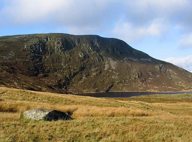
- Elevation
- 689 m
- above sea level
- Local time
- UTC+00:00
- Europe/London · UTC+00:00
- Airports
- LPL Liverpool John Lennon Airport74 km
- MAN Manchester Airport108 km
About Arenig Fach
Arenig Fach is a mountain. Location: Llanycil, Gwynedd. Elevation: 689 m.
Arenig Fach is a mountain in southern Snowdonia, north Wales. It is a peak in the Arenig range and lies to the north of its parent peak Arenig Fawr. It lies close to Llyn Celyn alongside the A4212 between Trawsfynydd and Bala. Carnedd y Filiast and Foel Goch (Arenigs) is to the east, while Moel Llyfnant, Gallt y Daren and Arenig Fawr are to the south.
Source: Wikipedia · CC BY-SA 4.0
At a glance
- Topographic prominence
- 294 m
Source: Wikidata
Photos of Arenig Fach
-

Chris Andrews · CC BY-SA 2.0 -

Ben Brooksbank · CC BY-SA 2.0 -

Trevor Littlewood · CC BY-SA 2.0 -
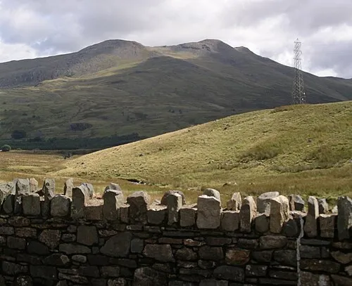
Arenig Fawr Wikimedia Commons · Public domain -
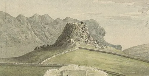
Castell Prysor Thomas Pennant · Public domain


Climate of Arenig Fach
This month · November
A wet month
Day 6° · Night 1° · Rain 178 mm
- Hottest month
- July (day 16°)
- Coldest month
- February (night -2°)
- Wettest month
- November (178 mm)
- Driest month
- May (88 mm)
Bars: average monthly low and high temperature. Below: precipitation. Monthly averages for 1970–2000 at about 18 km resolution, adjusted for elevation. Highlighted months are mild and relatively dry. Source: WorldClim 2.1 (CC BY 4.0).
Show values as a table
| Month | Jan | Feb | Mar | Apr | May | Jun | Jul | Aug | Sep | Oct | Nov | Dec |
|---|---|---|---|---|---|---|---|---|---|---|---|---|
| Average high (°C) | 4° | 3° | 5° | 8° | 11° | 14° | 16° | 15° | 13° | 10° | 6° | 4° |
| Average low (°C) | -2° | -2° | -1° | 0° | 3° | 6° | 8° | 8° | 6° | 4° | 1° | -1° |
| Precipitation (mm) | 164 | 120 | 140 | 98 | 88 | 98 | 98 | 117 | 132 | 158 | 178 | 175 |
How to get to Arenig Fach
The nearest airport is Liverpool John Lennon Airport (LPL), 74 km to the northeast as the crow flies. The nearest large city is Birkenhead, 69 km to the northeast.
Airports
- Liverpool John Lennon Airport (LPL) Liverpool 74 kmnortheast
- Manchester Airport (MAN) Manchester, Greater Manchester 108 kmnortheast
- Isle of Man Airport (IOM) Castletown, Rushen 138 kmnorthwest
Nearby large cities
- Birkenhead Population: 325.3K 69 kmnortheast
- Liverpool Population: 496.8K 72 kmnortheast
- St Helens Population: 183.2K 88 kmnortheast
- Warrington Population: 172.3K 92 kmnortheast
- Telford Population: 155.6K 94 kmeast
Straight-line distances; road distances are longer. Airport data: OurAirports.
Day trips from Arenig Fach
Within 100 km: 556 historic and cultural sites, 2,069 natural sites, 179 lakes, rivers and coasts.
0–25 km427 places
- Ynys Gifftan Island 22 kmW
- Ynys Dol-lleian Island 24 kmW
- Ynys Goediog Island 3 kmSE
- Lake Vyrnwy Lake 25 kmSE
25–60 km1,151 places
- Anglesey Island 53 kmNW
- Porth Towyn Beach Beach 59 kmW
- Traeth Lligwy Beach 56 kmNW
- Thurstaston Beach Beach 59 kmNE
60–100 km1,226 places
- Whistling Sands Beach 66 kmW
- Traeth Penllech Beach 62 kmW
- Formby Beach Beach 81 kmNE
- Ainsdale Beach Beach 86 kmNE
Straight-line distances.
Nearest towns and villages
-
Ysbyty Ifan Municipality, Conwy4.7 km N
-
Llidiardau Village, Llanycil6.2 km SE
-
Ysbyty Ifan Village, Ysbyty Ifan6.7 km N
-
Bala Village, Bala12 km SE
-
Llan Ffestiniog Village, Ffestiniog12 km W
-
Blaenau-Ffestiniog Village, Ffestiniog13 km W
Nearby attractions & nature
Everything nearby-
Mochowgryn Mountain, Llanycil1.7 km SW
-
Foel Bodrenig Mountain, Llanycil2.8 km SE
-
Arenig Fawr Mountain, Llanycil4.8 km S
-
Ynys Goediog Island, Llanycil2.7 km SE
-
Bryn-mawr Mountain, Ysbyty Ifan3.3 km NW
-
Carnedd Iago Mountain, Ysbyty Ifan3.9 km W
-
Moel Llechwedd Mountain, Llanycil4.4 km S
-
Ffridd-y-fedw Mountain, Ysbyty Ifan4.5 km N
Sources & licences
Data last updated: · 2 independent sources