- Elevation
- 339 m
- above sea level
- Local time
- UTC+00:00
- Europe/London · UTC+00:00
- Airports
- LPL Liverpool John Lennon Airport72 km
- MAN Manchester Airport105 km
About Llidiardau
Llidiardau is a village. Location: Llanycil, Gwynedd. Elevation: 339 m. The best months to visit are June–August. The nearest airport is Liverpool John Lennon Airport (72 km). Nearby sights include Mynydd Nodol and Arenig Fawr.
Photos of Llidiardau
-
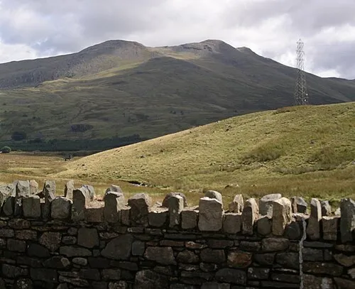
Arenig Fawr Wikimedia Commons · Public domain -
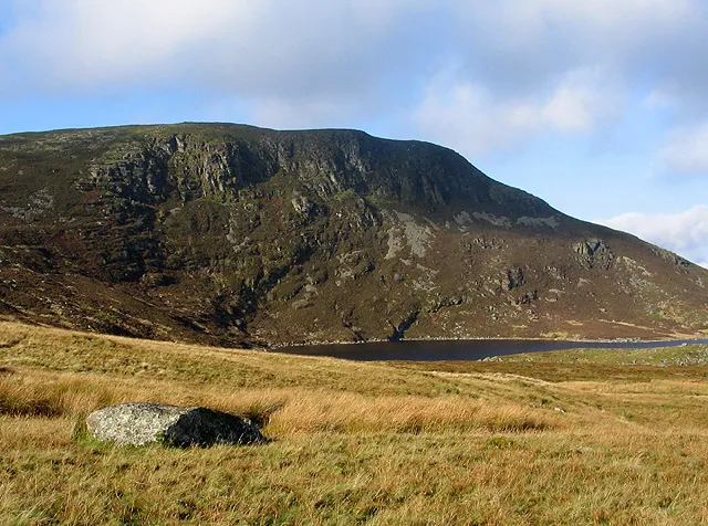
Arenig Fach Peter Aylmer · CC BY-SA 2.0 -
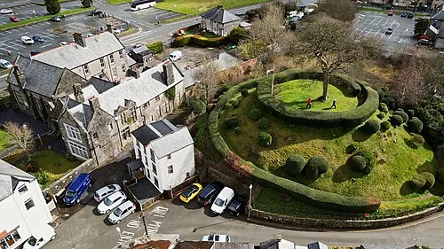
Tomen y Bala Llywelyn2000 · CC BY-SA 4.0


Climate of Llidiardau
Best months for sightseeingBest months for sightseeing: June–August.
This month · November
A wet month
Day 9° · Night 3° · Rain 178 mm
- Hottest month
- July (day 18°)
- Coldest month
- February (night 1°)
- Wettest month
- November (178 mm)
- Driest month
- May (88 mm)
Bars: average monthly low and high temperature. Below: precipitation. Monthly averages for 1970–2000 at about 18 km resolution, adjusted for elevation. Highlighted months are mild and relatively dry. Source: WorldClim 2.1 (CC BY 4.0).
Show values as a table
| Month | Jan | Feb | Mar | Apr | May | Jun | Jul | Aug | Sep | Oct | Nov | Dec |
|---|---|---|---|---|---|---|---|---|---|---|---|---|
| Average high (°C) | 6° | 6° | 8° | 10° | 14° | 16° | 18° | 18° | 15° | 12° | 9° | 7° |
| Average low (°C) | 1° | 1° | 2° | 2° | 5° | 8° | 10° | 10° | 8° | 6° | 3° | 2° |
| Precipitation (mm) | 164 | 120 | 140 | 98 | 88 | 98 | 98 | 117 | 132 | 158 | 178 | 175 |
How to get to Llidiardau
The nearest airport is Liverpool John Lennon Airport (LPL), 72 km to the northeast as the crow flies. The nearest large city is Birkenhead, 68 km to the northeast.
Airports
- Liverpool John Lennon Airport (LPL) Liverpool 72 kmnortheast
- Manchester Airport (MAN) Manchester, Greater Manchester 105 kmnortheast
- Birmingham Airport (BHX) Birmingham, West Midlands 141 kmeast
Nearby large cities
- Birkenhead Population: 325.3K 68 kmnortheast
- Liverpool Population: 496.8K 71 kmnortheast
- St Helens Population: 183.2K 86 kmnortheast
- Telford Population: 155.6K 88 kmeast
- Warrington Population: 172.3K 90 kmnortheast
Straight-line distances; road distances are longer. Airport data: OurAirports.
Day trips from Llidiardau
Within 100 km: 597 historic and cultural sites, 2,120 natural sites, 185 lakes, rivers and coasts.
0–25 km402 places
- Ynys Goediog Island 4 kmNW
- Lake Vyrnwy Lake 19 kmSE
- Llyn Conwy Lake 13 kmNW
- Llyn Brân Lake 23 kmN
25–60 km1,274 places
- Anglesey Island 59 kmNW
- Thurstaston Beach Beach 58 kmNE
- Ynys Tywyn Island 30 kmW
- Saint Tudwals Island West Island 55 kmW
60–100 km1,226 places
- Whistling Sands Beach 71 kmW
- Traeth Penllech Beach 67 kmW
- Porth Towyn Beach Beach 64 kmW
- Traeth Lligwy Beach 62 kmNW
Straight-line distances.
Nearby attractions & nature
Everything nearby-
Mynydd Nodol Mountain, Llanycil1.3 km NW
-
Arenig Fawr Mountain, Llanycil4.7 km W
-
Pen Ty-nant Mountain, Llanycil3.2 km SE
-
Foel Bodrenig Mountain, Llanycil3.6 km NW
-
Moel y Garnedd Mountain, Llanycil3.6 km SE
-
Pen Garneddwen Mountain, Llandderfel3.2 km N
Sources & licences
Data last updated: