Mawddwy
Located in Gwynedd, Wales Coordinates: 52°44′03″ N 3°41′20″ W
- Elevation
- 305 m
- above sea level
- Local time
- UTC+00:00
- Europe/London · UTC+00:00
- Places inside
- 37
- listed under Mawddwy
About Mawddwy
Mawddwy is a municipality. Location: Gwynedd, Wales. Elevation: 305 m.
In comparison
- Nearest larger town: Dolgellau, 13 km W
- 64 sights and natural places within 10 km Foel Benddin, Tarren Fach
- Listed here: Mountain: 30, Village: 7
Climate of Mawddwy
Best months for sightseeing: June–August.
| Month | Jan | Feb | Mar | Apr | May | Jun | Jul | Aug | Sep | Oct | Nov | Dec |
|---|---|---|---|---|---|---|---|---|---|---|---|---|
| Average high (°C) | 6° | 6° | 8° | 10° | 14° | 16° | 18° | 18° | 15° | 12° | 9° | 7° |
| Average low (°C) | 1° | 1° | 2° | 3° | 5° | 8° | 10° | 10° | 8° | 6° | 3° | 2° |
| Precipitation (mm) | 164 | 119 | 140 | 98 | 87 | 98 | 98 | 117 | 131 | 158 | 177 | 175 |
Monthly averages for 1970–2000 at about 18 km resolution, adjusted for elevation. Highlighted months are mild and relatively dry. Source: WorldClim 2.1 (CC BY 4.0).
Airports nearest to Mawddwy
- Liverpool John Lennon Airport (LPL) Liverpool 87 km
- Manchester Airport (MAN) Manchester, Greater Manchester 117 km
- Birmingham Airport (BHX) Birmingham, West Midlands 135 km
Straight-line distance; airports with scheduled flights only. Source: OurAirports (public domain).
Places in Mawddwy
37 places-
Aber Cowarch Village
-
Bryn Glas Mountain
-
Camlan Mountain
-
Cefn Brith Uchaf Mountain
-
Cefn Coch Mountain
-
Craig Portas Mountain
-
Craig y Gamell Mountain
-
Creigiau Dwyfron Mountain
-
Cwm-Cewydd Village
-
Cytir Mountain
-
Dinas Mawddwy Village
-
Ffridd Ddu Mountain
-
Foel Benddin Mountain
-
Foel Dinas Mountain
-
Foel Dugoed Mountain
-
Foel Hafod-fynydd Mountain
-
Foel Lluestbadlon Mountain
-
Foel y Ffridd Mountain
-
Gwaun Lydan Mountain
-
Gwaun y Llwyni Mountain
-
Llanymawddwy Village
-
Llechwedd Du Mountain
-
Maesglase Mountain
-
Maesglase (old GR) - Maen Du Mountain
-
Mallwyd Village
-
Minllyn Village
-
Moel Llygoed Mountain
-
Mynydd Clywedog Mountain
-
Mynydd Copog Mountain
-
Mynydd Gartheiniog Mountain
-
Mynydd Gartheiniog South Top Mountain
-
Pen Foel-y-ffridd Mountain
-
Pennant Village
-
Pen yr Allt Uchaf Mountain
-
Tarren Fach Mountain
-
Waun Camddwr Mountain
-
Y Gribin (old GR) Mountain
Nearby attractions & nature
Everything nearby-
Glasgwm Mountain, Brithdir and Llanfachreth3.8 km NW
-
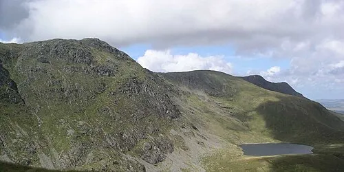 Aran Fawddwy Mountain, Llanuwchllyn5.9 km N
-
Pen y Brynfforchog Mountain, Brithdir and Llanfachreth4.5 km W
-
Collfryn Mound Historic site, Llanbrynmair5.3 km SE
-
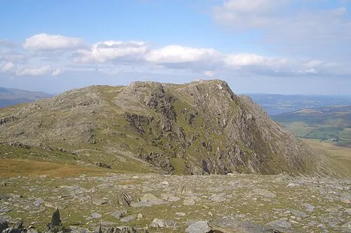 Aran Benllyn Mountain, Llanuwchllyn7.8 km N
-
Esgair Ddu Mountain, Llanbrynmair6 km S
-
Mynydd Talyglannau Mountain, Llanbrynmair6.7 km SE
-
Cribin Fawr Mountain, Brithdir and Llanfachreth6.7 km W
Sources & licences
Data last updated: