Rushcliffe
Situado en Nottinghamshire, Inglaterra Coordenadas: 52°54′44″ N 1°02′37″ O
El nombre de este lugar aún no se ha verificado en este idioma; se muestra en su forma original.
- Población
- 115.204
- 115,2 mil
- Altitud
- 39 m
- sobre el nivel del mar
- Hora local
- UTC+00:00
- Europe/London · UTC+00:00
- Lugares incluidos
- 62
- clasificados en Rushcliffe
Acerca de Rushcliffe
Rushcliffe es un municipio. Ubicación: Nottinghamshire, Inglaterra. Población: 115.204. Altitud: 39 m.
En comparación
- N.º 4 de 7 lugares en Nottinghamshire por población
- Localidad mayor más cercana: Nottingham, a 9 km (NO)
- 12 lugares de interés y naturales a menos de 10 km Dewberry Hill, Wilford Hill
- Incluye: Pueblo: 59, Monumento: 1, Montaña: 1, Localidad: 1
Clima de Rushcliffe
Mejores meses para hacer turismo: junio–agosto.
| Mes | ene. | feb. | mar. | abr. | may. | jun. | jul. | ago. | sep. | oct. | nov. | dic. |
|---|---|---|---|---|---|---|---|---|---|---|---|---|
| Máxima media (°C) | 7° | 7° | 10° | 12° | 16° | 19° | 22° | 21° | 18° | 14° | 10° | 8° |
| Mínima media (°C) | 1° | 1° | 3° | 4° | 7° | 10° | 12° | 11° | 9° | 7° | 4° | 2° |
| Precipitación (mm) | 55 | 43 | 47 | 46 | 45 | 58 | 46 | 53 | 52 | 53 | 54 | 59 |
Promedios mensuales de 1970–2000 con una resolución de unos 18 km, corregidos según la altitud. Los meses destacados son templados y relativamente secos. Fuente: WorldClim 2.1 (CC BY 4.0).
Aeropuertos más cercanos a Rushcliffe
- East Midlands Airport (EMA) Nottingham, Leicestershire 21 km
- Birmingham Airport (BHX) Birmingham, West Midlands 70 km
- Humberside Airport (HUY) Grimsby, Lincolnshire 87 km
Distancia en línea recta; solo aeropuertos con vuelos regulares. Fuente: OurAirports (dominio público).
Lugares en Rushcliffe
62 lugares-
West Bridgford Localidad36,5 mil
-
Stanton-on-the-Wolds Pueblo413
-
Aslockton Pueblo
-
Barton in Fabis Pueblo
-
Bingham Pueblo
-
Bradmore Pueblo
-
Bunny Pueblo
-
Car Colston Pueblo
-
City Ground Monumento
-
Clipston Pueblo
-
Colston Bassett Pueblo
-
Costock Pueblo
-
Cotgrave Pueblo
-
Cropwell Bishop Pueblo
-
Cropwell Butler Pueblo
-
East Bridgford Pueblo
-
East Leake Pueblo
-
Edwalton Pueblo
-
Elton-on-the-Hill Pueblo
-
Flawborough Pueblo
-
Flintham Pueblo
-
Gamston Pueblo
-
Gotham Pueblo
-
Granby Pueblo
-
Hawksworth Pueblo
-
Hickling Pueblo
-
Holme Pierrepont Pueblo
-
Keyworth Pueblo
-
Kingston on Soar Pueblo
-
Kinoulton Pueblo
-
Kneeton Pueblo
-
Langar cum Barnstone Pueblo
-
Normanton on Soar Pueblo
-
Normanton on the Wolds Pueblo
-
Orston Pueblo
-
Owthorpe Pueblo
-
Plumtree Pueblo
-
Radcliffe on Trent Pueblo
-
Ratcliffe on Soar Pueblo
-
Rempstone Pueblo
-
Ruddington Pueblo
-
Saxondale Pueblo
-
Scarrington Pueblo
-
Screveton Pueblo
-
Shelford and Newton Pueblo
-
Shelton Pueblo
-
Sibthorpe Pueblo
-
Stanford on Soar Pueblo
-
Sutton Bonington Pueblo
-
Thoroton Pueblo
-
Thorpe in the Glebe Pueblo
-
Thrumpton Pueblo
-
Tithby Pueblo
-
Tollerton Pueblo
-
Upper Broughton Pueblo
-
West Leake Pueblo
-
Whatton-in-the-Vale Pueblo
-
Widmerpool Pueblo
-
Wilford Hill Montaña
-
Willoughby on the Wolds Pueblo
Atracciones y naturaleza cercanas
Todo lo cercano-
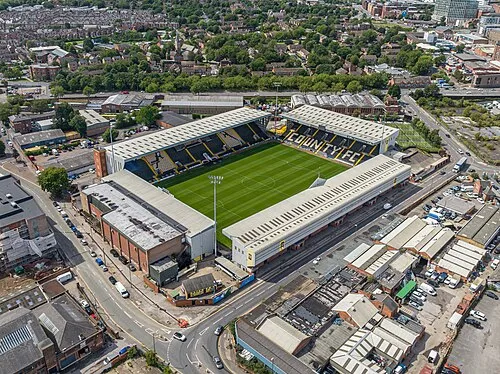 Meadow Lane Monumento, Nottingham7,1 km NO
-
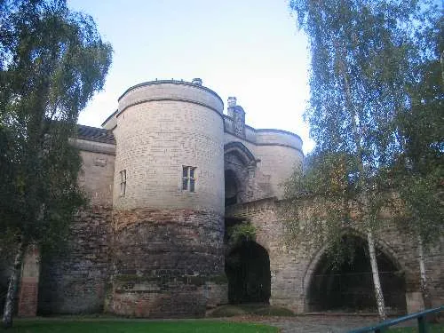 Nottingham Castle Sitio histórico, Nottingham8,5 km NO
-
Gunthorpe Henge Sitio histórico, Gunthorpe9,7 km N
-
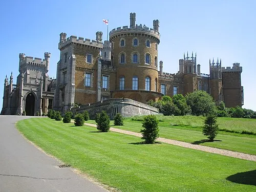 Castillo de Belvoir Sitio histórico, Belvoir18 km E
-
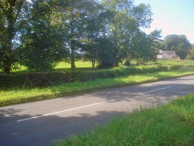 Greasley Castle Sitio histórico, Greasley19 km NO
-
Donington Castle Sitio histórico, Castle Donington21 km O
-
The Mount motte at Melton Mowbray Sitio histórico, Melton District20 km SE
-
Thorpe Arnold Sitio histórico, Waltham on the Wolds and Thorpe Arnold20 km SE
Otras ciudades y localidades en Nottinghamshire
Fuentes y licencias
Datos actualizados por última vez: