Spitzeck
Located in Bad Bleiberg, Politischer Bezirk Villach Land Coordinates: 46°38′00″ N 13°45′00″ E
- Elevation
- 1,332 m
- above sea level
- Local time
- UTC+01:00
- Europe/Vienna · UTC+01:00
- Airports
- KLU Klagenfurt Airport45 km
- LJU Ljubljana Jože Pučnik Airport71 km
About Spitzeck
Spitzeck is a mountain. Location: Bad Bleiberg, Politischer Bezirk Villach Land. Elevation: 1,332 m. The best months to visit are July–August. The nearest airport is Klagenfurt Airport (45 km). Nearby sights include Mittagskofel and Jäger Rast.
Photos of Spitzeck
-
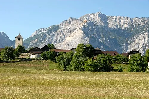
Villacher Alpe Johann Jaritz · CC BY-SA 3.0 -
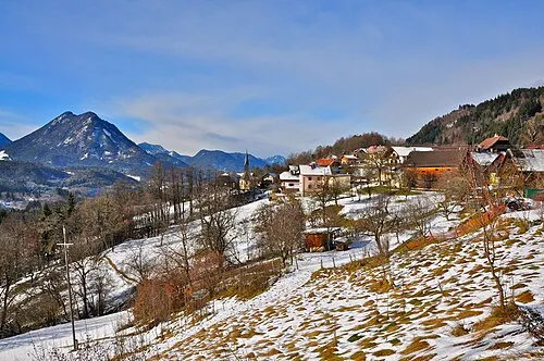
Mittagskofel Johann Jaritz · CC BY-SA 3.0 -
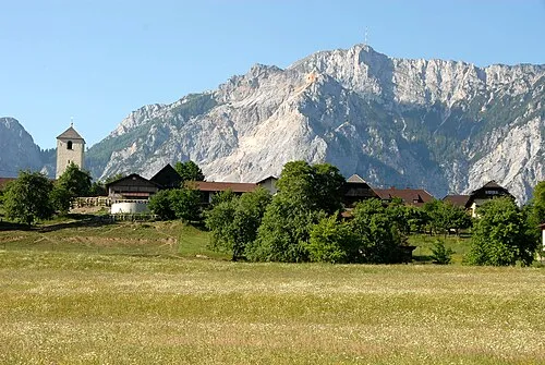
Dobratsch Johann Jaritz · CC BY-SA 3.0 -
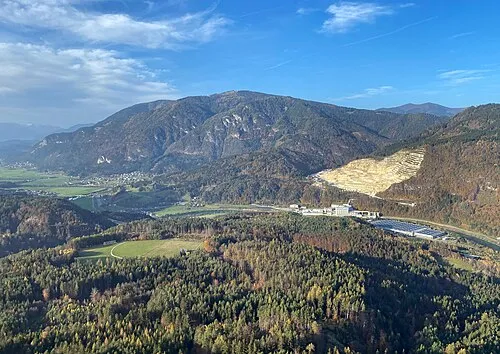
Amberger Alpe Hangman'sDeath · CC0


Climate of Spitzeck
Best months for sightseeingBest months for sightseeing: July–August.
This month · November
A wet month
Day 3° · Night -5° · Rain 149 mm
- Hottest month
- July (day 20°)
- Coldest month
- January (night -10°)
- Wettest month
- June (158 mm)
- Driest month
- February (67 mm)
Bars: average monthly low and high temperature. Below: precipitation. Monthly averages for 1970–2000 at about 18 km resolution, adjusted for elevation. Highlighted months are mild and relatively dry. Source: WorldClim 2.1 (CC BY 4.0).
Show values as a table
| Month | Jan | Feb | Mar | Apr | May | Jun | Jul | Aug | Sep | Oct | Nov | Dec |
|---|---|---|---|---|---|---|---|---|---|---|---|---|
| Average high (°C) | -2° | 0° | 4° | 8° | 14° | 17° | 20° | 19° | 15° | 10° | 3° | -1° |
| Average low (°C) | -10° | -9° | -6° | -2° | 3° | 6° | 8° | 8° | 4° | 0° | -5° | -9° |
| Precipitation (mm) | 76 | 67 | 95 | 122 | 133 | 158 | 156 | 138 | 147 | 155 | 149 | 103 |
How to get to Spitzeck
The nearest airport is Klagenfurt Airport (KLU), 45 km to the east as the crow flies. The nearest large city is Klagenfurt, 43 km to the east.
Airports
- Klagenfurt Airport (KLU) Klagenfurt am Wörthersee 45 kmeast
- Ljubljana Jože Pučnik Airport (LJU) Zgornji Brnik 71 kmsoutheast
- Trieste Airport (TRS) Ronchi dei Legionari/Trieste 92 kmsouth
Nearby large cities
- Klagenfurt Population: 100.3K 43 kmeast
- Ljubljana Population: 272.2K 87 kmsoutheast
- Graz Population: 303.3K 138 kmeast
- Salzburg Population: 157.2K 140 kmnorth
- Rijeka Population: 108K 155 kmsouth
Straight-line distances; road distances are longer. Airport data: OurAirports.
Day trips from Spitzeck
Within 100 km: 195 historic and cultural sites, 2,326 natural sites, 671 lakes, rivers and coasts.
0–25 km191 places
- Vršič Mountain 22 kmS
- Planica Natural site 18 kmS
- Mangrt Mountain 23 kmS
- Škrlatica Mountain 23 kmS
25–60 km806 places
- Lake Bohinj Lake 40 kmS
- Lake Bled Lake 40 kmSE
- Triglav Mountain 29 kmS
- Rjavina Mountain 29 kmS
60–100 km2,195 places
- Hoher Dachstein Mountain 94 kmN
- Raša River 92 kmS
- Šmarna gora Mountain 78 kmSE
- Mrzla Gora Mountain 71 kmSE
Straight-line distances.
Nearest towns and villages
-
Kadutschen Village, Bad Bleiberg1.3 km W
-
 Mittewald ob Villach Village, Villach1.3 km E
-
Töplitsch Village, Weißenstein2.4 km N
-
Weißenstein Municipality, Politischer Bezirk Villach Land3.7 km N
-
Heiligengeist Neighbourhood, Villach2.3 km S
-
Puch Village, Weißenstein3.8 km N
Nearby attractions & nature
Everything nearby-
Mittagskofel Mountain, Weißenstein1.9 km N
-
Jäger Rast Mountain, Villach2.2 km SW
-
Neunernock Mountain, Bad Bleiberg3.2 km SW
-
Wabenriegel Mountain, Villach3.7 km S
-
Schwandnock Mountain, Weißenstein3.1 km W
-
Buchberg Mountain, Villach4.3 km NE
-
Weissenbach River, Carinthia2.9 km NE
-
Erzberg Mountain, Carinthia4.3 km W
More nature in Austria
-
Dobratsch Mountain, Bad Bleiberg6.5 km SW
-
Hachelnock Mountain, Bad Bleiberg6.4 km W
-
Badstuben Mountain, Bad Bleiberg11 km W
Sources & licences
Data last updated: