Lurnfeld
Located in Spittal an der Drau District, Carinthia Coordinates: 46°51′40″ N 13°23′04″ E
- Population
- 2,583
- 2.6K
- Elevation
- 1,025 m
- above sea level
- Local time
- UTC+01:00
- Europe/Vienna · UTC+01:00
- Places inside
- 7
- listed under Lurnfeld
About Lurnfeld
Lurnfeld is a municipality. Location: Spittal an der Drau District, Carinthia. Population: 2,583. Elevation: 1,025 m.
In comparison
- No. 5 of 33 places in Spittal an der Drau District by population
- Nearest larger town: Seeboden, 11 km E
- 41 sights and natural places within 10 km Maria in Hohenburg, Mühldorferbach
- Listed here: Village: 6, Attraction: 1
Places in Lurnfeld
7 places-
Möllbrücke Village1.2K
-
Pusarnitz Village527
-
Göriach Village284
-
Pattendorf Village190
-
Premersdorf Village48
-
Stöcklern Village41
-
Maria in Hohenburg Attraction
Nearby attractions & nature
Everything nearby-
Plankogel Mountain, Lendorf3.1 km N
-
Böse Nase Mountain, Lendorf2.9 km NE
-
Hochegg Mountain, Lendorf3.7 km N
-
Mühldorferbach River, Carinthia2.7 km W
-
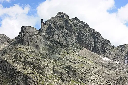 Kleine Leier Mountain, Lendorf4.3 km N
-
Kirschberger Graben Natural site, Carinthia4 km E
-
Sonnblick Mountain, Lendorf4.3 km N
-
Möll River, Carinthia3.2 km S
Sources & licences
Data last updated: