Reißeck
Located in Spittal an der Drau District, Carinthia Coordinates: 46°53′16″ N 13°15′16″ E
- Population
- 2,162
- 2.2K
- Elevation
- 994 m
- above sea level
- Local time
- UTC+01:00
- Europe/Vienna · UTC+01:00
- Places inside
- 27
- listed under Reißeck
About Reißeck
Reißeck is a municipality. Location: Spittal an der Drau District, Carinthia. Population: 2,162. Elevation: 994 m.
In comparison
- No. 8 of 33 places in Spittal an der Drau District by population
- Nearest larger town: Obervellach, 7 km NW
- 41 sights and natural places within 10 km Teuchltal, Teuchlbach
- Listed here: Village: 12, Mountain: 11, Lake: 3, Landmark: 1
Climate of Reißeck
Best months for sightseeing: July–August.
| Month | Jan | Feb | Mar | Apr | May | Jun | Jul | Aug | Sep | Oct | Nov | Dec |
|---|---|---|---|---|---|---|---|---|---|---|---|---|
| Average high (°C) | 3° | 4° | 6° | 9° | 15° | 18° | 20° | 20° | 17° | 13° | 6° | 3° |
| Average low (°C) | -5° | -5° | -2° | 1° | 5° | 9° | 11° | 11° | 8° | 4° | -1° | -4° |
| Precipitation (mm) | 76 | 68 | 94 | 116 | 132 | 165 | 175 | 157 | 137 | 127 | 122 | 94 |
Monthly averages for 1970–2000 at about 18 km resolution, adjusted for elevation. Highlighted months are mild and relatively dry. Source: WorldClim 2.1 (CC BY 4.0).
Airports nearest to Reißeck
- Klagenfurt Airport (KLU) Klagenfurt am Wörthersee 87 km
- Salzburg Airport (SZG) Salzburg 102 km
- Ljubljana Jože Pučnik Airport (LJU) Zgornji Brnik 118 km
Straight-line distance; airports with scheduled flights only. Source: OurAirports (public domain).
Places in Reißeck
27 places-
Unterkolbnitz Village373
-
Oberkolbnitz Village309
-
Penk Village277
-
Napplach Village250
-
Zandlach Village249
-
Preissdorf Village85
-
Teuchl Village75
-
Litzldorf Village54
-
Mitterberg Village52
-
Zwenberg Village46
-
Hattelberg Village19
-
Dechant Mountain
-
Gamolnig Spitze Mountain
-
Geiersspitz Mountain
-
Hochalmsee Lake
-
Kampleck Mountain
-
Kolbnitz Village
-
Mittagspitze Mountain
-
Pfaffenberg-Zwenberg railway bridge Landmark
-
Riedbock Mountain
-
Salzkofel Mountain
-
Schoberspitz Mountain
-
Schroneck Mountain
-
Seebach Höhe Mountain
-
Sonnblick Mountain
Nearby attractions & nature
Everything nearby-
Teuchltal Natural site, Carinthia0.6 km SW
-
Teuchlbach River, Carinthia1.4 km E
-
Teuchlspitze Mountain, Obervellach3.3 km W
-
Rieken Bach River, Carinthia3.5 km E
-
castle Falkenstein Historic site, Obervellach4 km N
-
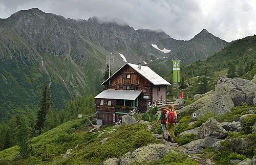 Grosser Grakofl Mountain, Sachsenburg6.1 km S
-
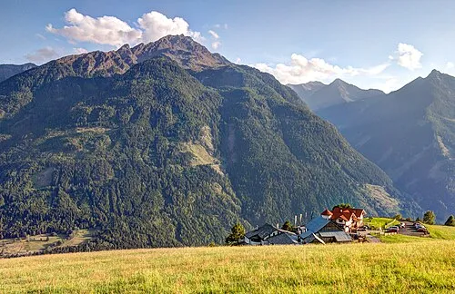 Polinik Mountain, Obervellach7.2 km W
-
Zwenberger Bach River, Carinthia3 km N
Sources & licences
Data last updated: