Obervellach
Located in Spittal an der Drau District, Carinthia Coordinates: 46°55′59″ N 13°11′51″ E
- Population
- 2,269
- 2.3K
- Elevation
- 690 m
- above sea level
- Local time
- UTC+01:00
- Europe/Vienna · UTC+01:00
- Places inside
- 29
- listed under Obervellach
About Obervellach
Obervellach is a municipality. Location: Spittal an der Drau District, Carinthia. Population: 2,269. Elevation: 690 m.
In comparison
- No. 7 of 33 places in Spittal an der Drau District by population
- Nearest larger town: Lurnfeld, 16 km SE
- 49 sights and natural places within 10 km Kaponigbach, Mallnitzbach
- Listed here: Village: 18, Mountain: 10, Historic site: 1
Places in Obervellach
29 places-
Obervellach Village654
-
Semslach Village305
-
Räuflach Village293
-
Stallhofen Village186
-
Dürnvellach Village173
-
Söbriach Village140
-
Untergratschach Village133
-
Pfaffenberg Village63
-
Untervocken Village46
-
Lassach Schattseite Village41
-
Lassach Sonnseite Village31
-
Unterwolliggen Village11
-
Obergratschach Village10
-
Leutschach Village8
-
Stampf Village7
-
Raufen Village2
-
castle Falkenstein Historic site
-
Ebeneck Mountain
-
Gappen Village
-
Gröneck Mountain
-
Kesseleck Mountain
-
Lonza Höhe Mountain
-
Oberwolligen Village
-
Polinik Mountain
-
Schneestellkopf Mountain
-
Strieden Mountain
-
Striedenkopf Mountain
-
Teuchlspitze Mountain
-
Tristen Spitze Mountain
Nearby attractions & nature
Everything nearby-
Kaponigbach River, Carinthia0.1 km NE
-
Mallnitzbach River, Carinthia1.1 km W
-
Groppensteinerfall Natural site, Carinthia2.2 km NW
-
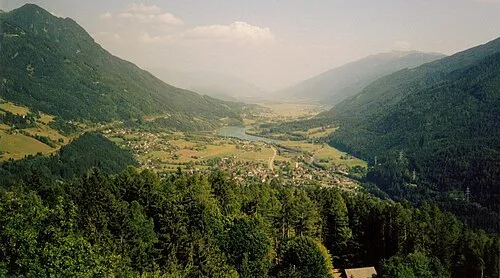 Mölltal Natural site, Carinthia4.3 km W
-
Hohe Leiten Mountain, Carinthia3.8 km S
-
Bodensee Lake, Carinthia4 km SW
-
Pfaffenberg-Zwenberg railway bridge Landmark, Reißeck4.7 km SE
-
Ragga Bach River, Carinthia4.3 km W
Sources & licences
Data last updated: