Sperkerriegel
Located in Wiesmath, Politischer Bezirk Wiener Neustadt Coordinates: 47°36′00″ N 16°18′00″ E
- Elevation
- 678 m
- above sea level
- Local time
- UTC+01:00
- Europe/Vienna · UTC+01:00
- Airports
- VIE Vienna International Airport60 km
- BTS M. R. Štefánik Airport93 km
About Sperkerriegel
Sperkerriegel is a mountain. Location: Wiesmath, Politischer Bezirk Wiener Neustadt. Elevation: 678 m. The best months to visit are June–August. The nearest airport is Vienna International Airport (60 km). Nearby sights include Pauliberg and Klosterberg.
Climate of Sperkerriegel
Best months for sightseeingBest months for sightseeing: June–August.
This month · November
A cold month
Day 6° · Night -1° · Rain 61 mm
- Hottest month
- July (day 22°)
- Coldest month
- January (night -5°)
- Wettest month
- June (102 mm)
- Driest month
- February (37 mm)
Bars: average monthly low and high temperature. Below: precipitation. Monthly averages for 1970–2000 at about 18 km resolution, adjusted for elevation. Highlighted months are mild and relatively dry. Source: WorldClim 2.1 (CC BY 4.0).
Show values as a table
| Month | Jan | Feb | Mar | Apr | May | Jun | Jul | Aug | Sep | Oct | Nov | Dec |
|---|---|---|---|---|---|---|---|---|---|---|---|---|
| Average high (°C) | 2° | 4° | 8° | 12° | 17° | 20° | 22° | 22° | 18° | 13° | 6° | 3° |
| Average low (°C) | -5° | -5° | -1° | 2° | 7° | 10° | 11° | 11° | 8° | 3° | -1° | -4° |
| Precipitation (mm) | 39 | 37 | 54 | 57 | 84 | 102 | 101 | 91 | 73 | 59 | 61 | 50 |
How to get to Sperkerriegel
The nearest airport is Vienna International Airport (VIE), 60 km to the north as the crow flies. The nearest large city is Bratislava, 86 km to the northeast.
Airports
- Vienna International Airport (VIE) Vienna 60 kmnorth
- M. R. Štefánik Airport (BTS) Bratislava 93 kmnortheast
- Graz Airport (GRZ) Feldkirchen bei Graz 94 kmsouthwest
Nearby large cities
- Bratislava Population: 423.7K 86 kmnortheast
- Graz Population: 303.3K 88 kmsouthwest
- Győr Population: 129.3K 101 kmeast
- Székesfehérvár Population: 101.6K 166 kmeast
- Linz Population: 204.8K 170 kmnorthwest
Straight-line distances; road distances are longer. Airport data: OurAirports.
Day trips from Sperkerriegel
Within 100 km: 527 historic and cultural sites, 1,398 natural sites, 443 lakes, rivers and coasts.
0–25 km83 places
- Weisjackel Mountain 15 kmNW
- Spitzer Riegel Mountain 19 kmSW
- Scheibenriegel Mountain 11 kmSE
- Rosaliengebirge Mountain 13 kmN
25–60 km645 places
- Schellensee Lake 58 kmN
- Zicksee Lake 49 kmNE
- Zick See Lake 41 kmNE
- Salziger See Lake 53 kmE
60–100 km1,640 places
- Devínska Kobyla Mountain 84 kmNE
- Mirbach Palace Historic site 86 kmNE
- Bratislava Castle Historic site 85 kmNE
- Most SNP Landmark 85 kmNE
Straight-line distances.
Nearest towns and villages
-
Wiesmath Village, Wiesmath2.2 km NW
-
Hollenthon Municipality, Politischer Bezirk Wiener Neustadt3.2 km SW
-
Hollenthon Village, Hollenthon3.1 km W
-
Horndorf Village, Hollenthon3.1 km SW
-
Geretschlag Village, Wiesmath2.5 km W
-
Spratzeck Village, Hollenthon3.7 km S
Nearby attractions & nature
Everything nearby-
Pauliberg Mountain, Kobersdorf2.5 km E
-
Klosterberg Mountain, Markt Sankt Martin4.5 km SE
-
Spratzbach River, Lower Austria3.9 km S
-
Horaubach River, Lower Austria4.5 km NE
-
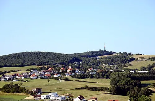 Brenntenriegel Mountain, Sieggraben9.5 km NE
-
Heidriegel Mountain, Kaisersdorf6.4 km SE
-
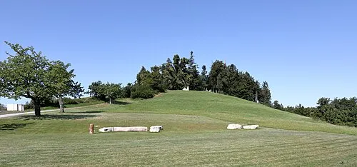 Heuberg Mountain, Forchtenstein11 km N
-
Thalbach River, Lower Austria5.6 km S
Sources & licences
Data last updated: