Elsenau Sparberegg
Located in Schäffern, Hartberg-Fürstenfeld District Coordinates: 47°26′28″ N 16°07′55″ E
- Elevation
- 583 m
- above sea level
- Local time
- UTC+01:00
- Europe/Vienna · UTC+01:00
- Airports
- GRZ Graz Airport72 km
- VIE Vienna International Airport81 km
About Elsenau Sparberegg
Elsenau Sparberegg is a neighbourhood. Location: Schäffern, Hartberg-Fürstenfeld District. The best months to visit are June–August. The nearest airport is Graz Airport (72 km). Nearby sights include Schloss Bärnegg and Schaffern Bach.
Photos of Elsenau Sparberegg
-
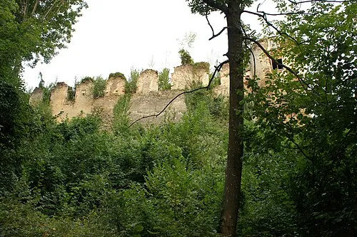
Schloss Bärnegg Ufoao · CC BY-SA 3.0 at

Climate of Elsenau Sparberegg
Best months for sightseeingBest months for sightseeing: June–August.
This month · November
A cold month
Day 7° · Night -1° · Rain 63 mm
- Hottest month
- July (day 23°)
- Coldest month
- January (night -5°)
- Wettest month
- July (110 mm)
- Driest month
- February (37 mm)
Bars: average monthly low and high temperature. Below: precipitation. Monthly averages for 1970–2000 at about 18 km resolution, adjusted for elevation. Highlighted months are mild and relatively dry. Source: WorldClim 2.1 (CC BY 4.0).
Show values as a table
| Month | Jan | Feb | Mar | Apr | May | Jun | Jul | Aug | Sep | Oct | Nov | Dec |
|---|---|---|---|---|---|---|---|---|---|---|---|---|
| Average high (°C) | 2° | 5° | 9° | 13° | 18° | 21° | 23° | 23° | 19° | 14° | 7° | 4° |
| Average low (°C) | -5° | -4° | -1° | 2° | 7° | 10° | 12° | 12° | 8° | 4° | -1° | -4° |
| Precipitation (mm) | 38 | 37 | 55 | 60 | 87 | 109 | 110 | 97 | 77 | 63 | 63 | 50 |
How to get to Elsenau Sparberegg
The nearest airport is Graz Airport (GRZ), 72 km to the southwest as the crow flies. The nearest large city is Graz, 67 km to the southwest.
Airports
- Graz Airport (GRZ) Feldkirchen bei Graz 72 kmsouthwest
- Vienna International Airport (VIE) Vienna 81 kmnortheast
- Maribor Edvard Rusjan Airport (MBX) Maribor 112 kmsouth
Nearby large cities
- Graz Population: 303.3K 67 kmsouthwest
- Bratislava Population: 423.7K 107 kmnortheast
- Győr Population: 129.3K 116 kmeast
- Klagenfurt Population: 100.3K 166 kmsouthwest
- Linz Population: 204.8K 168 kmnorthwest
Straight-line distances; road distances are longer. Airport data: OurAirports.
Day trips from Elsenau Sparberegg
Within 100 km: 491 historic and cultural sites, 1,375 natural sites, 446 lakes, rivers and coasts.
0–25 km85 places
- Herrenstein Mountain 22 kmW
- Totterfeld Mountain 24 kmSW
- Tommer Mountain 21 kmW
- Spitzer Riegel Mountain 9 kmNW
25–60 km519 places
- Waldteiche Lake 59 kmSW
- Neufelder See Lake 51 kmN
- St. Margarethener Seebad Lake 54 kmNE
- Granegg Mountain 40 kmW
60–100 km1,708 places
- Jezero Pernica Lake 100 kmS
- Donauinsel Island 86 kmN
- Vienna Forest Lake Lake 82 kmN
- Steinsee Lake 80 kmN
Straight-line distances.
Nearby attractions & nature
Everything nearby-
Schloss Bärnegg Historic site, Pinggau1.4 km SW
-
Schaffern Bach River, Austria3.6 km SW
-
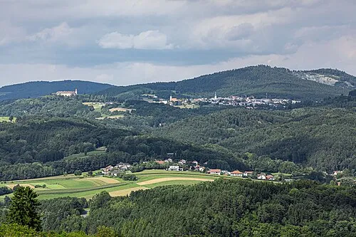 Bernsteiner Gebirge Mountain, Austria9.3 km E
-
 Schloss Thalberg Historic site, Dechantskirchen10 km W
-
Ziegersberg Historic site, Zöbern6.5 km N
-
Kienberg Mountain, Bernstein10 km E
Sources & licences
Data last updated: