- Elevation
- 1,062 m
- above sea level
- Local time
- UTC+01:00
- Europe/Vienna · UTC+01:00
- Airports
- SZG Salzburg Airport57 km
- LNZ Linz-Hörsching Airport73 km
About Dietrichskogel
Dietrichskogel is a mountain. Location: Altaussee, Liezen District. Elevation: 1,062 m. The best months to visit are July–August. The nearest airport is Salzburg Airport (57 km). Nearby sights include Rehkogel and Scheiblkogel.
Climate of Dietrichskogel
Best months for sightseeingBest months for sightseeing: July–August.
This month · November
A wet month
Day 5° · Night -2° · Rain 105 mm
- Hottest month
- July (day 19°)
- Coldest month
- January (night -6°)
- Wettest month
- July (195 mm)
- Driest month
- February (78 mm)
Bars: average monthly low and high temperature. Below: precipitation. Monthly averages for 1970–2000 at about 18 km resolution, adjusted for elevation. Highlighted months are mild and relatively dry. Source: WorldClim 2.1 (CC BY 4.0).
Show values as a table
| Month | Jan | Feb | Mar | Apr | May | Jun | Jul | Aug | Sep | Oct | Nov | Dec |
|---|---|---|---|---|---|---|---|---|---|---|---|---|
| Average high (°C) | 1° | 2° | 5° | 8° | 14° | 17° | 19° | 19° | 15° | 11° | 5° | 2° |
| Average low (°C) | -6° | -6° | -3° | 0° | 5° | 8° | 10° | 10° | 7° | 3° | -2° | -5° |
| Precipitation (mm) | 87 | 78 | 107 | 106 | 124 | 175 | 195 | 165 | 127 | 97 | 105 | 109 |
How to get to Dietrichskogel
The nearest airport is Salzburg Airport (SZG), 57 km to the west as the crow flies. The nearest large city is Salzburg, 54 km to the west.
Airports
- Salzburg Airport (SZG) Salzburg 57 kmwest
- Linz-Hörsching Airport (LNZ) Linz 73 kmnortheast
- Klagenfurt Airport (KLU) Klagenfurt am Wörthersee 121 kmsouth
Nearby large cities
- Salzburg Population: 157.2K 54 kmwest
- Linz Population: 204.8K 84 kmnortheast
- Klagenfurt Population: 100.3K 122 kmsouth
- Graz Population: 303.3K 144 kmsoutheast
- Munich Population: 1.5M 170 kmwest
Straight-line distances; road distances are longer. Airport data: OurAirports.
Nearest towns and villages
-
Lichtersberg Village, Altaussee1.9 km S
-
Lupitsch Village, Altaussee2.3 km S
-
Puchen Village, Altaussee2.7 km SE
-
Altaussee Village, Altaussee2.6 km SE
-
Fischerndorf Village, Altaussee3.1 km SE
-
Ramsau Village, Altaussee1.7 km NE
Nearby attractions & nature
Everything nearby-
Rehkogel Mountain, Altaussee<0.1 km N
-
Scheiblkogel Mountain, Altaussee<0.1 km N
-
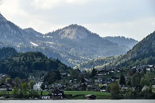 Pötschenstein Mountain, Altaussee1.9 km N
-
Kritkogel Mountain, Altaussee1.3 km W
-
Sandling Mountain, Altaussee1.3 km W
-
Dimmelberg Mountain, Altaussee1.9 km S
-
Klammeckkogel Mountain, Altaussee2.2 km SW
-
Sonnkogel Mountain, Bad Goisern2.5 km W
More nature in Austria
-
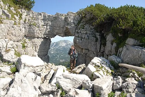 Schönberg Mountain, Altaussee6.7 km NE
-
Schafberg Mountain, Altaussee4.5 km NE
-
Loser Mountain, Altaussee2.5 km E
-
Plattenkogel Mountain, Altaussee3.1 km SE
-
Hinterer Raucher Mountain, Altaussee6.1 km NE
-
Vorderer Schwarzmooskogel Mountain, Altaussee6.5 km E
Sources & licences
Data last updated: