Gaal
Located in Murtal District, Styria Coordinates: 47°18′37″ N 14°39′26″ E
- Population
- 1,388
- 1.4K
- Elevation
- 1,571 m
- above sea level
- Local time
- UTC+01:00
- Europe/Vienna · UTC+01:00
- Places inside
- 27
- listed under Gaal
About Gaal
Gaal is a municipality. Location: Murtal District, Styria. Population: 1,388. Elevation: 1,571 m.
In comparison
- No. 14 of 20 places in Murtal District by population
- Nearest larger town: Fohnsdorf, 10 km S
- 52 sights and natural places within 10 km Ingeringsee, Sundlsee
- Listed here: Mountain: 15, Village: 9, Historic site: 2, Attraction: 1
Places in Gaal
27 places-
Bischoffeld Village292
-
Graden Village275
-
Ingering Zwei Village263
-
Puchschachen Village163
-
Schattenberg Village144
-
Gaalgraben Village120
-
Gaal Village119
-
Glaneck Mountain
-
Großer Ringkogel Mountain
-
Hammerkogel Mountain
-
Hart Village
-
Hohenwart Mountain
-
Hölzlberg Mountain
-
Krugspitze Mountain
-
Lahneck Mountain
-
Lorettokapelle Attraction
-
Maieranger Kogel Mountain
-
Ochsenspitze Mountain
-
Papstriegel Mountain
-
Pirkach Village
-
Pletzen Mountain
-
Schloss Wasserberg Historic site
-
Schnoppenhütte Historic site
-
Seckauer Zinken Mountain
-
Sonntagkogel Mountain
-
Speikleitenberg Mountain
-
Zinken Mountain
Nearby attractions & nature
Everything nearby-
Ingeringsee Lake, Styria2.6 km N
-
Sundlsee Lake, Styria2.8 km NW
-
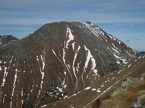 Hochreichhart Mountain, Wald am Schoberpaß6.2 km N
-
Rottenmanner Tauern Mountain, Styria5 km NW
-
Gaalbach River, Styria5.2 km S
-
Karhüttenbach River, Styria5.7 km W
-
Schöntal Natural site, Styria7.5 km SW
-
Vorwitzbach River, Styria5.8 km SE
Sources & licences
Data last updated: