Pflegerhube
Located in Kainach bei Voitsberg, Voitsberg District Coordinates: 47°12′00″ N 15°04′00″ E
- Elevation
- 1,132 m
- above sea level
- Local time
- UTC+01:00
- Europe/Vienna · UTC+01:00
- Airports
- GRZ Graz Airport37 km
- KLU Klagenfurt Airport83 km
About Pflegerhube
Pflegerhube is a village. Location: Kainach bei Voitsberg, Voitsberg District. Elevation: 1,132 m. The best months to visit are July–August. The nearest airport is Graz Airport (37 km). Nearby sights include Gleinalpe and Rossbach Kogel.
Climate of Pflegerhube
Best months for sightseeingBest months for sightseeing: July–August.
This month · November
A cold month
Day 5° · Night -3° · Rain 83 mm
- Hottest month
- July (day 20°)
- Coldest month
- January (night -7°)
- Wettest month
- July (159 mm)
- Driest month
- January (55 mm)
Bars: average monthly low and high temperature. Below: precipitation. Monthly averages for 1970–2000 at about 18 km resolution, adjusted for elevation. Highlighted months are mild and relatively dry. Source: WorldClim 2.1 (CC BY 4.0).
Show values as a table
| Month | Jan | Feb | Mar | Apr | May | Jun | Jul | Aug | Sep | Oct | Nov | Dec |
|---|---|---|---|---|---|---|---|---|---|---|---|---|
| Average high (°C) | 1° | 2° | 5° | 9° | 15° | 18° | 20° | 20° | 16° | 11° | 5° | 1° |
| Average low (°C) | -7° | -7° | -4° | 0° | 5° | 8° | 9° | 9° | 6° | 2° | -3° | -6° |
| Precipitation (mm) | 55 | 57 | 82 | 88 | 110 | 146 | 159 | 139 | 114 | 89 | 83 | 73 |
How to get to Pflegerhube
The nearest airport is Graz Airport (GRZ), 37 km to the southeast as the crow flies. The nearest large city is Graz, 32 km to the southeast.
Airports
- Graz Airport (GRZ) Feldkirchen bei Graz 37 kmsoutheast
- Klagenfurt Airport (KLU) Klagenfurt am Wörthersee 83 kmsouthwest
- Maribor Edvard Rusjan Airport (MBX) Maribor 93 kmsoutheast
Nearby large cities
- Graz Population: 303.3K 32 kmsoutheast
- Klagenfurt Population: 100.3K 86 kmsouthwest
- Linz Population: 204.8K 136 kmnorthwest
- Salzburg Population: 157.2K 166 kmnorthwest
- Zagreb Population: 663.6K 169 kmsoutheast
Straight-line distances; road distances are longer. Airport data: OurAirports.
Nearby attractions & nature
Everything nearby-
Gleinalpe Mountain, Kainach bei Voitsberg1.3 km W
-
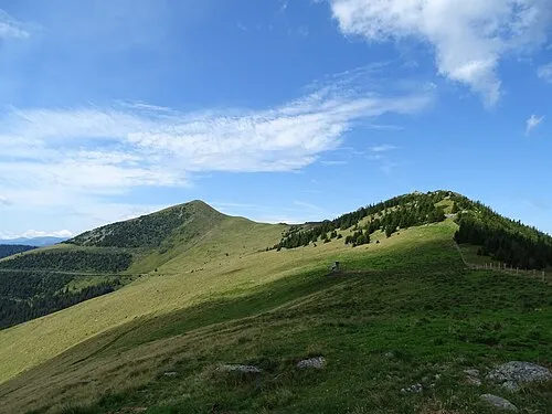 Rossbach Kogel Mountain, Kainach bei Voitsberg2.5 km W
-
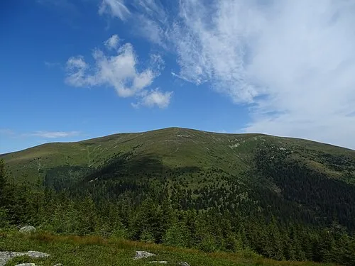 Speikkogel Mountain, Sankt Margarethen bei Knittelfeld2.2 km NW
-
Rossbach Alpe Mountain, Styria2.2 km SW
-
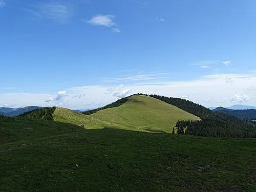 Ochsenkogel Mountain, Übelbach2.2 km NE
-
Walzkogel Mountain, Geistthal-Södingberg5.1 km E
Sources & licences
Data last updated: