Kundl
Located in Politischer Bezirk Kufstein, Tyrol Coordinates: 47°27′45″ N 11°59′44″ E
- Population
- 4,300
- 4.3K
- Elevation
- 724 m
- above sea level
- Local time
- UTC+01:00
- Europe/Vienna · UTC+01:00
- Places inside
- 4
- listed under Kundl
About Kundl
Kundl is a municipality. Location: Politischer Bezirk Kufstein, Tyrol. Population: 4,300. Elevation: 724 m.
In comparison
- No. 6 of 30 places in Politischer Bezirk Kufstein by population
- Nearest larger town: Wörgl, 6 km NE
- 26 sights and natural places within 10 km Kundler Klamm, Wildschönauer Ache
- Listed here: Village: 4
Airports nearest to Kundl
- Innsbruck Airport (INN) Innsbruck 54 km
- Salzburg Airport (SZG) Salzburg 84 km
- Munich Airport (MUC) Munich 100 km
Straight-line distance; airports with scheduled flights only. Source: OurAirports (public domain).
Places in Kundl
4 places-
Kundl Village3.8K
-
Liesfeld Village636
-
Saulueg Village57
-
Sankt Leonhard Village
Nearby attractions & nature
Everything nearby-
Kundler Klamm Natural site, Tyrol1 km NW
-
Kragenjoch Mountain, Wildschönau3.2 km SE
-
Wildschönauer Ache River, Tyrol2.5 km N
-
Unterinntal Natural site, Tyrol3.6 km W
-
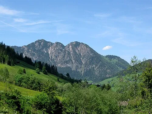 Gratlspitze Mountain, Alpbach6.4 km SW
-
Wörgler Bach River, Tyrol4.7 km NE
-
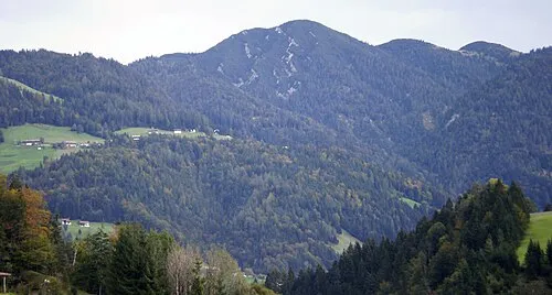 Kienberg Mountain, Brandenberg6.9 km NW
-
NDB-Funkfeuer RTT Landmark, Brixlegg5.5 km SW
Sources & licences
Data last updated: