Kragenjoch
Located in Wildschönau, Politischer Bezirk Kufstein Coordinates: 47°27′00″ N 12°02′00″ E
- Elevation
- 1,425 m
- above sea level
- Local time
- UTC+01:00
- Europe/Vienna · UTC+01:00
- Airports
- INN Innsbruck Airport56 km
- SZG Salzburg Airport82 km
About Kragenjoch
Kragenjoch is a mountain. Location: Wildschönau, Politischer Bezirk Kufstein. Elevation: 1,425 m. The best months to visit are July–August. The nearest airport is Innsbruck Airport (56 km). Nearby sights include Roßkopf and Kundler Klamm.
Photos of Kragenjoch
-
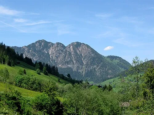
Gratlspitze Rufus46 · CC BY-SA 3.0

Climate of Kragenjoch
Best months for sightseeingBest months for sightseeing: July–August.
This month · November
A cold month
Day 3° · Night -4° · Rain 84 mm
- Hottest month
- July (day 18°)
- Coldest month
- January (night -8°)
- Wettest month
- July (167 mm)
- Driest month
- February (62 mm)
Bars: average monthly low and high temperature. Below: precipitation. Monthly averages for 1970–2000 at about 18 km resolution, adjusted for elevation. Highlighted months are mild and relatively dry. Source: WorldClim 2.1 (CC BY 4.0).
Show values as a table
| Month | Jan | Feb | Mar | Apr | May | Jun | Jul | Aug | Sep | Oct | Nov | Dec |
|---|---|---|---|---|---|---|---|---|---|---|---|---|
| Average high (°C) | -1° | 1° | 4° | 8° | 13° | 16° | 18° | 18° | 15° | 10° | 3° | -1° |
| Average low (°C) | -8° | -7° | -4° | -1° | 4° | 7° | 9° | 9° | 6° | 1° | -4° | -7° |
| Precipitation (mm) | 64 | 62 | 79 | 85 | 110 | 151 | 167 | 149 | 102 | 77 | 84 | 75 |
How to get to Kragenjoch
The nearest airport is Innsbruck Airport (INN), 56 km to the west as the crow flies. The nearest large city is Innsbruck, 53 km to the southwest.
Airports
- Innsbruck Airport (INN) Innsbruck 56 kmwest
- Salzburg Airport (SZG) Salzburg 82 kmnortheast
- Munich Airport (MUC) Munich 102 kmnorth
Nearby large cities
- Innsbruck Population: 132.5K 53 kmsouthwest
- Munich Population: 1.5M 84 kmnorthwest
- Salzburg Population: 157.2K 85 kmnortheast
- Augsburg Population: 301.1K 133 kmnorthwest
- Ingolstadt Population: 120.7K 153 kmnorth
Straight-line distances; road distances are longer. Airport data: OurAirports.
Day trips from Kragenjoch
Within 100 km: 381 historic and cultural sites, 4,272 natural sites, 1,199 lakes, rivers and coasts.
0–25 km236 places
- Zireiner See Lake 16 kmW
- Reinthalen See Lake 10 kmW
- Hintersteiner See Lake 17 kmNE
- Hecht See Lake 20 kmNE
25–60 km2,254 places
- Bayerisches Oberland Mountain 55 kmNW
- Frauenchiemsee Island 55 kmNE
- Herreninsel Island 53 kmNE
- Fürlegsee Lake 56 kmSE
60–100 km3,362 places
- Schloss Hirschberg am Haarsee Historic site 73 kmNW
- elf-pavlik's tent Historic site 87 kmN
- Sille River 80 kmS
- Vorderer Langtalsee Lake 76 kmSE
Straight-line distances.
Nearest towns and villages
Nearby attractions & nature
Everything nearby-
Roßkopf Mountain, Wildschönau3.9 km SE
-
Kundler Klamm Natural site, Tyrol4.2 km NW
-
Wörgler Bach River, Tyrol3.9 km N
-
Winkelalpel Mountain, Wörgl5.3 km NE
-
Gratlspitze Mountain, Alpbach7.5 km SW
-
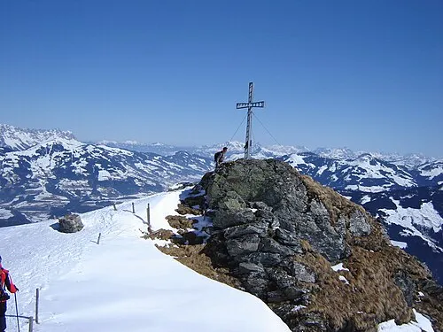 Feldalpenhorn Mountain, Hopfgarten im Brixental8.3 km SE
-
Turmkogel Mountain, Hopfgarten im Brixental6.7 km SE
-
Unterinntal Natural site, Tyrol6.5 km W
Sources & licences
Data last updated: · 2 independent sources