Alpenberg
Located in Weyregg am Attersee, Vöcklabruck District Coordinates: 47°55′22″ N 13°39′52″ E
- Elevation
- 973 m
- above sea level
- Local time
- UTC+01:00
- Europe/Vienna · UTC+01:00
- Airports
- SZG Salzburg Airport51 km
- LNZ Linz-Hörsching Airport52 km
About Alpenberg
Alpenberg is a mountain. Location: Weyregg am Attersee, Vöcklabruck District. Elevation: 973 m. The best months to visit are July–August. The nearest airport is Salzburg Airport (51 km). Nearby sights include Hongar and Schimplgupf.
Photos of Alpenberg
-
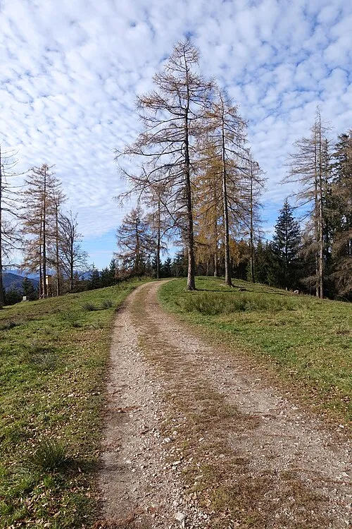
Hongar Tigerente · CC BY-SA 4.0 -
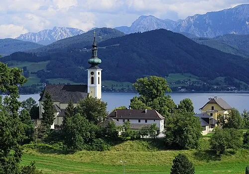
Wachtberg Thomas Ledl · CC BY-SA 4.0


Climate of Alpenberg
Best months for sightseeingBest months for sightseeing: July–August.
This month · November
A wet month
Day 4° · Night -3° · Rain 103 mm
- Hottest month
- July (day 19°)
- Coldest month
- January (night -7°)
- Wettest month
- July (175 mm)
- Driest month
- February (79 mm)
Bars: average monthly low and high temperature. Below: precipitation. Monthly averages for 1970–2000 at about 18 km resolution, adjusted for elevation. Highlighted months are mild and relatively dry. Source: WorldClim 2.1 (CC BY 4.0).
Show values as a table
| Month | Jan | Feb | Mar | Apr | May | Jun | Jul | Aug | Sep | Oct | Nov | Dec |
|---|---|---|---|---|---|---|---|---|---|---|---|---|
| Average high (°C) | 0° | 1° | 5° | 9° | 15° | 17° | 19° | 19° | 15° | 10° | 4° | 0° |
| Average low (°C) | -7° | -6° | -3° | 0° | 5° | 8° | 10° | 10° | 6° | 2° | -3° | -6° |
| Precipitation (mm) | 90 | 79 | 101 | 96 | 110 | 154 | 175 | 150 | 111 | 90 | 103 | 105 |
How to get to Alpenberg
The nearest airport is Salzburg Airport (SZG), 51 km to the west as the crow flies. The nearest large city is Salzburg, 48 km to the west.
Airports
- Salzburg Airport (SZG) Salzburg 51 kmwest
- Linz-Hörsching Airport (LNZ) Linz 52 kmnortheast
- České Budějovice South Bohemian Airport (JCL) České Budějovice 127 kmnortheast
Nearby large cities
- Salzburg Population: 157.2K 48 kmwest
- Linz Population: 204.8K 63 kmnortheast
- Klagenfurt Population: 100.3K 152 kmsouth
- Munich Population: 1.5M 158 kmwest
- Graz Population: 303.3K 164 kmsoutheast
Straight-line distances; road distances are longer. Airport data: OurAirports.
Day trips from Alpenberg
Within 100 km: 276 historic and cultural sites, 2,773 natural sites, 999 lakes, rivers and coasts.
0–25 km212 places
- Vorderer Langbathsee Lake 10 kmS
- Traunsee Lake 13 kmSE
- Schwarzensee Lake 23 kmSW
- Schwarzensee Lake 20 kmS
25–60 km1,271 places
- Hoher Dachstein Mountain 50 kmS
- Windhagersee Lake 51 kmSE
- Brunnsteiner See Lake 54 kmSE
- Brunner See Lake 51 kmSE
60–100 km2,565 places
- Frauenchiemsee Island 93 kmW
- Herreninsel Island 95 kmW
- Klamm Natural site 67 kmSE
- Gusen I Concentration Camp Historic site 70 kmNE
Straight-line distances.
Nearest towns and villages
-
Kasten Village, Aurach am Hongar1.2 km N
-
Aurach am Hongar Municipality, Vöcklabruck District2.5 km N
-
Schörfling am Attersee Municipality, Vöcklabruck District3.7 km W
-
Halbmoos Village, Aurach am Hongar2.1 km N
-
Häusern Village, Schörfling am Attersee0.4 km W
-
Oberhehenfeld Village, Schörfling am Attersee3 km W
Nearby attractions & nature
Everything nearby-
Hongar Mountain, Aurach am Hongar2.4 km E
-
Schimplgupf Mountain, Aurach am Hongar2.9 km NE
-
Richtberg Mountain, Weyregg am Attersee3.6 km S
-
Taubenkogel Mountain, Weyregg am Attersee3.5 km SW
-
Widhag Mountain, Weyregg am Attersee3.7 km SW
-
Gahberg Mountain, Weyregg am Attersee5.4 km W
-
Kienesberg Mountain, Weyregg am Attersee5.5 km SW
-
Hochkreut Mountain, Altmünster5.6 km S
More nature in Austria
-
Wachtberg Mountain, Weyregg am Attersee7.7 km SW
-
Miesenberg Mountain, Weyregg am Attersee6.5 km S
-
Gupf Mountain, Weyregg am Attersee7.1 km SW
Sources & licences
Data last updated: · 2 independent sources