Au
Located in Politischer Bezirk Bregenz, Vorarlberg Coordinates: 47°18′32″ N 9°58′00″ E
- Population
- 1,726
- 1.7K
- Elevation
- 1,304 m
- above sea level
- Local time
- UTC+01:00
- Europe/Vienna · UTC+01:00
- Places inside
- 34
- listed under Au
- Airports
- ACH Sankt Gallen Altenrhein Airport36 km
- FDH Bodensee Airport Friedrichshafen53 km
About Au
Au is a municipality. Location: Politischer Bezirk Bregenz, Vorarlberg. Population: 1,726. Elevation: 1,304 m. The best months to visit are July–August. The nearest airport is Sankt Gallen Altenrhein Airport (36 km). Nearby sights include Pfarrkirche Schoppernau and Toblermann.
Climate of Au
Best months for sightseeingBest months for sightseeing: July–August.
This month · November
A wet month
Day 5° · Night -2° · Rain 112 mm
- Hottest month
- July (day 19°)
- Coldest month
- January (night -6°)
- Wettest month
- July (183 mm)
- Driest month
- October (96 mm)
Bars: average monthly low and high temperature. Below: precipitation. Monthly averages for 1970–2000 at about 18 km resolution, adjusted for elevation. Highlighted months are mild and relatively dry. Source: WorldClim 2.1 (CC BY 4.0).
Show values as a table
| Month | Jan | Feb | Mar | Apr | May | Jun | Jul | Aug | Sep | Oct | Nov | Dec |
|---|---|---|---|---|---|---|---|---|---|---|---|---|
| Average high (°C) | 2° | 2° | 5° | 8° | 13° | 16° | 19° | 18° | 15° | 11° | 5° | 3° |
| Average low (°C) | -6° | -6° | -3° | 0° | 4° | 7° | 10° | 10° | 7° | 3° | -2° | -4° |
| Precipitation (mm) | 100 | 97 | 99 | 105 | 126 | 166 | 183 | 169 | 127 | 96 | 112 | 108 |
How to get to Au
The nearest airport is Sankt Gallen Altenrhein Airport (ACH), 36 km to the northwest as the crow flies. For international flights: Bodensee Airport Friedrichshafen (FDH) (53 km). The nearest large city is Winterthur, 96 km to the west.
Airports
- Sankt Gallen Altenrhein Airport (ACH) St. Gallen 36 kmnorthwest
- Bodensee Airport Friedrichshafen (FDH) Friedrichshafen 53 kmnorthwest
- Memmingen Allgau Airport (FMM) Memmingen 78 kmnorth
Nearby large cities
- Winterthur Population: 111.8K 96 kmwest
- Zurich Population: 415.4K 107 kmwest
- Innsbruck Population: 132.5K 108 kmeast
- Ulm Population: 120.5K 121 kmnorth
- Augsburg Population: 301.1K 137 kmnortheast
Straight-line distances; road distances are longer. Airport data: OurAirports.
Places in Au
34 placesBar: population relative to the most populous place in this list.
Cities & villages8
- Ahornen Berggüter · Village
- Ahornen Vorsäß · Village
- Argenau · Neighbourhood
- Argenzipfel · Village
- Berbigen Vorsäß · Village
- Hinter Boden Vorsäß · Village
- Schrecken · Neighbourhood
- Vorder Boden Vorsäß · Village
Mountains & nature20
- Annalper Stecken · Mountain
- Äuelewald · Natural site
- Auf der Platte · Mountain
- Brendler Lug · Mountain
- Diedamskopf · Mountain
- Dreihüttenwald · Natural site
- Grünes Gräshorn · Mountain
- Gunga · Mountain
- Gungern · Mountain
- Hohes Hehle · Mountain
- Hörnle · Mountain
- Klipperen · Mountain
- Kohlerswäldchen · Natural site
- Kuhgehrwald · Natural site
- Mittagsfluh · Mountain
- Runder Kopf (Kanisfluh) · Mountain
- Sonnenspitz (Kanisfluh) · Mountain
- Stübarkopf · Mountain
- Töbelejoch · Mountain
- Wannenkopf · Mountain
Lakes, rivers & coasts3
- Annalperbach · River
- Leuebach · River
- Riedbach · River
Heritage & sights1
- Pfarrkirche Au · Attraction
Nearby attractions & nature
Everything nearby-
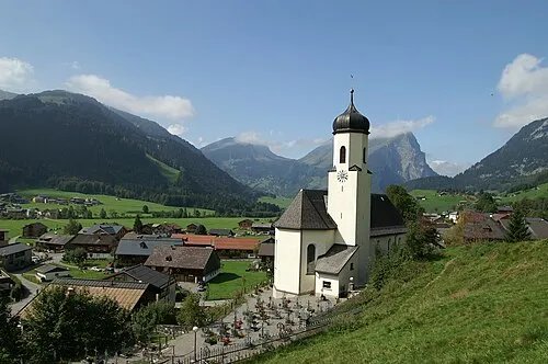 Pfarrkirche Schoppernau Attraction, Schoppernau3.9 km E
-
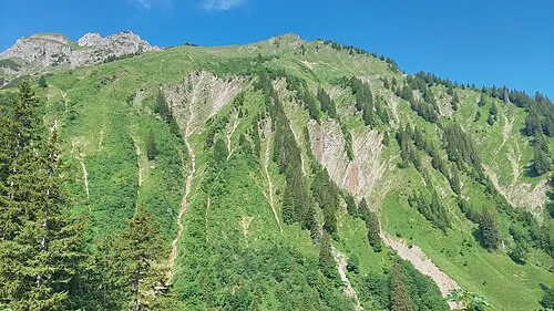 Toblermann Mountain, Schoppernau4 km SE
-
Korbschrofen Mountain, Mellau3.2 km W
-
Dürrenbach River, Schoppernau2.8 km E
-
Sonnenspitz Mountain, Schnepfau3.4 km NW
-
Kanisfluh Mountain, Mellau3.4 km NW
-
Holenke Mountain, Schnepfau3.9 km NW
-
Holenke Mountain, Mellau3.9 km NW
Sources & licences
Data last updated: