Arrondissement of Oudenaarde
Located in East Flanders, Flemish Region Coordinates: 50°49′57″ N 3°39′12″ E
- Population
- 123,330
- 123.3K
- Elevation
- 86 m
- above sea level
- Local time
- UTC+01:00
- Europe/Brussels · UTC+01:00
- Places inside
- 10
- listed under Arrondissement of Oudenaarde
- Airports
- LIL Lille Airport49 km
- BRU Brussels Airport59 km
About Arrondissement of Oudenaarde
Arrondissement of Oudenaarde is a municipality. Location: East Flanders, Flemish Region. Population: 123,330. Elevation: 86 m. The best months to visit are June–August. The nearest airport is Lille Airport (49 km). Nearby sights include Borrebeek and Pauwelsbeek.
Climate of Arrondissement of Oudenaarde
Best months for sightseeingBest months for sightseeing: June–August.
This month · November
A cold month
Day 9° · Night 4° · Rain 80 mm
- Hottest month
- August (day 23°)
- Coldest month
- February (night 0°)
- Wettest month
- November (80 mm)
- Driest month
- February (50 mm)
Bars: average monthly low and high temperature. Below: precipitation. Monthly averages for 1970–2000 at about 18 km resolution, adjusted for elevation. Highlighted months are mild and relatively dry. Source: WorldClim 2.1 (CC BY 4.0).
Show values as a table
| Month | Jan | Feb | Mar | Apr | May | Jun | Jul | Aug | Sep | Oct | Nov | Dec |
|---|---|---|---|---|---|---|---|---|---|---|---|---|
| Average high (°C) | 5° | 6° | 10° | 13° | 18° | 20° | 22° | 23° | 19° | 14° | 9° | 6° |
| Average low (°C) | 1° | 0° | 3° | 4° | 8° | 11° | 13° | 13° | 10° | 7° | 4° | 2° |
| Precipitation (mm) | 64 | 50 | 66 | 50 | 63 | 74 | 68 | 58 | 65 | 75 | 80 | 73 |
How to get to Arrondissement of Oudenaarde
The nearest airport is Lille Airport (LIL), 49 km to the southwest as the crow flies. The nearest large city is Ghent, 25 km to the north.
Airports
- Lille Airport (LIL) Lesquin 49 kmsouthwest
- Brussels Airport (BRU) Zaventem 59 kmeast
- Ostend-Bruges International Airport (OST) Oostende 68 kmnorthwest
Nearby large cities
- Ghent Population: 265.1K 25 kmnorth
- Anderlecht Population: 160.6K 47 kmeast
- Lille Population: 238.7K 48 kmsouthwest
- Brussels Population: 1M 49 kmeast
- Schaarbeek Population: 132.8K 51 kmeast
Straight-line distances; road distances are longer. Airport data: OurAirports.
Day trips from Arrondissement of Oudenaarde
Within 100 km: 268 historic and cultural sites, 569 natural sites, 907 lakes, rivers and coasts.
0–25 km184 places
- Mont de Rhodes Mountain 9 kmSE
- Muziekberg Mountain 9 kmS
- Mont de Mainvault Mountain 20 kmS
- Kruiken Berg Mountain 10 kmS
25–60 km706 places
- Het Eiland Island 48 kmNE
- Blankaart Lake 58 kmW
- Lac des Herbieres Lake 42 kmS
- Les marais d'HArchies Lake 41 kmS
60–100 km854 places
- Knokke-Strand Beach 63 kmNW
- Klein Strand Oostende Beach 68 kmNW
- Putse Moer Lake 82 kmNE
- Étang de Virelles Lake 98 kmSE
Straight-line distances.
Arrondissement of Oudenaarde and similar cities
Side by side with cities of similar size in the same country: population, elevation and climate.
| Measure | Arrondissement of Oudenaarde | Bruges | Schaarbeek | Namur |
|---|---|---|---|---|
| Population | 123.3K | 118.5K | 132.8K | 110.9K |
| Elevation | 86 m | 13 m | 29 m | 88 m |
| Summer day (hottest month) | 23° | 22° | 23° | 23° |
| Winter night (coldest month) | 0° | 1° | 1° | 0° |
| Annual rainfall | 786 mm | 783 mm | 783 mm | 813 mm |
| Best months | Jun–Aug | Jun–Sep | Jun–Aug | Jun–Aug |
| Distance | — | 52 km | 51 km | 95 km |
Climate values are 1970–2000 monthly averages; straight-line distance.
Places in Arrondissement of Oudenaarde
10 places
Oudenaarde
Population: 31.4K

Ronse
Population: 26.5K

Kruisem
Population: 15.6K
Brakel
Population: 14.8K

Zwalm
Population: 8.1K

Lierde
Population: 6.6K
Bar: population relative to the most populous place in this list.
Nearby attractions & nature
Everything nearby-
Borrebeek River, East Flanders0.9 km E
-
Pauwelsbeek River, East Flanders1.8 km S
-
Schamperijbeek River, East Flanders2 km SE
-
Broekbeek River, East Flanders2 km SE
-
Spouwaterbeek River, East Flanders2.1 km NE
-
Sint-Amelbergabeek River, East Flanders2.1 km NE
-
Riedekensbeek River, East Flanders2.4 km NW
-
Meulebeek River, East Flanders2.6 km SW
Other cities and towns in East Flanders
-
Oudenaarde Town, Oudenaarde3.8 km NW
-
Bevere Town, Oudenaarde5 km W
-
Arrondissement of Aalst Municipality, East Flanders22 km E
-
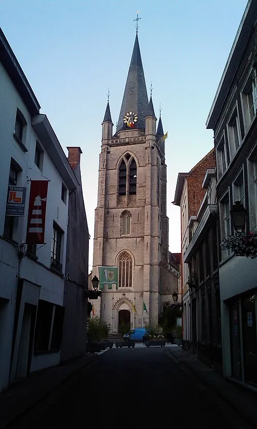 Ronse Town, Ronse10 km S
-
Arrondissement of Ghent Municipality, East Flanders24 km N
-
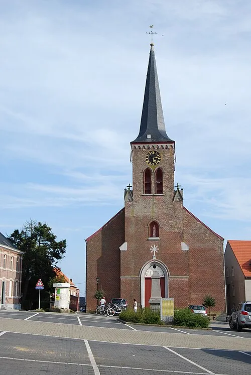 Sint-Maria-Lierde Town, Lierde14 km E
Sources & licences
Data last updated: