Temse
Located in Arrondissement Sint-Niklaas, East Flanders Coordinates: 51°08′04″ N 4°12′31″ E

- Population
- 29,926
- 29.9K
- Elevation
- 11 m
- above sea level
- Local time
- UTC+01:00
- Europe/Brussels · UTC+01:00
- Places inside
- 40
- listed under Temse
- Airports
- ANR Antwerp International Airport (Deurne)19 km
- BRU Brussels Airport32 km
About Temse
Temse is a village. Location: Arrondissement Sint-Niklaas, East Flanders. Population: 29,926. Elevation: 11 m.
Temse (Dutch pronunciation: [ˈtɛmsə] ; French: Tamise [tamiz]) is a municipality in East Flanders, Belgium. The name Temse is derived from the Gallo-Roman/Gaul Tamisiacum or Tamasiacum. This is also reflected in the French name for the town, Tamise. The main sights include the Church of Our Lady, whose steeple was designed by the famous sculptor Adriaan Nijs, who died in Temse, and who also sculpted the wooden pulpit. Inside the church the relics of Amalberga of Temse are venerated.
Source: Wikipedia · CC BY-SA 4.0
Photos of Temse
-

Torsade de Pointes · CC0 -

Torsade de Pointes · CC0 -

Mertens, Joeri · CC BY 4.0 -

Wikimedia Commons · CC BY 4.0 -

Willemjans · CC BY-SA 3.0


Places bordering Temse
- Bornem
- Waasmunster
- Hamme
- Sint-Niklaas
Climate of Temse
Best months for sightseeingBest months for sightseeing: June–August.
This month · November
A cold month
Day 10° · Night 4° · Rain 77 mm
- Hottest month
- August (day 23°)
- Coldest month
- February (night 1°)
- Wettest month
- November (77 mm)
- Driest month
- April (50 mm)
Bars: average monthly low and high temperature. Below: precipitation. Monthly averages for 1970–2000 at about 18 km resolution, adjusted for elevation. Highlighted months are mild and relatively dry. Source: WorldClim 2.1 (CC BY 4.0).
Show values as a table
| Month | Jan | Feb | Mar | Apr | May | Jun | Jul | Aug | Sep | Oct | Nov | Dec |
|---|---|---|---|---|---|---|---|---|---|---|---|---|
| Average high (°C) | 6° | 7° | 10° | 13° | 18° | 20° | 22° | 23° | 19° | 15° | 10° | 7° |
| Average low (°C) | 1° | 1° | 3° | 5° | 9° | 12° | 13° | 13° | 11° | 7° | 4° | 2° |
| Precipitation (mm) | 64 | 51 | 63 | 50 | 63 | 75 | 68 | 60 | 69 | 72 | 77 | 74 |
How to get to Temse
The nearest airport is Antwerp International Airport (Deurne) (ANR), 19 km to the east as the crow flies. For international flights: Brussels Airport (BRU) (32 km). The nearest large city is Antwerp, 16 km to the northeast.
Airports
- Antwerp International Airport (Deurne) (ANR) Antwerp 19 kmeast
- Brussels Airport (BRU) Zaventem 32 kmsoutheast
- Brussels South Charleroi Airport (CRL) Charleroi 77 kmsouth
Nearby large cities
- Antwerp Population: 529.2K 16 kmnortheast
- Schaarbeek Population: 132.8K 32 kmsouth
- Brussels Population: 1M 33 kmsouth
- Anderlecht Population: 160.6K 34 kmsouth
- Ghent Population: 265.1K 36 kmwest
Straight-line distances; road distances are longer. Airport data: OurAirports.
Day trips from Temse
Within 100 km: 270 historic and cultural sites, 593 natural sites, 1,028 lakes, rivers and coasts.
0–25 km190 places
- Het Eiland Island 20 kmNW
- Kleine Weel Lake 17 kmN
- Grote Weel Lake 16 kmN
- Grote Geule Lake 17 kmN
25–60 km701 places
- Putse Moer Lake 32 kmNE
- Stappensven Lake 35 kmNE
- Hofstademeer Lake 27 kmSE
- Vijvers van Bellefroid Lake 43 kmSE
60–100 km1,000 places
- IJsselmonde Island 84 kmN
- Knokke-Strand Beach 69 kmW
- Klein Strand Oostende Beach 91 kmW
- Grand Étang de Fosse Lake 92 kmS
Straight-line distances.
Places in Temse
40 placesBar: population relative to the most populous place in this list.
Cities & villages34
- Beekstraat · Village
- Bergstraat · Village
- Blauwhof · Village
- Brandstraat · Village
- Den Doorn · Village
- De Wallen · Village
- Eekhoutdries · Village
- Eigenlo · Village
- Groenen Boomgaard · Village
- Hazennest · Village
- Hogenakker · Village
- Hollebeek · Village
- Hoogkamerstraat · Village
- Houtbriel · Village
- Kerkstraat · Village
- Kettermuit · Village
- Kraak · Village
- Laagstraat · Village
- Luiseek · Village
- Molenstraat · Village
- Moortelstraat · Village
- Oevers · Village
- Oostbarm · Village
- Rotstraat · Village
- Ruistraat · Village
- Schoenstraat · Village
- Schouselbroek · Village
- Schouselhoek · Village
- Smesken · Village
- Veldstraat · Village
- Velle · Village
- Vierstraat · Village
- Vijfhuizen · Village
- Wallekenhof · Village
Heritage & sights2
- Fort van Steendorp · Historic site
- Schans van Lauwershoek · Historic site
Nearby attractions & nature
Everything nearby-
Jachtbeek River, East Flanders1.8 km N
-
Vrouwerhofbeek River, East Flanders2.1 km S
-
Libeek River, East Flanders2.5 km NW
-
Kletterbos Natural site, East Flanders3 km NW
-
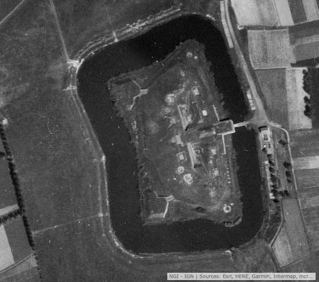 Fort van Haasdonk Historic site, Beveren-Kruibeke-Zwijndrecht4.5 km N
-
Schans van Landmolen Historic site, Beveren-Kruibeke-Zwijndrecht3.4 km NE
Sources & licences
Data last updated: · 2 independent sources