
- Elevation
- 34 m
- above sea level
- Local time
- UTC+01:00
- Europe/Brussels · UTC+01:00
- Airports
- LIL Lille Airport41 km
- OST Ostend-Bruges International Airport45 km
About Abele
Abele is a village. Location: West Flanders Province, Flemish Region. Elevation: 34 m.
Abele (also spelled Abeele) is a small village or hamlet in the city of Poperinge, in the Belgian province of West Flanders. The village is located on the territory of Poperinge proper and its "deelgemeente" Watou, but is also partly located on French territory. Abele has about 600 inhabitants, of whom about 100 are French. The main street coincides with the border between Belgium and France, so houses located on different sides of the street are located in a different country.
Source: Wikipedia · CC BY-SA 4.0
Photos of Abele
-
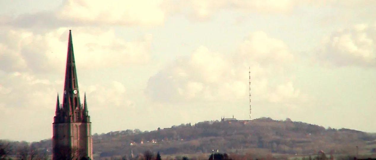
Mont des Cats Lion59 · CC BY-SA 3.0 -
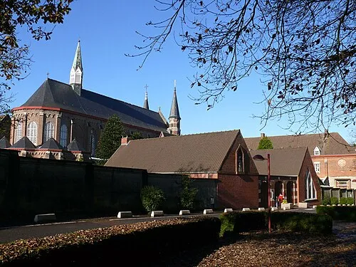
Abbaye du Mont des Cats This illustration was made by Peter Potrowl . Please credit this with : © Peter Potrowl in the immediate vicinity of the · CC BY-SA 3.0


Climate of Abele
Best months for sightseeingBest months for sightseeing: June–August.
This month · November
A cold month
Day 10° · Night 4° · Rain 75 mm
- Hottest month
- August (day 22°)
- Coldest month
- February (night 1°)
- Wettest month
- November (75 mm)
- Driest month
- February (43 mm)
Bars: average monthly low and high temperature. Below: precipitation. Monthly averages for 1970–2000 at about 18 km resolution, adjusted for elevation. Highlighted months are mild and relatively dry. Source: WorldClim 2.1 (CC BY 4.0).
Show values as a table
| Month | Jan | Feb | Mar | Apr | May | Jun | Jul | Aug | Sep | Oct | Nov | Dec |
|---|---|---|---|---|---|---|---|---|---|---|---|---|
| Average high (°C) | 6° | 7° | 10° | 13° | 17° | 19° | 22° | 22° | 19° | 15° | 10° | 7° |
| Average low (°C) | 1° | 1° | 3° | 4° | 8° | 11° | 13° | 13° | 10° | 7° | 4° | 2° |
| Precipitation (mm) | 58 | 43 | 55 | 48 | 57 | 64 | 60 | 53 | 69 | 70 | 75 | 66 |
How to get to Abele
The nearest airport is Lille Airport (LIL), 41 km to the southeast as the crow flies. The nearest large city is Lille, 34 km to the southeast.
Airports
- Lille Airport (LIL) Lesquin 41 kmsoutheast
- Ostend-Bruges International Airport (OST) Oostende 45 kmnorth
- Brussels Airport (BRU) Zaventem 128 kmeast
Nearby large cities
- Lille Population: 238.7K 34 kmsoutheast
- Bruges Population: 118.5K 59 kmnortheast
- Ghent Population: 265.1K 78 kmeast
- Amiens Population: 143.1K 105 kmsouth
- Saint Peters Population: 125.4K 107 kmnorthwest
Straight-line distances; road distances are longer. Airport data: OurAirports.
Day trips from Abele
Within 100 km: 147 historic and cultural sites, 200 natural sites, 461 lakes, rivers and coasts.
0–25 km73 places
- Blankaart Lake 23 kmNE
- Rode Berg Mountain 7 kmSE
- Kemmelberg Mountain 11 kmE
- Polygoon van Zonnebeke Natural site 23 kmE
25–60 km249 places
- Klein Strand Oostende Beach 50 kmN
- Mont de l'Enclus Mountain 59 kmE
- Wijnendaelebos Natural site 39 kmNE
- Vagevuurbos Natural site 56 kmNE
60–100 km486 places
- Plage Saint-Gabriel Beach 81 kmW
- Plage de Fort-Mahon Beach 96 kmSW
- Knokke-Strand Beach 74 kmNE
- Lac des Herbieres Lake 89 kmSE
Straight-line distances.
Nearby attractions & nature
Everything nearby-
Abbaye du Mont des Cats Attraction, Godewaersvelde3.5 km S
-
Mont des Cats Mountain, Berthen3.7 km S
-
Mont des Cats TV Mast Landmark, Berthen3.8 km S
-
Winterbeek River, West Flanders Province3 km NE
-
Plokhaanbeek River, West Flanders Province4.4 km NW
-
Steenvoordebeek River, Belgium5.9 km NW
Other cities and towns in West Flanders Province


Sources & licences
Data last updated: · 2 independent sources