Arrondissement of Thuin
Located in Hainaut Province, Wallonia Coordinates: 50°14′08″ N 4°15′37″ E
- Population
- 151,699
- 151.7K
- Elevation
- 227 m
- above sea level
- Local time
- UTC+01:00
- Europe/Brussels · UTC+01:00
- Places inside
- 14
- listed under Arrondissement of Thuin
- Airports
- CRL Brussels South Charleroi Airport29 km
- BRU Brussels Airport76 km
About Arrondissement of Thuin
Arrondissement of Thuin is a municipality. Location: Hainaut Province, Wallonia. Population: 151,699. Elevation: 227 m. The best months to visit are June–August. The nearest airport is Brussels South Charleroi Airport (29 km). Nearby sights include Barbesioneau and Ruisseau de Beaumont.
Climate of Arrondissement of Thuin
Best months for sightseeingBest months for sightseeing: June–August.
This month · November
A cold month
Day 9° · Night 3° · Rain 78 mm
- Hottest month
- August (day 22°)
- Coldest month
- February (night -1°)
- Wettest month
- November (78 mm)
- Driest month
- February (59 mm)
Bars: average monthly low and high temperature. Below: precipitation. Monthly averages for 1970–2000 at about 18 km resolution, adjusted for elevation. Highlighted months are mild and relatively dry. Source: WorldClim 2.1 (CC BY 4.0).
Show values as a table
| Month | Jan | Feb | Mar | Apr | May | Jun | Jul | Aug | Sep | Oct | Nov | Dec |
|---|---|---|---|---|---|---|---|---|---|---|---|---|
| Average high (°C) | 5° | 6° | 9° | 12° | 17° | 20° | 22° | 22° | 18° | 14° | 9° | 6° |
| Average low (°C) | 0° | -1° | 2° | 3° | 7° | 10° | 12° | 12° | 9° | 6° | 3° | 1° |
| Precipitation (mm) | 71 | 59 | 72 | 59 | 69 | 77 | 70 | 61 | 64 | 71 | 78 | 78 |
How to get to Arrondissement of Thuin
The nearest airport is Brussels South Charleroi Airport (CRL), 29 km to the northeast as the crow flies. The nearest large city is Charleroi, 24 km to the northeast.
Airports
- Brussels South Charleroi Airport (CRL) Charleroi 29 kmnortheast
- Brussels Airport (BRU) Zaventem 76 kmnorth
- Lille Airport (LIL) Lesquin 90 kmnorthwest
Nearby large cities
- Charleroi Population: 200.1K 24 kmnortheast
- Namur Population: 110.9K 50 kmnortheast
- Anderlecht Population: 160.6K 67 kmnorth
- Brussels Population: 1M 69 kmnorth
- Schaarbeek Population: 132.8K 71 kmnorth
Straight-line distances; road distances are longer. Airport data: OurAirports.
Day trips from Arrondissement of Thuin
Within 100 km: 247 historic and cultural sites, 1,075 natural sites, 827 lakes, rivers and coasts.
0–25 km216 places
- Étang de Virelles Lake 19 kmS
- Étang de Séloignes Lake 24 kmS
- Étang du Moulin Lake 11 kmS
- Lac de l'Eau d'Heure Lake 10 kmE
25–60 km673 places
- Île d'Androssart Island 41 kmE
- Étang d'Oise Lake 26 kmS
- Grand Étang de Fosse Lake 33 kmNE
- Étang de la Forge Gérard Lake 28 kmS
60–100 km1,260 places
- Hofstademeer Lake 85 kmN
- Étang des Épioux Lake 92 kmSE
- Vijvers van Bellefroid Lake 81 kmNE
- Wijngaardberg Mountain 87 kmNE
Straight-line distances.
Arrondissement of Thuin and similar cities
Side by side with cities of similar size in the same country: population, elevation and climate.
| Measure | Arrondissement of Thuin | Anderlecht | Schaarbeek | Bruges |
|---|---|---|---|---|
| Population | 151.7K | 160.6K | 132.8K | 118.5K |
| Elevation | 227 m | 27 m | 29 m | 13 m |
| Summer day (hottest month) | 22° | 23° | 23° | 22° |
| Winter night (coldest month) | -1° | 1° | 1° | 1° |
| Annual rainfall | 829 mm | 790 mm | 783 mm | 783 mm |
| Best months | Jun–Aug | Jun–Aug | Jun–Aug | Jun–Sep |
| Distance | — | 67 km | 71 km | 131 km |
Climate values are 1970–2000 monthly averages; straight-line distance.
Places in Arrondissement of Thuin
14 places- 1 Binche 32.8K
- 2 Morlanwelz 19.1K
- 3 Thuin 14.7K
- 4 Ham-sur-Heure-Nalinnes 13.6K
- 5 Anderlues 12.3K
- 6 Erquelinnes 10K
- 7 Chimay 9.8K
- 8 Estinnes 7.7K
- 9 Beaumont 7.1K
- 10 Lobbes 5.8K
- 11 Momignies 5.3K
- 12 Sivry-Rance 4.8K
- 13 Merbes-le-Château 4.3K
- 14 Froidchapelle 4K
Bar: population relative to the most populous place in this list.
Nearby attractions & nature
Everything nearby-
Barbesioneau River, Hainaut Province1.8 km SW
-
Ruisseau de Beaumont River, Hainaut Province2.2 km S
-
Bois de Blimont Natural site, Hainaut Province2.5 km E
-
Bois du Goulot Natural site, Hainaut Province3.1 km W
-
Bois du Tronquois Natural site, Hainaut Province3.6 km NE
-
Bois des Foulons Natural site, Hainaut Province4 km S
-
Bois de Strée Natural site, Hainaut Province4.6 km N
-
Bois des Menus Natural site, Hainaut Province5.3 km N
Other cities and towns in Hainaut Province
-
Beaumont Town, Beaumont1.5 km W
-
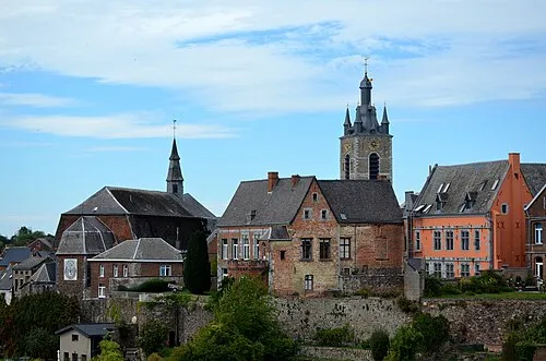 Thuin Town, Thuin12 km N
-
Erquelinnes Town, Erquelinnes13 km NW
-
Lobbes Town, Lobbes13 km N
-
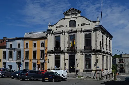 Lodelinsart Town, Charleroi26 km NE
-
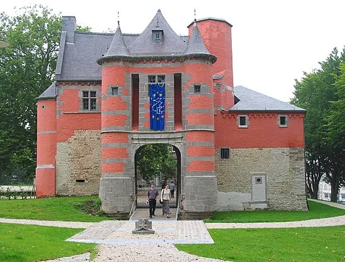 Trazegnies Town, Courcelles26 km N
Sources & licences
Data last updated: