Bois du Carmois
Located in Hainaut Province, Wallonia Coordinates: 50°39′09″ N 3°39′32″ E
- Elevation
- 80 m
- above sea level
- Local time
- UTC+01:00
- Europe/Brussels · UTC+01:00
- Airports
- LIL Lille Airport41 km
- CRL Brussels South Charleroi Airport61 km
About Bois du Carmois
Bois du Carmois is a natural site. Location: Hainaut Province, Wallonia. The best months to visit are June–August. The nearest airport is Lille Airport (41 km). Nearby sights include Bois d'Houtaing and Bois Saint-Martin.
Climate of Bois du Carmois
Best months for sightseeingBest months for sightseeing: June–August.
This month · November
A cold month
Day 9° · Night 3° · Rain 77 mm
- Hottest month
- August (day 23°)
- Coldest month
- February (night 0°)
- Wettest month
- November (77 mm)
- Driest month
- February (49 mm)
Bars: average monthly low and high temperature. Below: precipitation. Monthly averages for 1970–2000 at about 18 km resolution, adjusted for elevation. Highlighted months are mild and relatively dry. Source: WorldClim 2.1 (CC BY 4.0).
Show values as a table
| Month | Jan | Feb | Mar | Apr | May | Jun | Jul | Aug | Sep | Oct | Nov | Dec |
|---|---|---|---|---|---|---|---|---|---|---|---|---|
| Average high (°C) | 5° | 6° | 10° | 13° | 17° | 20° | 23° | 23° | 19° | 14° | 9° | 6° |
| Average low (°C) | 1° | 0° | 3° | 4° | 8° | 11° | 13° | 12° | 10° | 7° | 3° | 2° |
| Precipitation (mm) | 62 | 49 | 66 | 51 | 63 | 72 | 67 | 57 | 60 | 72 | 77 | 70 |
How to get to Bois du Carmois
The nearest airport is Lille Airport (LIL), 41 km to the west as the crow flies. The nearest large city is Lille, 43 km to the west.
Airports
- Lille Airport (LIL) Lesquin 41 kmwest
- Brussels South Charleroi Airport (CRL) Charleroi 61 kmeast
- Brussels Airport (BRU) Zaventem 64 kmnortheast
Nearby large cities
- Lille Population: 238.7K 43 kmwest
- Ghent Population: 265.1K 44 kmnorth
- Anderlecht Population: 160.6K 51 kmnortheast
- Brussels Population: 1M 53 kmnortheast
- Schaarbeek Population: 132.8K 56 kmnortheast
Straight-line distances; road distances are longer. Airport data: OurAirports.
Day trips from Bois du Carmois
Within 100 km: 289 historic and cultural sites, 647 natural sites, 927 lakes, rivers and coasts.
0–25 km196 places
- Lac des Herbieres Lake 23 kmSE
- Les marais d'HArchies Lake 21 kmS
- Mont de Rhodes Mountain 14 kmN
- Muziekberg Mountain 11 kmN
25–60 km649 places
- Mont Panisel Mountain 33 kmSE
- Terril de l'Héribus Mountain 31 kmSE
- Bois de Wauhu Natural site 45 kmSE
- Warande Bos Natural site 41 kmN
60–100 km1,018 places
- Knokke-Strand Beach 82 kmN
- Klein Strand Oostende Beach 83 kmNW
- Het Eiland Island 66 kmN
- Île d'Androssart Island 98 kmSE
Straight-line distances.
Nearest towns and villages
-
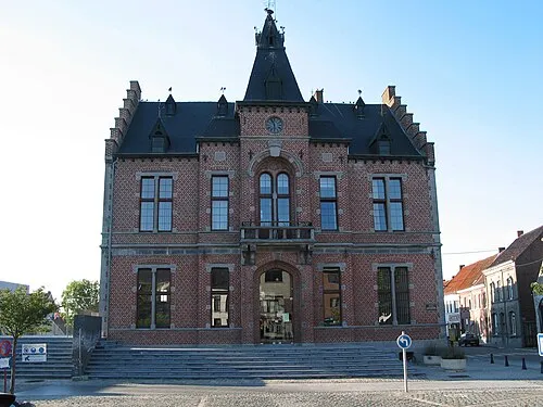 Frasnes-lez-Buissenal Town, Frasnes-lez-Anvaing3.2 km NW
-
Buissenal Village, Frasnes-lez-Anvaing1.4 km N
-
Houtaing Village, Ath2.3 km SE
-
Moustier Village, Frasnes-lez-Anvaing2.8 km W
-
Saule Pendu Village, Ath0.6 km SE
-
Mon Plaisir Village, Frasnes-lez-Anvaing0.7 km SW
Nearby attractions & nature
Everything nearby-
Bois d'Houtaing Natural site, Hainaut Province1 km E
-
Bois Saint-Martin Natural site, Hainaut Province1.4 km SW
-
Bois de Régnémont Natural site, Hainaut Province1.5 km SE
-
Bois d'Assomont Natural site, Hainaut Province1.7 km N
-
Bois de la Motte Natural site, Hainaut Province2.1 km SW
-
Bois de Chaque Natural site, Hainaut Province2.3 km NE
-
Mont de Mainvault Mountain, Ath3.1 km E
-
Rieu Pironche River, Hainaut Province3.4 km NW
Sources & licences
Data last updated: