- Elevation
- 163 m
- above sea level
- Local time
- UTC+01:00
- Europe/Brussels · UTC+01:00
- Airports
- CRL Brussels South Charleroi Airport37 km
- LGG Liège Airport67 km
About Bois des Anges
Bois des Anges is a natural site. Location: Namur Province, Wallonia. The best months to visit are June–August. The nearest airport is Brussels South Charleroi Airport (37 km). Nearby sights include Bois de Brejoul and Soumié.
Climate of Bois des Anges
Best months for sightseeingBest months for sightseeing: June–August.
This month · November
A cold month
Day 9° · Night 3° · Rain 76 mm
- Hottest month
- August (day 23°)
- Coldest month
- February (night 0°)
- Wettest month
- June (79 mm)
- Driest month
- February (58 mm)
Bars: average monthly low and high temperature. Below: precipitation. Monthly averages for 1970–2000 at about 18 km resolution, adjusted for elevation. Highlighted months are mild and relatively dry. Source: WorldClim 2.1 (CC BY 4.0).
Show values as a table
| Month | Jan | Feb | Mar | Apr | May | Jun | Jul | Aug | Sep | Oct | Nov | Dec |
|---|---|---|---|---|---|---|---|---|---|---|---|---|
| Average high (°C) | 5° | 6° | 10° | 13° | 17° | 20° | 22° | 23° | 19° | 14° | 9° | 6° |
| Average low (°C) | 0° | 0° | 2° | 4° | 8° | 11° | 13° | 12° | 10° | 7° | 3° | 1° |
| Precipitation (mm) | 68 | 58 | 68 | 60 | 72 | 79 | 74 | 66 | 65 | 70 | 76 | 75 |
How to get to Bois des Anges
The nearest airport is Brussels South Charleroi Airport (CRL), 37 km to the northwest as the crow flies. The nearest large city is Namur, 30 km to the north.
Airports
- Brussels South Charleroi Airport (CRL) Charleroi 37 kmnorthwest
- Liège Airport (LGG) Grâce-Hollogne 67 kmnortheast
- Brussels Airport (BRU) Zaventem 81 kmnorth
Nearby large cities
- Namur Population: 110.9K 30 kmnorth
- Charleroi Population: 200.1K 34 kmnorthwest
- Liège Population: 195.3K 72 kmnortheast
- Leuven Population: 101K 75 kmnorth
- Anderlecht Population: 160.6K 78 kmnorthwest
Straight-line distances; road distances are longer. Airport data: OurAirports.
Nearest towns and villages
-
Hastière Village, Arrondissement de Dinant1.8 km NE
-
Hermeton-sur-Meuse Village, Hastière1.5 km SE
-
Hastière-par-delà Village, Hastière2.4 km NE
-
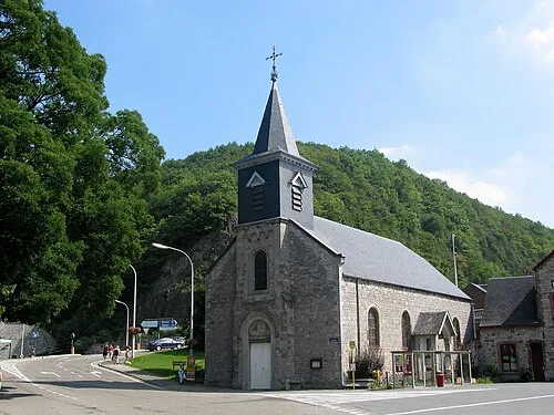 Hastière-Lavaux Town, Hastière2.3 km NE
-
Onhaye Village, Arrondissement de Dinant5.2 km NE
-
Les Journeux Village, Hastière1.3 km N
Nearby attractions & nature
Everything nearby-
Bois de Brejoul Natural site, Namur Province2.1 km SE
-
Soumié River, Namur Province1.3 km SW
-
Bois des Onches Natural site, Namur Province2.9 km S
-
Hermeton River, Namur Province1.5 km SE
-
Bois de Taille Notre-Dame Natural site, Namur Province3.4 km SW
-
Ruisseau de Féron River, Namur Province1.8 km NE
-
Bois du Roi Natural site, Namur Province3.7 km W
-
Île d'Androssart Island, Namur Province3.4 km SE
Sources & licences
Data last updated: