- Elevation
- 155 m
- above sea level
- Local time
- UTC+01:00
- Europe/Brussels · UTC+01:00
- Airports
- CRL Brussels South Charleroi Airport28 km
- LGG Liège Airport48 km
About Bois Spinette
Bois Spinette is a natural site. Location: Namur Province, Wallonia. The best months to visit are June–August. The nearest airport is Brussels South Charleroi Airport (28 km). Nearby sights include Bois de la Basse Marlagne and Bois Brûlé.
Climate of Bois Spinette
Best months for sightseeingBest months for sightseeing: June–August.
This month · November
A cold month
Day 9° · Night 3° · Rain 74 mm
- Hottest month
- August (day 23°)
- Coldest month
- February (night 0°)
- Wettest month
- June (77 mm)
- Driest month
- February (55 mm)
Bars: average monthly low and high temperature. Below: precipitation. Monthly averages for 1970–2000 at about 18 km resolution, adjusted for elevation. Highlighted months are mild and relatively dry. Source: WorldClim 2.1 (CC BY 4.0).
Show values as a table
| Month | Jan | Feb | Mar | Apr | May | Jun | Jul | Aug | Sep | Oct | Nov | Dec |
|---|---|---|---|---|---|---|---|---|---|---|---|---|
| Average high (°C) | 5° | 6° | 10° | 13° | 17° | 20° | 22° | 23° | 19° | 14° | 9° | 6° |
| Average low (°C) | 0° | 0° | 3° | 4° | 8° | 11° | 13° | 13° | 10° | 7° | 3° | 2° |
| Precipitation (mm) | 64 | 55 | 65 | 59 | 70 | 77 | 74 | 72 | 62 | 68 | 74 | 73 |
How to get to Bois Spinette
The nearest airport is Brussels South Charleroi Airport (CRL), 28 km to the west as the crow flies. The nearest large city is Namur, 4 km to the north.
Airports
- Brussels South Charleroi Airport (CRL) Charleroi 28 kmwest
- Liège Airport (LGG) Grâce-Hollogne 48 kmnortheast
- Brussels Airport (BRU) Zaventem 58 kmnorthwest
Nearby large cities
- Namur Population: 110.9K 4 kmnorth
- Charleroi Population: 200.1K 29 kmwest
- Leuven Population: 101K 51 kmnorth
- Liège Population: 195.3K 56 kmnortheast
- Brussels Population: 1M 58 kmnorthwest
Straight-line distances; road distances are longer. Airport data: OurAirports.
Nearest towns and villages
-
Arrondissement of Namur Village, Arrondissement de Namur4.1 km N
-
Wépion Town, Arrondissement of Namur1.6 km SE
-
La Pairelle Village, Arrondissement of Namur0.5 km NE
-
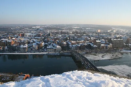 Jambes Town, Arrondissement of Namur3 km NE
-
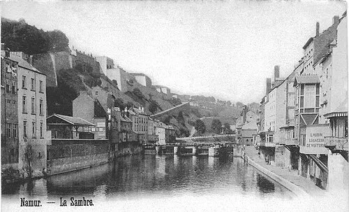 Namur City, Arrondissement of Namur3.9 km N
-
La Plante Village, Arrondissement of Namur1.9 km N
Nearby attractions & nature
Everything nearby-
Bois de la Basse Marlagne Natural site, Namur Province1.6 km NW
-
Bois Brûlé Natural site, Namur Province2.7 km E
-
Bois de l'Évèque Natural site, Namur Province5 km E
-
Bois de Dave Natural site, Namur Province5.1 km SE
-
Bois Wanchalle Natural site, Namur Province5.3 km NE
-
Bois des Acremonts Natural site, Namur Province5.3 km SE
-
Bois de la Flache Natural site, Namur Province5.8 km NW
-
Bois de la Haute Marlagne Natural site, Namur Province5.9 km SW
Sources & licences
Data last updated: