Beauvechain
Located in Arrondissement of Nivelles, Walloon Brabant Province Coordinates: 50°46′34″ N 4°45′53″ E

- Population
- 7,243
- 7.2K
- Elevation
- 86 m
- above sea level
- Local time
- UTC+01:00
- Europe/Brussels · UTC+01:00
- Places inside
- 15
- listed under Beauvechain
- Airports
- BRU Brussels Airport24 km
- CRL Brussels South Charleroi Airport41 km
About Beauvechain
Beauvechain is a village. Location: Arrondissement of Nivelles, Walloon Brabant Province. Population: 7,243. Elevation: 86 m.
Beauvechain (French: [bovəʃɛ̃]; Walloon: Bôvètchén [boːvɛˈtʃe, -ˈtʃẽ] ; Dutch: Bevekom [ˈbeːvəkɔm] ) is a municipality of Wallonia located in the province of Walloon Brabant, Belgium. On 1 January 2006 the municipality had 6,529 inhabitants. The total area is 38.58 km2, giving a population density of 169 inhabitants per km2. The municipality consists of the following districts: Beauvechain, Hamme-Mille, L’Écluse, Nodebais, and Tourinnes-la-Grosse. Beauvechain has several protected heritage sites.
Source: Wikipedia · CC BY-SA 4.0
Photos of Beauvechain
-

Smiley.toerist · CC BY-SA 3.0 -

Smiley.toerist · CC BY-SA 3.0 -

Smiley.toerist · CC BY-SA 3.0


Climate of Beauvechain
Best months for sightseeingBest months for sightseeing: June–August.
This month · November
A cold month
Day 9° · Night 4° · Rain 73 mm
- Hottest month
- August (day 23°)
- Coldest month
- February (night 0°)
- Wettest month
- November (73 mm)
- Driest month
- February (52 mm)
Bars: average monthly low and high temperature. Below: precipitation. Monthly averages for 1970–2000 at about 18 km resolution, adjusted for elevation. Highlighted months are mild and relatively dry. Source: WorldClim 2.1 (CC BY 4.0).
Show values as a table
| Month | Jan | Feb | Mar | Apr | May | Jun | Jul | Aug | Sep | Oct | Nov | Dec |
|---|---|---|---|---|---|---|---|---|---|---|---|---|
| Average high (°C) | 5° | 6° | 10° | 13° | 18° | 20° | 22° | 23° | 19° | 14° | 9° | 6° |
| Average low (°C) | 1° | 0° | 3° | 5° | 8° | 11° | 13° | 13° | 11° | 7° | 4° | 2° |
| Precipitation (mm) | 62 | 52 | 63 | 52 | 64 | 72 | 69 | 68 | 59 | 67 | 73 | 73 |
How to get to Beauvechain
The nearest airport is Brussels Airport (BRU), 24 km to the northwest as the crow flies. The nearest large city is Leuven, 12 km to the north.
Airports
- Brussels Airport (BRU) Zaventem 24 kmnorthwest
- Brussels South Charleroi Airport (CRL) Charleroi 41 kmsouthwest
- Liège Airport (LGG) Grâce-Hollogne 50 kmeast
Nearby large cities
- Leuven Population: 101K 12 kmnorth
- Schaarbeek Population: 132.8K 29 kmwest
- Brussels Population: 1M 30 kmwest
- Anderlecht Population: 160.6K 32 kmwest
- Namur Population: 110.9K 35 kmsouth
Straight-line distances; road distances are longer. Airport data: OurAirports.
Day trips from Beauvechain
Within 100 km: 278 historic and cultural sites, 1,250 natural sites, 1,166 lakes, rivers and coasts.
0–25 km181 places
- Vijvers van Bellefroid Lake 15 kmN
- Wijngaardberg Mountain 19 kmN
- Speelberg Mountain 15 kmN
- Middelborg Mountain 25 kmN
25–60 km1,039 places
- Hofstademeer Lake 29 kmNW
- Grand Étang de Fosse Lake 46 kmS
- Wetsberg Mountain 39 kmNE
- Weefberg Mountain 32 kmNE
60–100 km1,474 places
- Île du Moulin Island 63 kmE
- Île Monsin Island 63 kmE
- Het Eiland Island 75 kmNW
- Île de Franche Garenne Island 65 kmE
Straight-line distances.
Places in Beauvechain
15 placesBar: population relative to the most populous place in this list.
Cities & villages9
- Chabut · Village
- Keiberg · Village
- La Baraque · Village
- La Bruyère · Village
- La Misère · Village
- Les Burettes · Village
- Mille · Village
- Sclimpré · Village
- Tilleul du Chêne · Village
Heritage & sights1
- NDB-Transmitter HTB · Landmark
Nearby attractions & nature
Everything nearby-
Mollendaalbos Natural site, Flemish Region4.5 km NW
-
Bois de Beausart Natural site, Walloon Brabant Province4.6 km SW
-
Écluse River, Flemish Region6.1 km E
-
Meerdaalbos Natural site, Flemish Region6.8 km NW
-
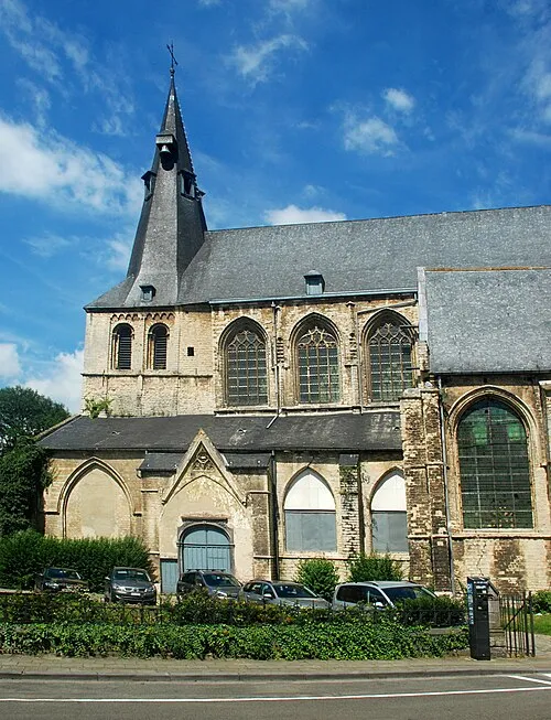 Saint Jacob's Church Attraction, Leuven13 km NW
-
Bois de Glabais Natural site, Walloon Brabant Province8.5 km SW
Sources & licences
Data last updated: · 2 independent sources