
- Elevation
- 1,809 m
- above sea level
- Local time
- UTC+01:00
- Europe/Sarajevo · UTC+01:00
- Airports
- SPU Split Saint Jerome Airport47 km
- BWK Brač Airport53 km
About Kamešnica
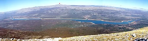
Kamešnica is a mountain. Location: Bosnia and Herzegovina. Elevation: 1,809 m. The best months to visit are June–August. The nearest airport is Split Saint Jerome Airport (47 km). Nearby sights include Dinaric Alps and Velika Golija.
Photos of Kamešnica
-

StormChaser123 · CC BY-SA 4.0

Climate of Kamešnica
Best months for sightseeingBest months for sightseeing: June–August.
This month · November
A wet month
Day 4° · Night -5° · Rain 127 mm
- Hottest month
- July (day 18°)
- Coldest month
- January (night -9°)
- Wettest month
- November (127 mm)
- Driest month
- July (50 mm)
Bars: average monthly low and high temperature. Below: precipitation. Monthly averages for 1970–2000 at about 18 km resolution, adjusted for elevation. Highlighted months are mild and relatively dry. Source: WorldClim 2.1 (CC BY 4.0).
Show values as a table
| Month | Jan | Feb | Mar | Apr | May | Jun | Jul | Aug | Sep | Oct | Nov | Dec |
|---|---|---|---|---|---|---|---|---|---|---|---|---|
| Average high (°C) | -2° | -1° | 2° | 7° | 12° | 16° | 18° | 18° | 14° | 9° | 4° | -1° |
| Average low (°C) | -9° | -9° | -6° | -3° | 1° | 4° | 7° | 6° | 3° | 0° | -5° | -8° |
| Precipitation (mm) | 77 | 71 | 76 | 83 | 70 | 73 | 50 | 62 | 87 | 109 | 127 | 106 |
How to get to Kamešnica
The nearest airport is Split Saint Jerome Airport (SPU), 47 km to the southwest as the crow flies. The nearest large city is Split, 40 km to the southwest.
Airports
- Split Saint Jerome Airport (SPU) Split 47 kmsouthwest
- Brač Airport (BWK) Gornji Humac 53 kmsouth
- Mostar International Airport (OMO) Mostar 99 kmsoutheast
Nearby large cities
- Split Population: 149.8K 40 kmsouthwest
- Mostar Population: 104.5K 93 kmsoutheast
- Zenica Population: 164.4K 102 kmnortheast
- Banja Luka Population: 221.1K 119 kmnorth
- Sarajevo Population: 696.7K 126 kmeast
Straight-line distances; road distances are longer. Airport data: OurAirports.
Day trips from Kamešnica
Within 100 km: 11 historic and cultural sites, 86 natural sites, 91 lakes, rivers and coasts.
0–25 km11 places
- Velika Golija Mountain 23 kmN
- Buško Jezero Lake 21 kmSE
- Ćulina Mountain 24 kmNW
- Peruća Lake Lake 22 kmW
25–60 km50 places
- Brač Island 50 kmS
- Šolta Island 58 kmSW
- Kukavičko Jezero Lake 48 kmNE
- Veliki Troglav Mountain 28 kmNW
60–100 km127 places
- Otok Prvić Island 81 kmW
- Otok Zlarin Island 77 kmW
- Otok Kaprije Island 88 kmW
- Krapanj Island 72 kmW
Straight-line distances.
Nearest towns and villages
-
Orguz Village, Federation of Bosnia and Herzegovina5.8 km NE
-
Otok City, Municipality of Otok8.9 km SW
-
Prolog Village, Federation of Bosnia and Herzegovina5.6 km NE
-
Tribić Village, Federation of Bosnia and Herzegovina5.9 km E
-
Bila Village, Federation of Bosnia and Herzegovina11 km E
-
 Sinj City, Town of Sinj14 km W
Nearby attractions & nature
Everything nearby-
 Dinaric Alps Mountain, Bosnia and Herzegovina20 km NW
-
 Velika Golija Mountain, Federation of Bosnia and Herzegovina23 km N
-
Kuke Mountain, Split-Dalmatia County17 km S
-
Naklo Mountain, Federation of Bosnia and Herzegovina23 km E
-
Ruda River, Croatia15 km S
-
Ćulina Mountain, Split-Dalmatia County24 km NW
-
 Peruća Lake Lake, Split-Dalmatia County22 km W
-
 Sturba River, Federation of Bosnia and Herzegovina15 km NE
More nature in Bosnia and Herzegovina
-
 Tušnica Mountain, Federation of Bosnia and Herzegovina26 km E
-
 Cincar Mountain, Federation of Bosnia and Herzegovina27 km NE
-
 Veliki Troglav Mountain, Federation of Bosnia and Herzegovina28 km NW
-
Vrba Natural site, Federation of Bosnia and Herzegovina30 km N
-
 Malovan Mountain, Federation of Bosnia and Herzegovina35 km NE
-
Staretina Mountain, Federation of Bosnia and Herzegovina39 km N
Sources & licences
Data last updated: