Dobroslavci
Located in Municipality of the Capital, Sofia-Capital Coordinates: 42°49′00″ N 23°17′00″ E
- Elevation
- 547 m
- above sea level
- Local time
- UTC+02:00
- Europe/Sofia · UTC+02:00
- Places inside
- 1
- listed under Dobroslavci
- Airports
- SOF Sofia Airport17 km
- INI Niš Constantine the Great Airport130 km
About Dobroslavci
Dobroslavci is a municipality. Location: Municipality of the Capital, Sofia-Capital. Elevation: 547 m. The best months to visit are May–June, September. The nearest airport is Sofia Airport (17 km).
Climate of Dobroslavci
Best months for sightseeingBest months for sightseeing: May–June, September.
This month · November
A cold month
Day 9° · Night 0° · Rain 51 mm
- Hottest month
- July (day 27°)
- Coldest month
- January (night -5°)
- Wettest month
- May (77 mm)
- Driest month
- January (33 mm)
Bars: average monthly low and high temperature. Below: precipitation. Monthly averages for 1970–2000 at about 18 km resolution, adjusted for elevation. Highlighted months are mild and relatively dry. Source: WorldClim 2.1 (CC BY 4.0).
Show values as a table
| Month | Jan | Feb | Mar | Apr | May | Jun | Jul | Aug | Sep | Oct | Nov | Dec |
|---|---|---|---|---|---|---|---|---|---|---|---|---|
| Average high (°C) | 3° | 6° | 11° | 16° | 21° | 25° | 27° | 27° | 23° | 17° | 9° | 5° |
| Average low (°C) | -5° | -4° | -1° | 4° | 8° | 12° | 13° | 13° | 9° | 4° | 0° | -3° |
| Precipitation (mm) | 33 | 36 | 43 | 55 | 77 | 77 | 64 | 51 | 43 | 44 | 51 | 42 |
How to get to Dobroslavci
The nearest airport is Sofia Airport (SOF), 17 km to the southeast as the crow flies. The nearest large city is Sofia, 14 km to the south.
Airports
- Sofia Airport (SOF) Sofia 17 kmsoutheast
- Niš Constantine the Great Airport (INI) Niš 130 kmnorthwest
- Plovdiv International Airport (PDV) Plovdiv 153 kmsoutheast
Nearby large cities
- Sofia Population: 1.2M 14 kmsouth
- Niš Population: 250K 126 kmnorthwest
- Plovdiv Population: 329.5K 141 kmsoutheast
- Craiova Population: 234.1K 172 kmnorth
- Stara Zagora Population: 121.6K 198 kmeast
Straight-line distances; road distances are longer. Airport data: OurAirports.
Day trips from Dobroslavci
Within 100 km: 6 historic and cultural sites, 27 natural sites, 4 lakes, rivers and coasts.
0–25 km6 places
- City Garden Attraction 14 kmS
- Ivan Vazov National Theatre Attraction 14 kmS
- Vitosha Mountain TV Tower Landmark 20 kmS
- Borisova Gradina TV Tower Landmark 16 kmS
25–60 km6 places
- Vidlich Mountain 53 kmNW
- Vlaška Planina Mountain 59 kmW
- Erma River 56 kmNW
- Vetren Mountain 58 kmW
60–100 km25 places
- Trem Mountain 99 kmNW
- Ostrozub Mountain 86 kmW
- Kruševica Mountain 94 kmW
- Gramada Mountain 75 kmW
Straight-line distances.
Places in Dobroslavci
1 place
Dobroslavtsi
Population: 1.3K
Other cities and towns in Municipality of the Capital
-
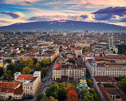 Sofia City, Municipality of the Capital14 km S
-
Podgumer Municipality, Municipality of the Capital9.7 km E
-
Ivanjane Municipality, Municipality of the Capital15 km SW
-
Kutina Municipality, Municipality of the Capital3.3 km NE
-
Rayon Vrŭbnitsa Municipality, Municipality of the Capital6.6 km S
-
Kubratovo Municipality, Municipality of the Capital7.8 km SE
Sources & licences
Data last updated: