- Elevation
- 40 m
- above sea level
- Local time
- UTC+02:00
- Europe/Sofia · UTC+02:00
- Airports
- CRA Craiova International Airport82 km
- INI Niš Constantine the Great Airport116 km
About Antimovo
Antimovo is a village. Location: Vidin, Vidin. Elevation: 40 m. The best months to visit are May, September. The nearest airport is Craiova International Airport (82 km).
Photos of Antimovo
-
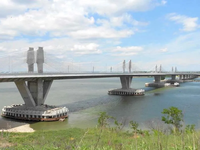
New Europe Bridge Uwarf · CC BY-SA 3.0

Climate of Antimovo
Best months for sightseeingBest months for sightseeing: May, September.
This month · November
A cold month
Day 10° · Night 2° · Rain 51 mm
- Hottest month
- July (day 29°)
- Coldest month
- January (night -3°)
- Wettest month
- June (67 mm)
- Driest month
- January (36 mm)
Bars: average monthly low and high temperature. Below: precipitation. Monthly averages for 1970–2000 at about 18 km resolution, adjusted for elevation. Highlighted months are mild and relatively dry. Source: WorldClim 2.1 (CC BY 4.0).
Show values as a table
| Month | Jan | Feb | Mar | Apr | May | Jun | Jul | Aug | Sep | Oct | Nov | Dec |
|---|---|---|---|---|---|---|---|---|---|---|---|---|
| Average high (°C) | 4° | 6° | 11° | 18° | 23° | 27° | 29° | 29° | 25° | 17° | 10° | 5° |
| Average low (°C) | -3° | -2° | 2° | 7° | 11° | 15° | 17° | 16° | 12° | 6° | 2° | -2° |
| Precipitation (mm) | 36 | 38 | 45 | 53 | 66 | 67 | 52 | 40 | 43 | 44 | 51 | 48 |
How to get to Antimovo
The nearest airport is Craiova International Airport (CRA), 82 km to the northeast as the crow flies. The nearest large city is Craiova, 76 km to the northeast.
Airports
- Craiova International Airport (CRA) Craiova 82 kmnortheast
- Niš Constantine the Great Airport (INI) Niš 116 kmsouthwest
- Sofia Airport (SOF) Sofia 153 kmsouth
Nearby large cities
- Craiova Population: 234.1K 76 kmnortheast
- Niš Population: 250K 115 kmsouthwest
- Sofia Population: 1.2M 151 kmsouth
- Piteşti Population: 141.3K 178 kmnortheast
- Belgrade Population: 1.3M 215 kmnorthwest
Straight-line distances; road distances are longer. Airport data: OurAirports.
Day trips from Antimovo
Within 100 km: 2 historic and cultural sites, 62 natural sites, 13 lakes, rivers and coasts.
0–25 km2 places
- Ostrov Bogdan Island 14 kmSW
- New Europe Bridge Landmark 2 kmS
25–60 km20 places
- Ravna Reka River 58 kmW
- Zamna River 52 kmNW
- Jelašnica River 50 kmW
- Crni Timok River 53 kmW
60–100 km55 places
- Borsko Jezero Lake 75 kmW
- Veliki Liškovac Mountain 87 kmNW
- Tresibaba Mountain 84 kmSW
- Stol Mountain 66 kmW
Straight-line distances.
Sources & licences
Data last updated: