- Local time
- UTC+01:00
- Europe/Zagreb · UTC+01:00
- Elevation
- 568 m
- above sea level
- Airports
- ZAG Zagreb Franjo Tuđman International Airport17 km
- MBX Maribor Edvard Rusjan Airport71 km
About Medvedgrad
Medvedgrad is a historic site. Location: City of Zagreb, Croatia.
Medvedgrad (pronounced [mědʋedɡraːd]; Croatian for bear-town; Hungarian: Medvevár) is a medieval fortified town located about 10 km north of Zagreb, on the south slopes of Medvednica mountain, approximately halfway from the Croatian capital Zagreb to the mountain top Sljeme. For defensive purposes it was built on a hill, Mali Plazur, that is a spur of the main ridge of the mountain that overlooks the city. On a clear day the castle can be seen from far away, especially the high main tower.
Source: Wikipedia · CC BY-SA 4.0
At a glance
- Built
- 13th century
- Heritage designation
- Register of Cultural Goods of Croatia
Source: Wikidata
Photos of Medvedgrad
-

Medvednica Wikimedia Commons · CC BY-SA 3.0

Climate of Medvedgrad
Best months for sightseeingBest months for sightseeing: June–August.
This month · November
A cold month
Day 6° · Night 0° · Rain 97 mm
- Hottest month
- July (day 23°)
- Coldest month
- January (night -5°)
- Wettest month
- June (112 mm)
- Driest month
- January (52 mm)
Bars: average monthly low and high temperature. Below: precipitation. Monthly averages for 1970–2000 at about 18 km resolution, adjusted for elevation. Highlighted months are mild and relatively dry. Source: WorldClim 2.1 (CC BY 4.0).
Show values as a table
| Month | Jan | Feb | Mar | Apr | May | Jun | Jul | Aug | Sep | Oct | Nov | Dec |
|---|---|---|---|---|---|---|---|---|---|---|---|---|
| Average high (°C) | 1° | 4° | 9° | 13° | 18° | 21° | 23° | 23° | 19° | 13° | 6° | 2° |
| Average low (°C) | -5° | -4° | -1° | 3° | 8° | 11° | 13° | 12° | 9° | 4° | 0° | -4° |
| Precipitation (mm) | 52 | 53 | 67 | 75 | 86 | 112 | 96 | 99 | 98 | 97 | 97 | 73 |
How to get to Medvedgrad
The nearest airport is Zagreb Franjo Tuđman International Airport (ZAG), 17 km to the southeast as the crow flies. The nearest large city is Zagreb, 7 km to the southeast.
Airports
- Zagreb Franjo Tuđman International Airport (ZAG) Velika Gorica 17 kmsoutheast
- Maribor Edvard Rusjan Airport (MBX) Maribor 71 kmnorth
- Ljubljana Jože Pučnik Airport (LJU) Zgornji Brnik 121 kmwest
Nearby large cities
- Zagreb Population: 663.6K 7 kmsoutheast
- Ljubljana Population: 272.2K 113 kmwest
- Rijeka Population: 108K 132 kmsouthwest
- Graz Population: 303.3K 139 kmnorth
- Klagenfurt Population: 100.3K 152 kmnorthwest
Straight-line distances; road distances are longer. Airport data: OurAirports.
Day trips from Medvedgrad
Within 100 km: 9 historic and cultural sites, 34 natural sites, 77 lakes, rivers and coasts.
0–25 km15 places
- Kašina River 23 kmE
- Krapina River 16 kmNW
- Glavničica River 21 kmE
- Krapina River 11 kmSW
25–60 km34 places
- Krka River 27 kmW
- Lake Ptuj Lake 59 kmN
- Žumberačka Gora Mountain 49 kmW
- Trdinov Vrh Mountain 50 kmW
60–100 km71 places
- Ribnica Lake Lake 87 kmNW
- Pohorje Mountain 82 kmNW
- Mala Gora Mountain 94 kmW
- Ledava River 84 kmNE
Straight-line distances.
Nearby attractions & nature
Everything nearby-
Zagreb TV Tower Landmark, City of Zagreb3.4 km N
-
St. Mark's Church Attraction, City of Zagreb6.4 km SE
-
Zagreb Cathedral Attraction, Croatia6.8 km SE
-
Zagreb ZOO Attraction, City of Zagreb8 km SE
-
Lotrščak tower Landmark, City of Zagreb6.6 km S
-
Medvednica Mountain, Croatia5.6 km N
-
Novi Dvori Historic site, Zagreb County11 km W
-
 Jezero Jarun Lake, City of Zagreb9.9 km S
Nearest towns and villages
-
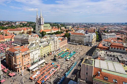 Zagreb City, City of Zagreb6.8 km SE
-
Donji grad Neighbourhood, City of Zagreb6.9 km SE
-
Gornja Bistra Village, Municipality of Bistra6.1 km NW
-
Novaki Bistranski Village, Municipality of Bistra6.3 km W
Sources & licences
Data last updated: · 2 independent sources