Donji Grad
Located in County of Osijek-Baranja, Croatia Coordinates: 45°33′27″ N 18°44′05″ E
- Elevation
- 88 m
- above sea level
- Local time
- UTC+01:00
- Europe/Zagreb · UTC+01:00
- Airports
- OSI Osijek Airport12 km
- PEV Pécs-Pogány International Airport61 km
About Donji Grad
Donji Grad is a neighbourhood. Location: County of Osijek-Baranja, Croatia. The best months to visit are May–June, September. The nearest airport is Osijek Airport (12 km). Nearby sights include Drava River and Kopački Rit Nature Park.
Climate of Donji Grad
Best months for sightseeingBest months for sightseeing: May–June, September.
This month · November
A cold month
Day 9° · Night 1° · Rain 59 mm
- Hottest month
- July (day 27°)
- Coldest month
- January (night -3°)
- Wettest month
- June (79 mm)
- Driest month
- February (35 mm)
Bars: average monthly low and high temperature. Below: precipitation. Monthly averages for 1970–2000 at about 18 km resolution, adjusted for elevation. Highlighted months are mild and relatively dry. Source: WorldClim 2.1 (CC BY 4.0).
Show values as a table
| Month | Jan | Feb | Mar | Apr | May | Jun | Jul | Aug | Sep | Oct | Nov | Dec |
|---|---|---|---|---|---|---|---|---|---|---|---|---|
| Average high (°C) | 3° | 6° | 12° | 17° | 22° | 25° | 27° | 27° | 23° | 17° | 9° | 5° |
| Average low (°C) | -3° | -2° | 1° | 6° | 11° | 14° | 15° | 15° | 11° | 6° | 1° | -2° |
| Precipitation (mm) | 41 | 35 | 39 | 50 | 59 | 79 | 64 | 60 | 50 | 53 | 59 | 49 |
How to get to Donji Grad
The nearest airport is Osijek Airport (OSI), 12 km to the southeast as the crow flies. For international flights: Pécs-Pogány International Airport (PEV) (61 km). The nearest large city is Pécs, 70 km to the northwest.
Airports
- Osijek Airport (OSI) Osijek(Klisa) 12 kmsoutheast
- Pécs-Pogány International Airport (PEV) Pécs 61 kmnorthwest
- Tuzla International Airport (TZL) Dubrave Gornje 122 kmsouth
Nearby large cities
- Pécs Population: 145.3K 70 kmnorthwest
- Szeged Population: 160.8K 134 kmnortheast
- Zemun Population: 155.6K 153 kmsoutheast
- New Belgrade Population: 209.8K 157 kmsoutheast
- Belgrade Population: 1.3M 160 kmsoutheast
Straight-line distances; road distances are longer. Airport data: OurAirports.
Day trips from Donji Grad
Within 100 km: 12 historic and cultural sites, 22 natural sites, 23 lakes, rivers and coasts.
0–25 km4 places
- Karašica River 12 kmNW
- Kopački Rit Nature Park Natural site 12 kmE
- Drava River River 14 kmE
- Vučica River 24 kmS
25–60 km15 places
- Island of Vukovar Island 33 kmSE
- Živica River 31 kmSE
- Šarengradska Ada Island 52 kmSE
- Plazović River 32 kmNE
60–100 km38 places
- Krndija Mountain 65 kmW
- Zasavica River 93 kmSE
- Palićko Jezero Lake 97 kmNE
- Studva River 72 kmSE
Straight-line distances.
Nearby attractions & nature
Everything nearby-
 Drava River River, Austria14 km E
-
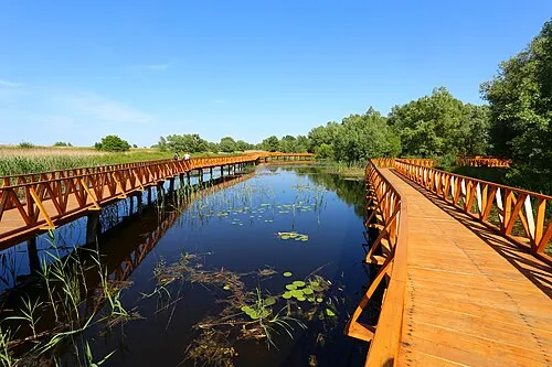 Kopački Rit Nature Park Natural site, County of Osijek-Baranja12 km E
-
Karašica River, Croatia12 km NW
-
Vučica River, Croatia24 km S
Other cities and towns in County of Osijek-Baranja
-
 Kopačevo Village, Municipality of Bilje6.4 km NE
-
 Sarvaš Village, City of Osijek8.7 km SE
-
 Retfala Neighbourhood, County of Osijek-Baranja6.7 km W
-
Gornji Grad Neighbourhood, County of Osijek-Baranja5.8 km W
-
Mece Village, Municipality of Darda6.9 km N
-
 Vardarac Village, Municipality of Bilje8.3 km N
Sources & licences
Data last updated: