Begovo Razdolje
Located in Municipality of Mrkopalj, Primorje-Gorski Kotar County Coordinates: 45°18′16″ N 14°54′15″ E
- Population
- 36
- 36
- Elevation
- 1,105 m
- above sea level
- Local time
- UTC+01:00
- Europe/Zagreb · UTC+01:00
- Airports
- RJK Rijeka Airport28 km
- PUY Pula Airport90 km
About Begovo Razdolje
Begovo Razdolje is a village. Location: Municipality of Mrkopalj, Primorje-Gorski Kotar County. Population: 36. Elevation: 1,105 m.
Begovo Razdolje (Croatian pronunciation: [bɛ̂ɡɔʋɔ rǎːzdɔːʎɛ]) is a village in Mrkopalj municipality, Primorje-Gorski Kotar County, in western Croatia. At 1,060 m (3,478 ft), it is the settlement with the highest elevation in Croatia. Begovo Razdolje has a population of 48 (as of 2011), mostly elderly people. The villagers, traditionally oriented towards forestry and hunting, are increasingly turning to livestock farming and tourism in recent decades.
Source: Wikipedia · CC BY-SA 4.0
At a glance
- Area
- 52.2 km²
Source: Wikidata
Climate of Begovo Razdolje
Best months for sightseeingBest months for sightseeing: July–August.
This month · November
A wet month
Day 6° · Night -2° · Rain 195 mm
- Hottest month
- July (day 20°)
- Coldest month
- January (night -6°)
- Wettest month
- November (195 mm)
- Driest month
- July (99 mm)
Bars: average monthly low and high temperature. Below: precipitation. Monthly averages for 1970–2000 at about 18 km resolution, adjusted for elevation. Highlighted months are mild and relatively dry. Source: WorldClim 2.1 (CC BY 4.0).
Show values as a table
| Month | Jan | Feb | Mar | Apr | May | Jun | Jul | Aug | Sep | Oct | Nov | Dec |
|---|---|---|---|---|---|---|---|---|---|---|---|---|
| Average high (°C) | 1° | 2° | 5° | 8° | 14° | 17° | 20° | 20° | 16° | 11° | 6° | 2° |
| Average low (°C) | -6° | -6° | -3° | 0° | 5° | 8° | 10° | 9° | 6° | 3° | -2° | -5° |
| Precipitation (mm) | 108 | 110 | 124 | 145 | 127 | 141 | 99 | 120 | 149 | 178 | 195 | 152 |
How to get to Begovo Razdolje
The nearest airport is Rijeka Airport (RJK), 28 km to the west as the crow flies. The nearest large city is Rijeka, 36 km to the west.
Airports
- Rijeka Airport (RJK) Rijeka(Omišalj) 28 kmwest
- Pula Airport (PUY) Pula 90 kmsouthwest
- Zagreb Franjo Tuđman International Airport (ZAG) Velika Gorica 103 kmnortheast
Nearby large cities
- Rijeka Population: 108K 36 kmwest
- Ljubljana Population: 272.2K 89 kmnorth
- Zagreb Population: 663.6K 101 kmnortheast
- Klagenfurt Population: 100.3K 154 kmnorth
- Banja Luka Population: 221.1K 191 kmeast
Straight-line distances; road distances are longer. Airport data: OurAirports.
Day trips from Begovo Razdolje
Within 100 km: 7 historic and cultural sites, 73 natural sites, 69 lakes, rivers and coasts.
0–25 km5 places
- Viševica Mountain 10 kmSW
- Tuhobić Mountain 21 kmW
- Burni bitoraj - Vrh Bitoraj Mountain 9 kmW
- Velika Kapela Mountain 12 kmSE
25–60 km35 places
- Krk Island 34 kmSW
- Uvala Stipanja Natural site 26 kmSW
- Otočić Košljun Island 38 kmSW
- Veliki Snežnik Mountain 46 kmNW
60–100 km109 places
- Lošinj Island 89 kmSW
- Otok Ilovik Island 99 kmS
- Otočić Srakane Vele Island 93 kmSW
- Raša River 98 kmNW
Straight-line distances.
Nearby attractions & nature
Everything nearby-
 Burni bitoraj - Vrh Bitoraj Mountain, Primorje-Gorski Kotar County9 km W
-
Viševica Mountain, Primorje-Gorski Kotar County9.8 km SW
-
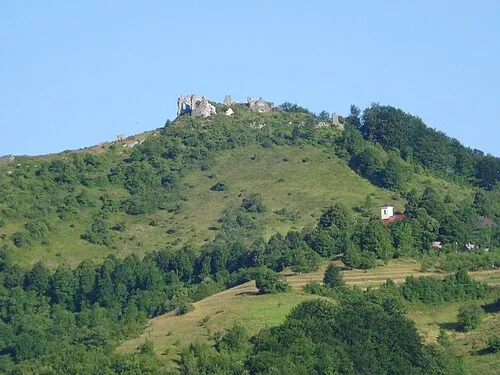 Velika Kapela Mountain, Croatia12 km SE
-
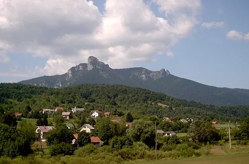 Klek Mountain, Karlovac County20 km E
-
Tuhobić Mountain, Primorje-Gorski Kotar County21 km W
Sources & licences
Data last updated: · 2 independent sources