Smrdelje
Located in Municipality of Kistanje, Šibenik-Knin County Coordinates: 43°55′57″ N 15°54′17″ E
- Population
- 90
- 90
- Elevation
- 230 m
- above sea level
- Local time
- UTC+01:00
- Europe/Zagreb · UTC+01:00
- Airports
- ZAD Zadar Airport48 km
- SPU Split Saint Jerome Airport54 km
About Smrdelje
Smrdelje is a village. Location: Municipality of Kistanje, Šibenik-Knin County. Population: 90. Elevation: 230 m.
Smrdelje (Serbian Cyrillic: Смрдеље) is a small village located 8 km southwest of Kistanje, in the continental part of Šibenik-Knin County, Croatia. The broader area of the village comprises several prehistoric tumuli. The remains of Roman architecture are found on two localities, as well as several graves from the early Croatian period. The largest graveyard was on a place called Debeljak, where the Croatian pagan burials from the 8th or 9th century have been established.
Source: Wikipedia · CC BY-SA 4.0
At a glance
- Area
- 13.5 km²
Source: Wikidata
Climate of Smrdelje
Best months for sightseeingBest months for sightseeing: May–June, September.
This month · November
A wet month
Day 13° · Night 5° · Rain 100 mm
- Hottest month
- July (day 29°)
- Coldest month
- January (night 1°)
- Wettest month
- November (100 mm)
- Driest month
- July (34 mm)
Bars: average monthly low and high temperature. Below: precipitation. Monthly averages for 1970–2000 at about 18 km resolution, adjusted for elevation. Highlighted months are mild and relatively dry. Source: WorldClim 2.1 (CC BY 4.0).
Show values as a table
| Month | Jan | Feb | Mar | Apr | May | Jun | Jul | Aug | Sep | Oct | Nov | Dec |
|---|---|---|---|---|---|---|---|---|---|---|---|---|
| Average high (°C) | 9° | 10° | 13° | 17° | 22° | 26° | 29° | 29° | 24° | 19° | 13° | 10° |
| Average low (°C) | 1° | 2° | 4° | 7° | 12° | 15° | 17° | 17° | 14° | 10° | 5° | 3° |
| Precipitation (mm) | 71 | 63 | 68 | 73 | 59 | 57 | 34 | 48 | 80 | 87 | 100 | 84 |
How to get to Smrdelje
The nearest airport is Zadar Airport (ZAD), 48 km to the northwest as the crow flies. The nearest large city is Split, 64 km to the southeast.
Airports
- Zadar Airport (ZAD) Zadar 48 kmnorthwest
- Split Saint Jerome Airport (SPU) Split 54 kmsoutheast
- Brač Airport (BWK) Gornji Humac 95 kmsoutheast
Nearby large cities
- Split Population: 149.8K 64 kmsoutheast
- Banja Luka Population: 221.1K 140 kmnortheast
- Zenica Population: 164.4K 163 kmeast
- Mostar Population: 104.5K 167 kmeast
- Rijeka Population: 108K 194 kmnorthwest
Straight-line distances; road distances are longer. Airport data: OurAirports.
Day trips from Smrdelje
Within 100 km: 10 historic and cultural sites, 46 natural sites, 73 lakes, rivers and coasts.
0–25 km11 places
- Otok Prvić Island 24 kmS
- Prokljansko Jezero Lake 14 kmS
- Krka National Park Natural site 9 kmSE
- Fort Saint John Historic site 21 kmS
25–60 km44 places
- Otok Zlarin Island 27 kmS
- Otok Kaprije Island 31 kmSW
- Krapanj Island 29 kmS
- Zuri Island Island 37 kmSW
60–100 km74 places
- Brač Island 90 kmSE
- Šolta Island 69 kmSE
- Birovača Mountain 73 kmN
- Otok Sestrunj Island 78 kmW
Straight-line distances.
Nearby attractions & nature
Everything nearby-
 Burnum Historic site, Šibenik-Knin County9.8 km NE
-
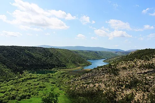 Krka National Park Natural site, Šibenik-Knin County9.4 km SE
-
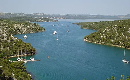 Prokljansko Jezero Lake, Šibenik-Knin County14 km S
-
Fort Saint John Historic site, Šibenik-Knin County21 km S
-
Fort Saint Michael Historic site, Šibenik-Knin County22 km S
-
Barone Fortress Historic site, Šibenik-Knin County22 km S
Other cities and towns in Municipality of Kistanje
-
Parčić Village, Municipality of Kistanje17 km N
-
 Biovičino Selo Village, Municipality of Kistanje14 km N
Sources & licences
Data last updated: · 2 independent sources