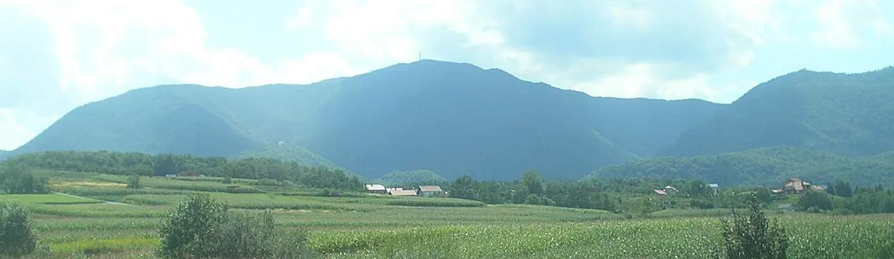
- Elevation
- 1,059 m
- above sea level
- Local time
- UTC+01:00
- Europe/Zagreb · UTC+01:00
- Airports
- MBX Maribor Edvard Rusjan Airport48 km
- ZAG Zagreb Franjo Tuđman International Airport49 km
About Ivanšćica
Ivanšćica is a mountain. Location: Varaždin County, Croatia. Elevation: 1,059 m.
Ivanščica (pronounced [iʋǎnʃʈ͡ʂit͡sa]) or Ivančica is a mountain in northern Croatia. The highest peak is the eponymous Ivanščica at 1,059 metres (3,474 ft). Together with Strahinjščica it forms the Očura massif. The rivers of Bednja, Lonja, Krapina and Veliki potok rise and flow in the area. On March 16, 1983, at 13:52:52, Ivanščica was the epicenter of a very strong (MCS VII) earthquake.
Source: Wikipedia · CC BY-SA 4.0
At a glance
- Length
- 30 km
Source: Wikidata
Climate of Ivanšćica
Best months for sightseeingBest months for sightseeing: June–August.
This month · November
A cold month
Day 3° · Night -4° · Rain 95 mm
- Hottest month
- July (day 20°)
- Coldest month
- January (night -9°)
- Wettest month
- June (118 mm)
- Driest month
- January (48 mm)
Bars: average monthly low and high temperature. Below: precipitation. Monthly averages for 1970–2000 at about 18 km resolution, adjusted for elevation. Highlighted months are mild and relatively dry. Source: WorldClim 2.1 (CC BY 4.0).
Show values as a table
| Month | Jan | Feb | Mar | Apr | May | Jun | Jul | Aug | Sep | Oct | Nov | Dec |
|---|---|---|---|---|---|---|---|---|---|---|---|---|
| Average high (°C) | -2° | 1° | 6° | 10° | 15° | 18° | 20° | 20° | 15° | 10° | 3° | -1° |
| Average low (°C) | -9° | -8° | -4° | 0° | 4° | 7° | 9° | 9° | 5° | 0° | -4° | -7° |
| Precipitation (mm) | 48 | 52 | 70 | 79 | 87 | 118 | 104 | 102 | 96 | 97 | 95 | 72 |
How to get to Ivanšćica
The nearest airport is Maribor Edvard Rusjan Airport (MBX), 48 km to the northwest as the crow flies. For international flights: Zagreb Franjo Tuđman International Airport (ZAG) (49 km). The nearest large city is Zagreb, 43 km to the south.
Airports
- Maribor Edvard Rusjan Airport (MBX) Maribor 48 kmnorthwest
- Zagreb Franjo Tuđman International Airport (ZAG) Velika Gorica 49 kmsouth
- Hévíz–Balaton Airport (SOB) Sármellék 97 kmnortheast
Nearby large cities
- Zagreb Population: 663.6K 43 kmsouth
- Graz Population: 303.3K 112 kmnorthwest
- Klagenfurt Population: 100.3K 149 kmwest
- Pécs Population: 145.3K 162 kmeast
- Rijeka Population: 108K 162 kmsouthwest
Straight-line distances; road distances are longer. Airport data: OurAirports.
Nearest towns and villages
-
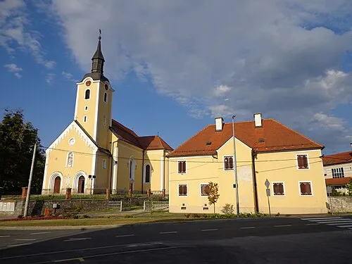 Ivanec City, Town of Ivanec4.5 km N
-
Gornja Selnica Village, Town of Zlatar4.1 km S
-
Salinovec Village, Town of Ivanec5 km NE
-
Zajezda Village, Municipality of Budinščina5.3 km SE
-
Jerovec Village, Town of Ivanec6.5 km N
-
Gornja Batina Village, Town of Zlatar7.3 km S
Nearby attractions & nature
Everything nearby-
Ivanscica Mountain, Town of Ivanec0.5 km SW
-
Lake Trakoščan Lake, Municipality of Bednja17 km NW
-
Pesnica River, Austria24 km N
-
Žutnica River, Croatia21 km W
Sources & licences
Data last updated: · 2 independent sources