Akrotírio Apóstolos Andréas
Located in Rizokárpaso, Ammochostos Coordinates: 35°41′40″ N 34°35′14″ E
- Elevation
- 10 m
- above sea level
- Local time
- UTC+02:00
- Asia/Nicosia · UTC+02:00
- Airports
- ECN Ercan International Airport115 km
- LCA Larnaca International Airport126 km
About Akrotírio Apóstolos Andréas
Akrotírio Apóstolos Andréas is a natural site. Location: Rizokárpaso, Ammochostos.
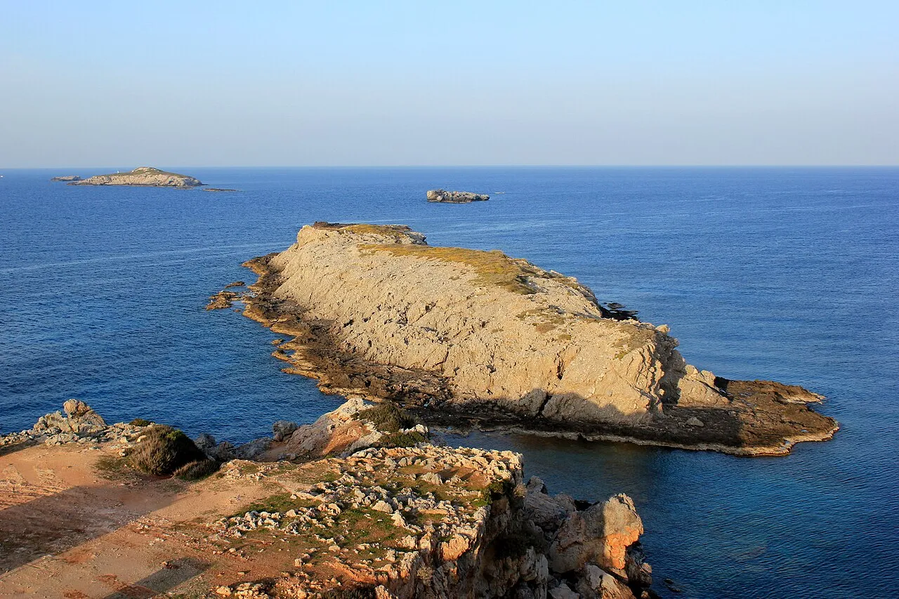
Cape Apostolos Andreas (Greek: Ακρωτήριο Αποστόλου Ανδρέα, "Cape Saint Andrew"; Turkish: Zafer Burnu, "Cape Victory") is the north-easternmost point (promontory) of the Mediterranean island of Cyprus (35°41.70′N 34°35.20′E). It lies at the tip of the finger-like Karpas Peninsula. The Apostolos Andreas Monastery is located 5 km southwest of the promontory itself. The city of Latakia in Syria is located about 68 miles (109 km) to the east.
Source: Wikipedia · CC BY-SA 4.0
Photos of Akrotírio Apóstolos Andréas
-

Zairon · CC BY-SA 4.0 -

Zairon · CC BY-SA 4.0 -

Zairon · CC BY-SA 4.0


Climate of Akrotírio Apóstolos Andréas
Best months for sightseeingBest months for sightseeing: April–June, October–November.
This month · November
A good month to visit
Day 22° · Night 13° · Rain 78 mm
- Hottest month
- August (day 31°)
- Coldest month
- February (night 8°)
- Wettest month
- December (149 mm)
- Driest month
- August (1 mm)
Bars: average monthly low and high temperature. Below: precipitation. Monthly averages for 1970–2000 at about 18 km resolution, adjusted for elevation. Highlighted months are mild and relatively dry. Source: WorldClim 2.1 (CC BY 4.0).
Show values as a table
| Month | Jan | Feb | Mar | Apr | May | Jun | Jul | Aug | Sep | Oct | Nov | Dec |
|---|---|---|---|---|---|---|---|---|---|---|---|---|
| Average high (°C) | 16° | 16° | 18° | 21° | 25° | 28° | 30° | 31° | 29° | 26° | 22° | 17° |
| Average low (°C) | 8° | 8° | 9° | 13° | 16° | 20° | 23° | 23° | 21° | 17° | 13° | 10° |
| Precipitation (mm) | 124 | 86 | 69 | 35 | 22 | 5 | 2 | 1 | 12 | 49 | 78 | 149 |
Other places to visit in this season: April May June October November
How to get to Akrotírio Apóstolos Andréas
The nearest airport is Ercan International Airport (ECN), 115 km to the southwest as the crow flies. The nearest large city is Silifke, 96 km to the northwest.
Airports
- Ercan International Airport (ECN) Tymbou (Kirklar) 115 kmsouthwest
- Larnaca International Airport (LCA) Larnaca 126 kmsouthwest
- Latakia International Airport (LTK) Latakia 128 kmeast
Nearby large cities
- Silifke Population: 132.7K 96 kmnorthwest
- Mersin Population: 537.8K 124 kmnorth
- Nicosia Population: 200.5K 126 kmsouthwest
- Samandağ Population: 123.4K 132 kmeast
- Tarsus Population: 350.7K 138 kmnorth
Straight-line distances; road distances are longer. Airport data: OurAirports.
Day trips from Akrotírio Apóstolos Andréas
Within 100 km: 258 historic and cultural sites, 201 natural sites, 48 lakes, rivers and coasts.
0–25 km70 places
- Nisídes Kordýlia Island 5 kmW
- Nisída Gláros Island 14 kmW
- Nisída Lefkónisos Island 16 kmW
- Nisía Kleídes Island 2 kmNE
25–60 km131 places
- Nisídes Skaloúdia Island 39 kmW
- Nisída Kernádia Island 52 kmSW
- Nisída Skáles Island 56 kmSW
- Nisída Kíla Island 32 kmSW
60–100 km306 places
- Poseidon Beach Beach 99 kmSW
- Nissi Beach Beach 97 kmSW
- Vrissiana Beach Beach 89 kmSW
- Pernera Beach Beach 89 kmSW
Straight-line distances.
Nearest towns and villages
-
Rizokárpaso Town, Rizokárpaso22 km SW
-
Aigialoúsa Village, Aigialoúsa40 km SW
-
Vothýlakas Village, Vothýlakas43 km SW
-
Leonariso Village, Leonárisso48 km SW
-
Galinóporni Village, Galinóporni32 km SW
-
Koróveia Village, Koróveia35 km SW
Nearby attractions & nature
Everything nearby-
Afroditi Akraia Historic site, Rizokárpaso0.1 km NE
-
Kástros Historic site, Rizokárpaso0.1 km W
-
Taş Adası Island, Ammochostos1 km NE
-
Nisía Kleídes Island, Ammochostos1.9 km NE
-
Karpaz Koruma Alanı Natural site, Ammochostos3.3 km SW
-
Kinanero Mountain, Rizokárpaso4.8 km SW
-
Apóstolos Andréas Natural site, Ammochostos6.9 km SW
-
Apóstolos Andréas Attraction, Rizokárpaso4.1 km S
Sources & licences
Data last updated: · 2 independent sources