Agios Kassianos
Local name: Άγιος Κασσιανός
Located in Nicosia Municipality, Nicosia Coordinates: 35°10′39″ N 33°22′08″ E
- Population
- 1,177
- 1.2K
- Elevation
- 142 m
- above sea level
- Local time
- UTC+02:00
- Asia/Nicosia · UTC+02:00
About Agios Kassianos
Agios Kassianos is a village. Location: Nicosia Municipality, Nicosia. Population: 1,177. Elevation: 142 m.
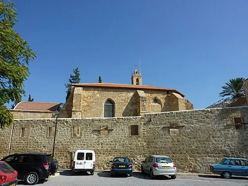
Ayios Kassianos is a Neighbourhood, Quarter, Mahalla or Parish of Nicosia, Cyprus and the church situated therein after which the Quarter is named. It is Άγιος Κασσιανός in Greek and Aykasyano in Turkish and also has the historic name Kafesli (lattice or cage). At the last Census (2011) it had a population of 315,. The population in 1946 was 1,177, consisting of 1,686 Greek Cypriots, 115 Turkish Cypriots and 1 other.
Read more on Wikipedia Text: Wikipedia contributors · CC BY-SA 4.0 · shortened
In comparison
- No. 13 of 16 places in Nicosia Municipality by population
- Nearest larger town: Taktelkale, 0 km SE
- 86 sights and natural places within 10 km Tahtakale Camii, Haydarpaşa Camii
Airports nearest to Agios Kassianos
- Ercan International Airport (ECN) Tymbou (Kirklar) 13 km
- Larnaca International Airport (LCA) Larnaca 41 km
- Paphos International Airport (PFO) Paphos 95 km
Straight-line distance; airports with scheduled flights only. Source: OurAirports (public domain).
Nearby attractions & nature
Everything nearby-
 Notre Dame de Tyre Attraction, Nicosia Municipality1 km W
-
Tahtakale Camii Attraction, Nicosia Municipality0.3 km S
-
Haydarpaşa Camii Attraction, Nicosia Municipality0.3 km W
-
Lapidere Müzesi Museum, Nicosia Municipality0.4 km W
-
Yeni Cami Attraction, Nicosia Municipality0.4 km W
-
Orthodox Cathedral of Panagia Hodegetria / Bedesten Historic site, Nicosia Municipality0.4 km W
Sources & licences
Data last updated: · 2 independent sources