Nempetchane
Local name: Νεμπετχανέ
Located in Nicosia Municipality, Nicosia Coordinates: 35°10′27″ N 33°21′37″ E
- Population
- 520
- 520
- Elevation
- 155 m
- above sea level
- Local time
- UTC+02:00
- Asia/Nicosia · UTC+02:00
- Airports
- ECN Ercan International Airport14 km
- LCA Larnaca International Airport41 km
About Nempetchane
Nempetchane is a neighbourhood. Location: Nicosia Municipality, Nicosia. Population: 520.
Nebethane is an historic neighbourhood, quarter, Mahalla, or parish of central Nicosia, Cyprus. Its name inherited from the Ottoman period is Turkish for police station or the guard room of the Turkish patrol. Nebethane Mesjid (small mosque) in this quarter was the place where the police patrol of the city assembled for changing the guard each day, accompanied by drums and pipes. The name is spelled Νεμπετχάνε in Greek, while the modern Turkish spelling is Nöbethane. The English spelling has varied.
Read more on Wikipedia Text: Wikipedia contributors · CC BY-SA 4.0 · shortened
In comparison
- No. 16 of 16 places in Nicosia Municipality by population
- Nearest larger town: Faneromeni, 0 km SE
- 90 sights and natural places within 10 km Turunçlu Cami, Notre Dame de Tyre
Climate of Nempetchane
Best months for sightseeingBest months for sightseeing: April, November.
Bars: average monthly low and high temperature. Below: precipitation. Monthly averages for 1970–2000 at about 18 km resolution, adjusted for elevation. Highlighted months are mild and relatively dry. Source: WorldClim 2.1 (CC BY 4.0).
Show values as a table
| Month | Jan | Feb | Mar | Apr | May | Jun | Jul | Aug | Sep | Oct | Nov | Dec |
|---|---|---|---|---|---|---|---|---|---|---|---|---|
| Average high (°C) | 15° | 16° | 18° | 23° | 28° | 32° | 36° | 36° | 33° | 29° | 22° | 18° |
| Average low (°C) | 6° | 6° | 7° | 11° | 14° | 19° | 22° | 22° | 20° | 16° | 11° | 8° |
| Precipitation (mm) | 73 | 59 | 50 | 23 | 18 | 6 | 2 | 2 | 7 | 25 | 48 | 82 |
Airports nearest to Nempetchane
- Ercan International Airport (ECN) Tymbou (Kirklar) 14 km
- Larnaca International Airport (LCA) Larnaca 41 km
- Paphos International Airport (PFO) Paphos 95 km
Straight-line distance; airports with scheduled flights only. Source: OurAirports (public domain).
Nearby attractions & nature
Everything nearby-
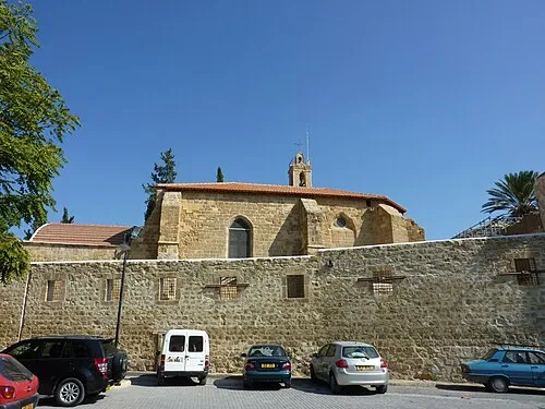 Notre Dame de Tyre Attraction, Nicosia Municipality0.2 km NW
-
Turunçlu Cami Attraction, Nicosia Municipality0.2 km N
-
Bank of Cyprus Cultural Foundation Museum, Nicosia Municipality0.2 km SE
-
Araplar Camii Attraction, Nicosia Municipality0.3 km E
-
İplik Pazarı Camii Attraction, Nicosia Municipality0.3 km N
-
Dervis Paşa Konağı Museum, Nicosia Municipality0.4 km NW
Sources & licences
Data last updated: · 2 independent sources