Martínkovice
Located in Náchod District, Hradec Králové Region Coordinates: 50°32′51″ N 16°20′01″ E
- Elevation
- 393 m
- above sea level
- Local time
- UTC+01:00
- Europe/Prague · UTC+01:00
- Places inside
- 2
- listed under Martínkovice
- Airports
- PED Pardubice Airport73 km
- WRO Copernicus Wrocław Airport73 km
About Martínkovice
Martínkovice is a municipality. Location: Náchod District, Hradec Králové Region. Elevation: 393 m. The best months to visit are June–August. The nearest airport is Pardubice Airport (73 km). Nearby sights include Broumovské Stěny and Koruna.
Photos of Martínkovice
-
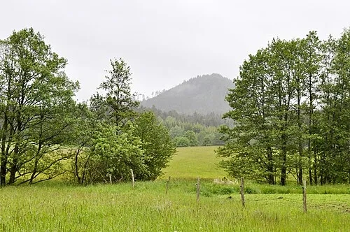
Špičák Jirka Dl · CC BY-SA 4.0 -
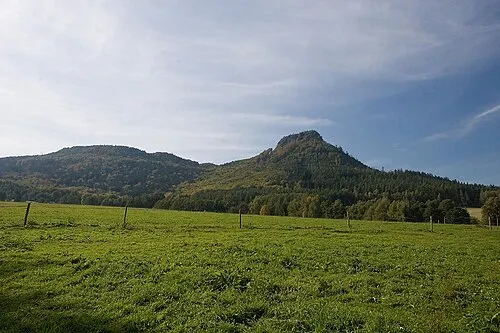
Koruna Petr1868 · CC BY 3.0 -
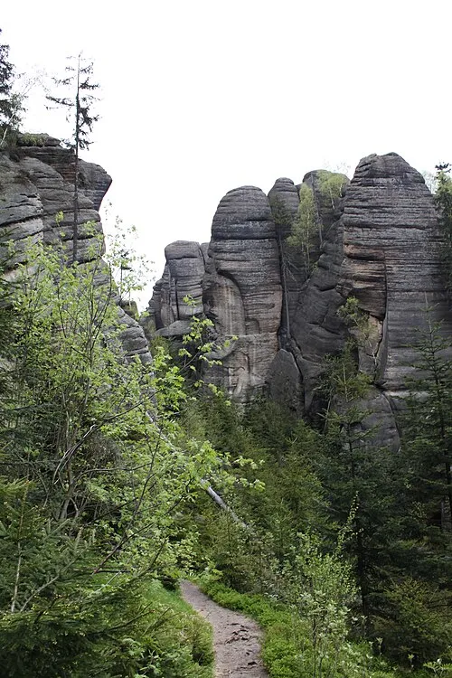
Broumovské Stěny Crusier · CC BY-SA 3.0


Climate of Martínkovice
Best months for sightseeingBest months for sightseeing: June–August.
This month · November
A cold month
Day 5° · Night 0° · Rain 38 mm
- Hottest month
- July (day 22°)
- Coldest month
- January (night -5°)
- Wettest month
- July (93 mm)
- Driest month
- February (26 mm)
Bars: average monthly low and high temperature. Below: precipitation. Monthly averages for 1970–2000 at about 18 km resolution, adjusted for elevation. Highlighted months are mild and relatively dry. Source: WorldClim 2.1 (CC BY 4.0).
Show values as a table
| Month | Jan | Feb | Mar | Apr | May | Jun | Jul | Aug | Sep | Oct | Nov | Dec |
|---|---|---|---|---|---|---|---|---|---|---|---|---|
| Average high (°C) | 0° | 2° | 6° | 12° | 17° | 20° | 22° | 22° | 17° | 12° | 5° | 2° |
| Average low (°C) | -5° | -4° | -1° | 2° | 6° | 10° | 11° | 11° | 8° | 4° | 0° | -3° |
| Precipitation (mm) | 27 | 26 | 33 | 40 | 64 | 90 | 93 | 77 | 51 | 40 | 38 | 35 |
How to get to Martínkovice
The nearest airport is Pardubice Airport (PED), 73 km to the southwest as the crow flies. The nearest large city is Prague, 146 km to the west.
Airports
- Pardubice Airport (PED) Pardubice 73 kmsouthwest
- Copernicus Wrocław Airport (WRO) Wrocław 73 kmnortheast
- Václav Havel Airport Prague (PRG) Prague 156 kmwest
Nearby large cities
- Prague Population: 1.2M 146 kmwest
- Brno Population: 404.3K 152 kmsouth
- Dresden Population: 564.9K 191 kmwest
- Chemnitz Population: 247.2K 243 kmwest
- Bratislava Population: 423.7K 273 kmsouth
Straight-line distances; road distances are longer. Airport data: OurAirports.
Day trips from Martínkovice
Within 100 km: 67 historic and cultural sites, 560 natural sites.
0–25 km116 places
- Ptak Mountain 9 kmS
- Wolarz Mountain 20 kmSE
- Włodarz Mountain 17 kmN
- Wielka Sowa Mountain 18 kmNE
25–60 km290 places
- Sucha Kopa Mountain 54 kmSE
- Bielec Mountain 42 kmNW
- Goworek Mountain 52 kmSE
- Parkowa Mountain 46 kmNW
60–100 km221 places
- Tvarožník Mountain 63 kmNW
- Jastrzębiec Mountain 69 kmNW
- Baranek Wawrzyn Mountain 96 kmNE
- Hořánck Mountain 93 kmSW
Straight-line distances.
Places in Martínkovice
2 placesBar: population relative to the most populous place in this list.
Mountains & nature1
- Velká kupa · Mountain
Nearby attractions & nature
Everything nearby-
Broumovské Stěny Mountain, Hradec Králové Region2.4 km W
-
Koruna Mountain, Božanov2.9 km S
-
Ovčín Mountain, Hradec Králové Region2.6 km W
-
Božanovský Špičák [Suchý Důl-Slavný] Mountain, Suchý Důl3.9 km S
-
Bahýnka Mountain, Machov4.3 km SW
-
Signal Mountain, Machov4.8 km SW
-
Špičák Mountain, Police nad Metují7.3 km NW
-
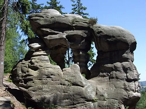 Ostaš Mountain, Žďár nad Metují9.1 km W
Sources & licences
Data last updated: