Štědrákova Lhota
Located in Ruda nad Moravou, Šumperk District Coordinates: 50°01′33″ N 16°52′15″ E

- Population
- 515
- 515
- Elevation
- 500 m
- above sea level
- Local time
- UTC+01:00
- Europe/Prague · UTC+01:00
- Airports
- PED Pardubice Airport81 km
- OSR Leoš Janáček Airport Ostrava96 km
About Štědrákova Lhota
Štědrákova Lhota is a village. Location: Ruda nad Moravou, Šumperk District. Population: 515. Elevation: 500 m.
Štědrákova Lhota (German: Tschödrich) is the village in Šumperk District in Olomouc Region of Czech Republic. It is named after Šťědrák, the administrator of Ruda nad Moravou manor who provided to new settlers timber for building and the tax exemption for a certain period (lhota in Czech). First note about the village comes from 1397. Štědrákova Lhota occupies 493 hectares along Pstruhovec creek in the steep hillside, the upper end is 700 meters above sea level. The Panorama ski resort in situated in the area.
Source: Wikipedia · CC BY-SA 4.0
At a glance
- Area
- 4.9 km²
Source: Wikidata
Photos of Štědrákova Lhota
-

RomanM82 · CC BY-SA 3.0 -
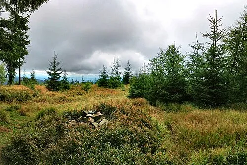
Jeřáb Maoman · Public domain


Population of Štědrákova Lhota over time
| 1900 | 482 | |
|---|---|---|
| 1910 | 435 | |
| 1921 | 431 | |
| 1930 | 380 | |
| 1950 | 247 | |
| 1961 | 216 | |
| 1970 | 169 | |
| 1980 | 107 | |
| 1991 | 76 | |
| 2001 | 69 | |
| 2011 | 72 | |
| 2021 | 78 |
Censuses and official estimates; source: Wikidata.
Climate of Štědrákova Lhota
Best months for sightseeingBest months for sightseeing: June–August.
This month · November
A cold month
Day 5° · Night 0° · Rain 42 mm
- Hottest month
- July (day 21°)
- Coldest month
- January (night -5°)
- Wettest month
- June (100 mm)
- Driest month
- February (30 mm)
Bars: average monthly low and high temperature. Below: precipitation. Monthly averages for 1970–2000 at about 18 km resolution, adjusted for elevation. Highlighted months are mild and relatively dry. Source: WorldClim 2.1 (CC BY 4.0).
Show values as a table
| Month | Jan | Feb | Mar | Apr | May | Jun | Jul | Aug | Sep | Oct | Nov | Dec |
|---|---|---|---|---|---|---|---|---|---|---|---|---|
| Average high (°C) | 0° | 2° | 6° | 11° | 17° | 19° | 21° | 21° | 16° | 11° | 5° | 1° |
| Average low (°C) | -5° | -5° | -2° | 2° | 7° | 9° | 11° | 11° | 8° | 4° | 0° | -4° |
| Precipitation (mm) | 32 | 30 | 33 | 43 | 69 | 100 | 92 | 87 | 57 | 43 | 42 | 40 |
How to get to Štědrákova Lhota
The nearest airport is Pardubice Airport (PED), 81 km to the west as the crow flies. The nearest large city is Brno, 94 km to the south.
Airports
- Pardubice Airport (PED) Pardubice 81 kmwest
- Leoš Janáček Airport Ostrava (OSR) Mošnov 96 kmeast
- Brno-Tuřany Airport (BRQ) Brno 98 kmsouth
Nearby large cities
- Brno Population: 404.3K 94 kmsouth
- Prague Population: 1.2M 176 kmwest
- Bratislava Population: 423.7K 210 kmsouth
- Dresden Population: 564.9K 250 kmnorthwest
- Győr Population: 129.3K 266 kmsouth
Straight-line distances; road distances are longer. Airport data: OurAirports.
Day trips from Štědrákova Lhota
Within 100 km: 40 historic and cultural sites, 542 natural sites.
0–25 km91 places
- Goworek Mountain 19 kmN
- Mały Śnieżnik Mountain 19 kmN
- Stroma Mountain 22 kmN
- Smrekowiec Mountain 23 kmN
25–60 km215 places
- Sucha Kopa Mountain 26 kmN
- Úsobrnka Natural site 50 kmS
- Kłobuk Mountain 44 kmNW
- Leszek Mountain 57 kmN
60–100 km276 places
- Ptak Mountain 61 kmNW
- Czuba Mountain 97 kmNW
- Włodarz Mountain 81 kmNW
- Wielka Sowa Mountain 78 kmN
Straight-line distances.
Nearby attractions & nature
Everything nearby-
Bouda Mountain, Malá Morava2.6 km NW
-
Vaškova hora Mountain, Bohdíkov3.6 km E
-
Raškovská bouda Mountain, Bohdíkov4.5 km NE
-
Jeřáb Mountain, Olomouc Region5.4 km NW
-
Lovák Mountain, Šumperk4.7 km SE
-
Sklený vrch Mountain, Bohdíkov5 km SE
Other cities and towns in Ruda nad Moravou
-
 Bartoňov Village, Ruda nad Moravou6.6 km S
-
 Radomilov Village, Ruda nad Moravou6.9 km S
-
Ruda nad Moravou Village, Ruda nad Moravou5 km S
Sources & licences
Data last updated: · 2 independent sources