- Elevation
- 603 m
- above sea level
- Local time
- UTC+01:00
- Europe/Prague · UTC+01:00
- Airports
- PED Pardubice Airport79 km
- BRQ Brno-Tuřany Airport88 km
About Háječek
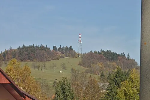
Háječek is a mountain. Location: Zborov, Šumperk District. Elevation: 603 m. The best months to visit are June–August. The nearest airport is Pardubice Airport (79 km). Nearby sights include Zbová and Pustina [Horní Studénky] outlook p..
Climate of Háječek
Best months for sightseeingBest months for sightseeing: June–August.
This month · November
A cold month
Day 4° · Night -2° · Rain 37 mm
- Hottest month
- July (day 21°)
- Coldest month
- January (night -6°)
- Wettest month
- June (89 mm)
- Driest month
- January (24 mm)
Bars: average monthly low and high temperature. Below: precipitation. Monthly averages for 1970–2000 at about 18 km resolution, adjusted for elevation. Highlighted months are mild and relatively dry. Source: WorldClim 2.1 (CC BY 4.0).
Show values as a table
| Month | Jan | Feb | Mar | Apr | May | Jun | Jul | Aug | Sep | Oct | Nov | Dec |
|---|---|---|---|---|---|---|---|---|---|---|---|---|
| Average high (°C) | -1° | 1° | 5° | 11° | 16° | 19° | 21° | 21° | 16° | 11° | 4° | 0° |
| Average low (°C) | -6° | -6° | -3° | 1° | 6° | 8° | 10° | 10° | 6° | 3° | -2° | -5° |
| Precipitation (mm) | 24 | 24 | 28 | 36 | 63 | 89 | 83 | 72 | 50 | 37 | 37 | 32 |
How to get to Háječek
The nearest airport is Pardubice Airport (PED), 79 km to the west as the crow flies. The nearest large city is Brno, 84 km to the south.
Airports
- Pardubice Airport (PED) Pardubice 79 kmwest
- Brno-Tuřany Airport (BRQ) Brno 88 kmsouth
- Leoš Janáček Airport Ostrava (OSR) Mošnov 96 kmeast
Nearby large cities
- Brno Population: 404.3K 84 kmsouth
- Prague Population: 1.2M 174 kmwest
- Bratislava Population: 423.7K 200 kmsouth
- Dresden Population: 564.9K 252 kmnorthwest
- Győr Population: 129.3K 257 kmsouth
Straight-line distances; road distances are longer. Airport data: OurAirports.
Day trips from Háječek
Within 100 km: 36 historic and cultural sites, 552 natural sites.
0–25 km53 places
- Opacz Mountain 23 kmN
- Urwista Mountain 24 kmN
- Sikornik Mountain 25 kmNW
- Vysoký Kámen Mountain 20 kmNW
25–60 km246 places
- Sucha Kopa Mountain 36 kmN
- Úsobrnka Natural site 40 kmS
- Goworek Mountain 28 kmN
- Kłobuk Mountain 51 kmNW
60–100 km289 places
- Ptak Mountain 68 kmNW
- Leszek Mountain 66 kmN
- Klimek Mountain 66 kmN
- Włodarz Mountain 90 kmN
Straight-line distances.
Nearest towns and villages
Nearby attractions & nature
Everything nearby-
Zbová Mountain, Bohutín4.1 km NE
-
Pustina [Horní Studénky] outlook p. Mountain, Horní Studénky4.4 km NW
-
Brusná Mountain, Bludov7.1 km E
-
Sklený vrch Mountain, Bohdíkov7.5 km NE
-
Lovák Mountain, Šumperk8.8 km NE
-
Markovice Mountain, Kolšov9.6 km SE
-
Skalka Mountain, Sudkov9.2 km E
-
 Lazek Mountain, Cotkytle9.5 km W
Sources & licences
Data last updated: · 2 independent sources