- Elevation
- 780 m
- above sea level
- Local time
- UTC+01:00
- Europe/Prague · UTC+01:00
- Airports
- PED Pardubice Airport42 km
- BRQ Brno-Tuřany Airport76 km
About Bubnovaný kopec
Bubnovaný kopec is a mountain. Location: Březiny, Svitavy District. Elevation: 780 m. The best months to visit are June–August. The nearest airport is Pardubice Airport (42 km). Nearby sights include Zelinka and Lubenský kopec.
Climate of Bubnovaný kopec
Best months for sightseeingBest months for sightseeing: June–August.
This month · November
A cold month
Day 3° · Night -2° · Rain 39 mm
- Hottest month
- August (day 20°)
- Coldest month
- January (night -6°)
- Wettest month
- June (88 mm)
- Driest month
- January (27 mm)
Bars: average monthly low and high temperature. Below: precipitation. Monthly averages for 1970–2000 at about 18 km resolution, adjusted for elevation. Highlighted months are mild and relatively dry. Source: WorldClim 2.1 (CC BY 4.0).
Show values as a table
| Month | Jan | Feb | Mar | Apr | May | Jun | Jul | Aug | Sep | Oct | Nov | Dec |
|---|---|---|---|---|---|---|---|---|---|---|---|---|
| Average high (°C) | -1° | 0° | 4° | 9° | 15° | 18° | 20° | 20° | 15° | 10° | 3° | 0° |
| Average low (°C) | -6° | -6° | -3° | 0° | 5° | 8° | 9° | 9° | 6° | 3° | -2° | -5° |
| Precipitation (mm) | 27 | 27 | 32 | 40 | 63 | 88 | 84 | 71 | 48 | 36 | 39 | 34 |
How to get to Bubnovaný kopec
The nearest airport is Pardubice Airport (PED), 42 km to the northwest as the crow flies. The nearest large city is Brno, 69 km to the southeast.
Airports
- Pardubice Airport (PED) Pardubice 42 kmnorthwest
- Brno-Tuřany Airport (BRQ) Brno 76 kmsoutheast
- Václav Havel Airport Prague (PRG) Prague 138 kmwest
Nearby large cities
- Brno Population: 404.3K 69 kmsoutheast
- Prague Population: 1.2M 127 kmwest
- Linz Population: 204.8K 204 kmsouthwest
- Dresden Population: 564.9K 224 kmnorthwest
- Győr Population: 129.3K 252 kmsoutheast
Straight-line distances; road distances are longer. Airport data: OurAirports.
Nearest towns and villages
-
Březiny Village, Březiny3.1 km SE
-
Pustá Rybná Village, Pustá Rybná3.5 km E
-
Svratka Village, Svratka4 km W
-
Svratouch Village, Svratouch4.2 km NW
-
Pustá Kamenice Village, Pustá Kamenice5.1 km N
-
Česká Cikánka Village, Svratka2.5 km W
Nearby attractions & nature
Everything nearby-
Zelinka Mountain, Oldřiš8 km NE
-
Lubenský kopec Mountain, Lubná10 km NE
-
Jarošov Mountain, Jarošov13 km NE
-
Škrabka Mountain, Chotěnov15 km NE
-
Kříby Mountain, Nové Město na Moravě12 km S
-
Chotovice Mountain, Chotovice17 km N
-
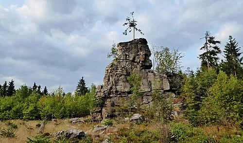 Pohledecká Skála Mountain, Nové Město na Moravě13 km S
-
Librův Kopec Mountain, Nedvězí18 km SE
Sources & licences
Data last updated: · 2 independent sources