Mezholezy (dříve okres Horšovský Týn)
Located in Domažlice District, Plzeň Region Coordinates: 49°37′49″ N 12°54′46″ E
- Elevation
- 438 m
- above sea level
- Local time
- UTC+01:00
- Europe/Prague · UTC+01:00
- Places inside
- 1
- listed under Mezholezy (dříve okres Horšovský Týn)
- Airports
- KLV Karlovy Vary Airport64 km
- PRG Václav Havel Airport Prague110 km
About Mezholezy (dříve okres Horšovský Týn)
Mezholezy (dříve okres Horšovský Týn) is a municipality. Location: Domažlice District, Plzeň Region. Elevation: 438 m. The best months to visit are June–August. The nearest airport is Karlovy Vary Airport (64 km). Nearby sights include Sedmihoří and Chlum.
Climate of Mezholezy (dříve okres Horšovský Týn)
Best months for sightseeingBest months for sightseeing: June–August.
This month · November
A cold month
Day 6° · Night 0° · Rain 46 mm
- Hottest month
- July (day 23°)
- Coldest month
- February (night -5°)
- Wettest month
- July (95 mm)
- Driest month
- February (42 mm)
Bars: average monthly low and high temperature. Below: precipitation. Monthly averages for 1970–2000 at about 18 km resolution, adjusted for elevation. Highlighted months are mild and relatively dry. Source: WorldClim 2.1 (CC BY 4.0).
Show values as a table
| Month | Jan | Feb | Mar | Apr | May | Jun | Jul | Aug | Sep | Oct | Nov | Dec |
|---|---|---|---|---|---|---|---|---|---|---|---|---|
| Average high (°C) | 2° | 3° | 7° | 12° | 18° | 21° | 23° | 23° | 18° | 12° | 6° | 2° |
| Average low (°C) | -4° | -5° | -1° | 2° | 6° | 10° | 11° | 11° | 7° | 3° | 0° | -3° |
| Precipitation (mm) | 50 | 42 | 46 | 42 | 62 | 82 | 95 | 78 | 58 | 54 | 46 | 59 |
How to get to Mezholezy (dříve okres Horšovský Týn)
The nearest airport is Karlovy Vary Airport (KLV), 64 km to the north as the crow flies. The nearest large city is Regensburg, 90 km to the southwest.
Airports
- Karlovy Vary Airport (KLV) Karlovy Vary 64 kmnorth
- Václav Havel Airport Prague (PRG) Prague 110 kmnortheast
- Nuremberg Airport (NUE) Nuremberg 134 kmwest
Nearby large cities
- Regensburg Population: 151.4K 90 kmsouthwest
- Prague Population: 1.2M 120 kmnortheast
- Nuremberg Population: 515.5K 134 kmwest
- Chemnitz Population: 247.2K 134 kmnorth
- Erlangen Population: 102.7K 138 kmwest
Straight-line distances; road distances are longer. Airport data: OurAirports.
Day trips from Mezholezy (dříve okres Horšovský Týn)
Within 100 km: 157 historic and cultural sites, 1,603 natural sites, 339 lakes, rivers and coasts.
0–25 km35 places
- Goldbach River 24 kmSW
- Sádek Mountain 24 kmSW
- Reichenstein Mountain 25 kmSW
- Häuslberg Mountain 25 kmSW
25–60 km553 places
- Biber-Revier River 48 kmS
- Český Les Mountain 30 kmW
- Süßenloher Weiher Lake 57 kmW
- Rollnhofweiher Lake 51 kmNW
60–100 km1,511 places
- Stoličná Mountain 81 kmN
- Pláň Mountain 82 kmN
- Bohemian Forest Mountain 70 kmS
- Isar River 92 kmS
Straight-line distances.
Places in Mezholezy (dříve okres Horšovský Týn)
1 placeBar: population relative to the most populous place in this list.
Nearby attractions & nature
Everything nearby-
Sedmihoří Mountain, Staré Sedlo1.9 km W
-
Chlum Mountain, Staré Sedlo3.1 km W
-
Racovský vrch Mountain, Staré Sedlo4.3 km W
-
Sedlo [Vidice-Libosváry] Mountain, Hostouň6.7 km SW
-
Hůrka Mountain, Stráž8.8 km W
-
Černá hora Mountain, Bělá nad Radbuzou11 km W
-
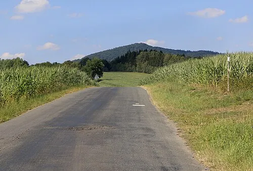 Starý Herštejn Mountain, Mnichov23 km SW
-
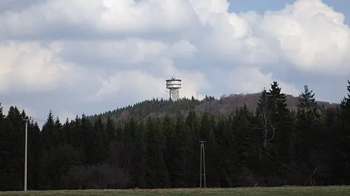 Velký zvon Mountain, Bělá nad Radbuzou22 km SW
Sources & licences
Data last updated: