
- Population
- 203
- 203
- Elevation
- 521 m
- above sea level
- Local time
- UTC+01:00
- Europe/Prague · UTC+01:00
- Airports
- JCL České Budějovice South Bohemian Airport50 km
- PED Pardubice Airport111 km
About Hrutkov
Hrutkov is a village. Location: Hospříz, Jindřichův Hradec District. Population: 203. Elevation: 521 m. The best months to visit are June–August. The nearest airport is České Budějovice South Bohemian Airport (50 km). Nearby sights include Hamerský potok and Vysoký Kámen.
At a glance
- Area
- 2.9 km²
Source: Wikidata
Photos of Hrutkov
-

This file is available under Creative Commons BY-SA license . Basically: You can use this picture for any purpose, provi · CC BY-SA 3.0 -

Hamerský potok I would appreciate being notified if you use my work outside Wikimedia. More of my work can be found in my personal gall · CC BY-SA 3.0 -

This file is available under Creative Commons BY-SA license . Basically: You can use this picture for any purpose, provi · CC BY-SA 3.0


Population of Hrutkov over time
| 1900 | 139 | |
|---|---|---|
| 1910 | 135 | |
| 1921 | 152 | |
| 1930 | 151 | |
| 1950 | 111 | |
| 1961 | 112 | |
| 1970 | 86 | |
| 1980 | 41 | |
| 1991 | 22 | |
| 2001 | 33 | |
| 2011 | 44 | |
| 2021 | 31 |
Censuses and official estimates; source: Wikidata.
Climate of Hrutkov
Best months for sightseeingBest months for sightseeing: June–August.
This month · November
A cold month
Day 5° · Night 0° · Rain 44 mm
- Hottest month
- July (day 23°)
- Coldest month
- January (night -5°)
- Wettest month
- July (88 mm)
- Driest month
- February (31 mm)
Bars: average monthly low and high temperature. Below: precipitation. Monthly averages for 1970–2000 at about 18 km resolution, adjusted for elevation. Highlighted months are mild and relatively dry. Source: WorldClim 2.1 (CC BY 4.0).
Show values as a table
| Month | Jan | Feb | Mar | Apr | May | Jun | Jul | Aug | Sep | Oct | Nov | Dec |
|---|---|---|---|---|---|---|---|---|---|---|---|---|
| Average high (°C) | 1° | 3° | 7° | 12° | 18° | 21° | 23° | 22° | 17° | 12° | 5° | 2° |
| Average low (°C) | -5° | -4° | -1° | 2° | 7° | 10° | 12° | 11° | 8° | 4° | 0° | -4° |
| Precipitation (mm) | 32 | 31 | 40 | 48 | 68 | 85 | 88 | 72 | 49 | 37 | 44 | 39 |
How to get to Hrutkov
The nearest airport is České Budějovice South Bohemian Airport (JCL), 50 km to the west as the crow flies. The nearest large city is Linz, 107 km to the southwest.
Airports
- České Budějovice South Bohemian Airport (JCL) České Budějovice 50 kmwest
- Pardubice Airport (PED) Pardubice 111 kmnortheast
- Linz-Hörsching Airport (LNZ) Linz 117 kmsouthwest
Nearby large cities
- Linz Population: 204.8K 107 kmsouthwest
- Brno Population: 404.3K 113 kmeast
- Prague Population: 1.2M 117 kmnorthwest
- Bratislava Population: 423.7K 186 kmsoutheast
- Salzburg Population: 157.2K 209 kmsouthwest
Straight-line distances; road distances are longer. Airport data: OurAirports.
Day trips from Hrutkov
Within 100 km: 83 historic and cultural sites, 1,003 natural sites, 190 lakes, rivers and coasts.
0–25 km103 places
- Hoher Stein Mountain 22 kmSE
- Steinbühel Mountain 16 kmS
- Türkenbühel Mountain 19 kmSE
- Scheibenberg Mountain 22 kmSE
25–60 km569 places
- Královský vršek Mountain 51 kmNE
- Kranbühel Mountain 34 kmSE
- Hutbühel Mountain 30 kmS
- Geißbühel Mountain 34 kmSE
60–100 km604 places
- Gassner Camel Riding School Natural site 96 kmS
- Unter-Rosenhofer Teich Lake 68 kmSW
- Ober-Rosenhofer Teich Lake 68 kmSW
- Spielberg Mountain 91 kmSE
Straight-line distances.
Nearby attractions & nature
Everything nearby-
Hamerský potok River, Czechia4.9 km NW
-
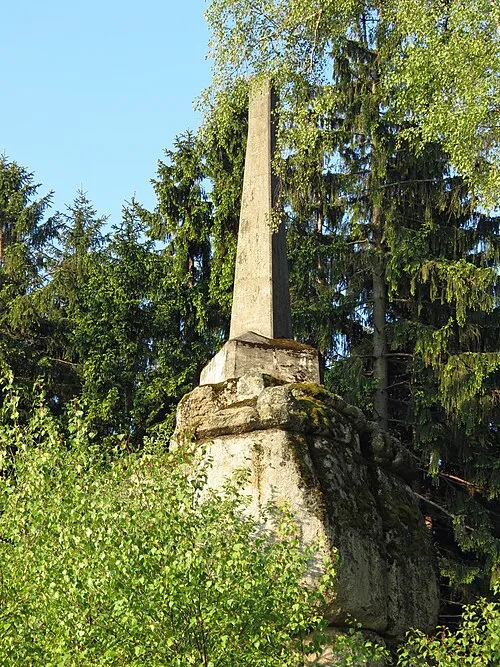 Vysoký Kámen Mountain, Kunžak9.9 km E
-
Fajka Mountain, Kunžak8.9 km E
-
Velký kopec Mountain, Kunžak11 km E
-
Dlouhý kopec Mountain, Jindřichův Hradec11 km N
-
Tůmův vrch [Strmilov-Česká Olešná] Mountain, Strmilov13 km NE
Sources & licences
Data last updated: · 2 independent sources