- Population
- 95,359
- 95.4K
- Elevation
- 519 m
- above sea level
- Local time
- UTC+01:00
- Europe/Prague · UTC+01:00
- Places inside
- 120
- listed under Havlíčkův Brod District
- Airports
- PED Pardubice Airport40 km
- BRQ Brno-Tuřany Airport99 km
About Havlíčkův Brod District
Havlíčkův Brod District is a district. Location: Vysocina, Czechia. Population: 95,359. The best months to visit are June–August. The nearest airport is Pardubice Airport (40 km). Nearby sights include Orlík and U Štocké silnice.
Climate of Havlíčkův Brod District
Best months for sightseeingBest months for sightseeing: June–August.
This month · November
A cold month
Day 5° · Night 0° · Rain 35 mm
- Hottest month
- August (day 22°)
- Coldest month
- January (night -5°)
- Wettest month
- June (78 mm)
- Driest month
- February (23 mm)
Bars: average monthly low and high temperature. Below: precipitation. Monthly averages for 1970–2000 at about 18 km resolution, adjusted for elevation. Highlighted months are mild and relatively dry. Source: WorldClim 2.1 (CC BY 4.0).
Show values as a table
| Month | Jan | Feb | Mar | Apr | May | Jun | Jul | Aug | Sep | Oct | Nov | Dec |
|---|---|---|---|---|---|---|---|---|---|---|---|---|
| Average high (°C) | 0° | 2° | 6° | 12° | 17° | 20° | 22° | 22° | 17° | 11° | 5° | 1° |
| Average low (°C) | -5° | -5° | -1° | 2° | 7° | 10° | 11° | 11° | 8° | 4° | 0° | -4° |
| Precipitation (mm) | 24 | 23 | 30 | 37 | 61 | 78 | 78 | 65 | 43 | 32 | 35 | 30 |
How to get to Havlíčkův Brod District
The nearest airport is Pardubice Airport (PED), 40 km to the north as the crow flies. The nearest large city is Brno, 91 km to the southeast.
Airports
- Pardubice Airport (PED) Pardubice 40 kmnorth
- Brno-Tuřany Airport (BRQ) Brno 99 kmsoutheast
- Václav Havel Airport Prague (PRG) Prague 107 kmnorthwest
Nearby large cities
- Brno Population: 404.3K 91 kmsoutheast
- Prague Population: 1.2M 96 kmnorthwest
- Linz Population: 204.8K 179 kmsouthwest
- Dresden Population: 564.9K 202 kmnorthwest
- Bratislava Population: 423.7K 202 kmsoutheast
Straight-line distances; road distances are longer. Airport data: OurAirports.
Day trips from Havlíčkův Brod District
Within 100 km: 31 historic and cultural sites, 780 natural sites, 88 lakes, rivers and coasts.
0–25 km16 places
- Orlík Mountain 17 kmSW
- Bučina Mountain 24 kmN
- Strážný vrch Mountain 12 kmN
- Friedlerův kopec Mountain 8 kmE
25–60 km252 places
- Královský vršek Mountain 28 kmS
- Seč Mountain 56 kmS
- Hořánck Mountain 50 kmNW
- Tlučin Mountain 57 kmSW
60–100 km631 places
- Kranbühel Mountain 91 kmS
- Hutbühel Mountain 93 kmS
- Geißbühel Mountain 94 kmS
- Steinberg Mountain 97 kmS
Straight-line distances.
Places in Havlíčkův Brod District
120 placesCities & villages60
- Malčín · Municipality
- Maleč · Municipality
- Michalovice · Municipality
- Modlíkov · Municipality
- Nejepín · Municipality
- Nová Ves u Chotěboře · Municipality
- Nová Ves u Leštiny · Municipality
- Nová Ves u Světlé · Municipality
- Okrouhlice · Municipality
- Okrouhlička · Municipality
- Olešenka · Municipality
- Olešná · Municipality
- Ostrov · Municipality
- Oudoleň · Municipality
- Ovesná Lhota · Municipality
- Pavlov · Municipality
- Podmoklany · Municipality
- Podmoky · Municipality
- Pohled · Municipality
- Pohleď · Municipality
- Přibyslav · Municipality
- Příseka · Municipality
- Prosíčka · Municipality
- Radostín · Municipality
- Rozsochatec · Municipality
- Rušinov · Municipality
- Rybníček · Municipality
- Sázavka · Municipality
- Sedletín · Municipality
- Skorkov · Municipality
- Skryje · Municipality
- Skuhrov · Municipality
- Šlapanov · Municipality
- Slavětín · Municipality
- Slavíkov · Municipality
- Slavníč · Municipality
- Sloupno · Municipality
- Služátky · Municipality
- Sobíňov · Municipality
- Štoky · Municipality
- Stříbrné Hory · Municipality
- Světlá nad Sázavou · Municipality
- Tis · Municipality
- Trpišovice · Municipality
- Uhelná Příbram · Municipality
- Úhořilka · Municipality
- Úsobí · Municipality
- Vepříkov · Municipality
- Veselý Žďár · Municipality
- Věž · Municipality
- Věžnice · Municipality
- Vilémov · Municipality
- Vilémovice · Municipality
- Víska · Municipality
- Vlkanov · Municipality
- Vysoká · Municipality
- Ždírec · Municipality
- Ždírec nad Doubravou · Municipality
- Žižkovo Pole · Municipality
- Zvěstovice · Municipality
Nature and heritage in Havlíčkův Brod District
Nearby attractions & nature
Everything nearby-
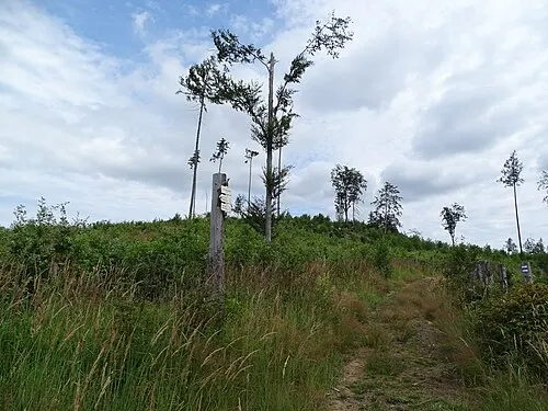 Orlík Mountain, Čejov17 km SW
-
U Štocké silnice Mountain, Smrčná21 km S
-
Skalky Mountain, Zbinohy21 km S
-
Zbinožský kopec Mountain, Zbinohy22 km S
-
Vysoký Kámen Mountain, Jihlava23 km S
-
Peklo Mountain, Větrný Jeníkov23 km S
Sources & licences
Data last updated: