- Elevation
- 592 m
- above sea level
- Local time
- UTC+01:00
- Europe/Prague · UTC+01:00
- Airports
- JCL České Budějovice South Bohemian Airport75 km
- BRQ Brno-Tuřany Airport94 km
About Březová hora
Březová hora is a mountain. Location: Borovná, Okres Jihlava. Elevation: 592 m. The best months to visit are June–August. The nearest airport is České Budějovice South Bohemian Airport (75 km). Nearby sights include Pahorky and Klínek.
Photos of Březová hora
-
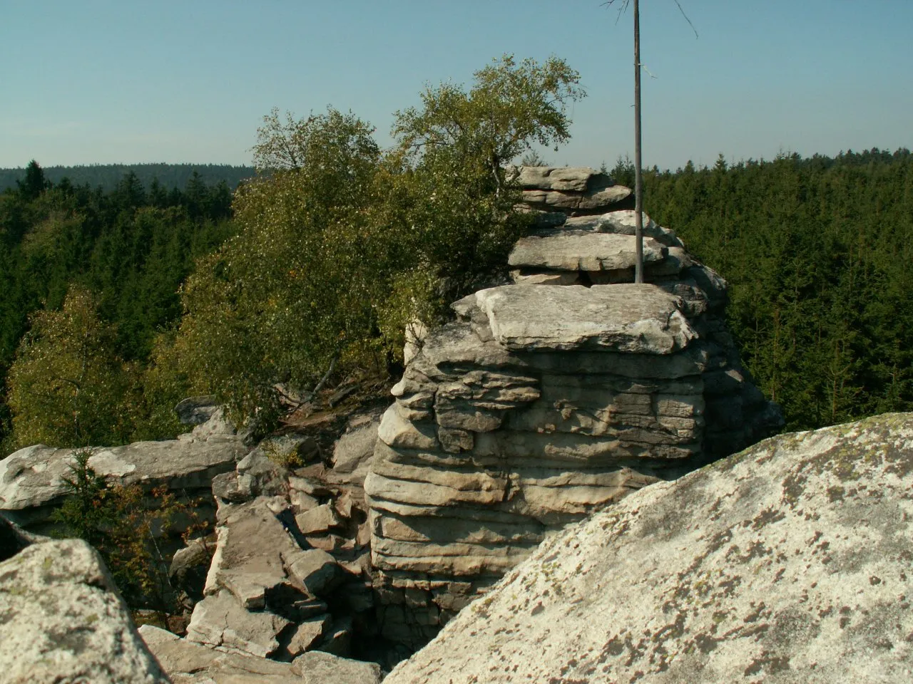
Míchova skála Bruce Shorty at Czech Wikipedia · Public domain

Climate of Březová hora
Best months for sightseeingBest months for sightseeing: June–August.
This month · November
A cold month
Day 4° · Night -1° · Rain 42 mm
- Hottest month
- August (day 22°)
- Coldest month
- January (night -5°)
- Wettest month
- June (86 mm)
- Driest month
- January (29 mm)
Bars: average monthly low and high temperature. Below: precipitation. Monthly averages for 1970–2000 at about 18 km resolution, adjusted for elevation. Highlighted months are mild and relatively dry. Source: WorldClim 2.1 (CC BY 4.0).
Show values as a table
| Month | Jan | Feb | Mar | Apr | May | Jun | Jul | Aug | Sep | Oct | Nov | Dec |
|---|---|---|---|---|---|---|---|---|---|---|---|---|
| Average high (°C) | 0° | 2° | 6° | 11° | 17° | 20° | 22° | 22° | 17° | 11° | 4° | 1° |
| Average low (°C) | -5° | -5° | -2° | 2° | 7° | 10° | 11° | 11° | 8° | 4° | -1° | -4° |
| Precipitation (mm) | 29 | 29 | 36 | 46 | 67 | 86 | 85 | 70 | 48 | 36 | 42 | 36 |
How to get to Březová hora
The nearest airport is České Budějovice South Bohemian Airport (JCL), 75 km to the west as the crow flies. The nearest large city is Brno, 88 km to the east.
Airports
- České Budějovice South Bohemian Airport (JCL) České Budějovice 75 kmwest
- Brno-Tuřany Airport (BRQ) Brno 94 kmeast
- Pardubice Airport (PED) Pardubice 97 kmnorth
Nearby large cities
- Brno Population: 404.3K 88 kmeast
- Prague Population: 1.2M 124 kmnorthwest
- Linz Population: 204.8K 127 kmsouthwest
- Bratislava Population: 423.7K 170 kmsoutheast
- Salzburg Population: 157.2K 232 kmsouthwest
Straight-line distances; road distances are longer. Airport data: OurAirports.
Day trips from Březová hora
Within 100 km: 100 historic and cultural sites, 1,192 natural sites, 232 lakes, rivers and coasts.
0–25 km198 places
- Steinberg Mountain 22 kmS
- Steinäckerhübel Mountain 24 kmS
- Hoher Stein Mountain 22 kmS
- Galgenberg Mountain 22 kmS
25–60 km580 places
- Královský vršek Mountain 30 kmNE
- Kranbühel Mountain 34 kmS
- Hutbühel Mountain 37 kmS
- Geißbühel Mountain 38 kmS
60–100 km746 places
- Unter-Rosenhofer Teich Lake 86 kmSW
- Ober-Rosenhofer Teich Lake 86 kmSW
- Waldbad Lake 98 kmSE
- Spielberg Mountain 82 kmSE
Straight-line distances.
Nearest towns and villages
-
Borovná Village, Borovná1.1 km SW
-
Krahulčí Village, Krahulčí1.4 km NE
-
 Částkovice Village, Hostětice2.4 km N
-
Horní Myslová Village, Horní Myslová1.8 km SE
-
Mrákotín Village, Mrákotín2.6 km NW
-
Hostětice Village, Hostětice2.2 km NE
Nearby attractions & nature
Everything nearby-
Pahorky Mountain, Horní Myslová1.4 km E
-
Klínek Mountain, Telč2.7 km E
-
Buzový Mountain, Kostelní Myslová3.2 km SE
-
Štamberk Mountain, Řásná4.8 km NW
-
Oslednice Mountain, Telč4.9 km E
-
Skalní kopec Mountain, Telč5 km NE
-
Řásenský vrch Mountain, Řásná5.1 km N
-
Mrhatina Mountain, Řásná5.3 km NW
Sources & licences
Data last updated: · 2 independent sources