- Elevation
- 525 m
- above sea level
- Local time
- UTC+01:00
- Europe/Prague · UTC+01:00
- Places inside
- 22
- listed under Pelhřimov
- Airports
- PED Pardubice Airport76 km
- JCL České Budějovice South Bohemian Airport79 km
About Pelhřimov
Pelhřimov is a municipality. Location: Pelhřimov District, Vysocina. Elevation: 525 m. The best months to visit are June–August. The nearest airport is Pardubice Airport (76 km). Nearby sights include Orlov and Nadavek.
Climate of Pelhřimov
Best months for sightseeingBest months for sightseeing: June–August.
This month · November
A cold month
Day 5° · Night 0° · Rain 39 mm
- Hottest month
- August (day 23°)
- Coldest month
- January (night -5°)
- Wettest month
- July (83 mm)
- Driest month
- February (27 mm)
Bars: average monthly low and high temperature. Below: precipitation. Monthly averages for 1970–2000 at about 18 km resolution, adjusted for elevation. Highlighted months are mild and relatively dry. Source: WorldClim 2.1 (CC BY 4.0).
Show values as a table
| Month | Jan | Feb | Mar | Apr | May | Jun | Jul | Aug | Sep | Oct | Nov | Dec |
|---|---|---|---|---|---|---|---|---|---|---|---|---|
| Average high (°C) | 1° | 3° | 7° | 12° | 18° | 21° | 23° | 23° | 17° | 12° | 5° | 1° |
| Average low (°C) | -5° | -4° | -1° | 3° | 7° | 10° | 12° | 12° | 8° | 4° | 0° | -4° |
| Precipitation (mm) | 29 | 27 | 35 | 43 | 67 | 82 | 83 | 69 | 47 | 35 | 39 | 35 |
How to get to Pelhřimov
The nearest airport is Pardubice Airport (PED), 76 km to the northeast as the crow flies. The nearest large city is Prague, 94 km to the northwest.
Airports
- Pardubice Airport (PED) Pardubice 76 kmnortheast
- České Budějovice South Bohemian Airport (JCL) České Budějovice 79 kmsouthwest
- Václav Havel Airport Prague (PRG) Prague 103 kmnorthwest
Nearby large cities
- Prague Population: 1.2M 94 kmnorthwest
- Brno Population: 404.3K 103 kmeast
- Linz Population: 204.8K 142 kmsouthwest
- Bratislava Population: 423.7K 198 kmsoutheast
- Dresden Population: 564.9K 210 kmnorthwest
Straight-line distances; road distances are longer. Airport data: OurAirports.
Day trips from Pelhřimov
Within 100 km: 58 historic and cultural sites, 872 natural sites, 130 lakes, rivers and coasts.
0–25 km89 places
- Tlučin Mountain 21 kmSW
- Vršík [Pošná] outlook p. Mountain 14 kmW
- Vrchy Mountain 18 kmW
- U Svatého Antonína Mountain 19 kmE
25–60 km329 places
- Královský vršek Mountain 26 kmE
- Steinberg Mountain 50 kmS
- Steinäckerhübel Mountain 53 kmS
- Niklasberg Mountain 57 kmS
60–100 km642 places
- Kranbühel Mountain 62 kmS
- Hutbühel Mountain 62 kmS
- Geißbühel Mountain 64 kmS
- Steinberg Mountain 75 kmS
Straight-line distances.
Places in Pelhřimov
22 placesPelhřimov
Population: 16.2K

Skrýšov
Population: 307

Vlásenice-Drbohlavy
Population: 297

Lešov
Population: 294

Strměchy
Population: 271

Janovice
Population: 266
- 7 Ostrovec 243
- 8 Vlásenice 243
- 9 Hodějovice 223
- 10 Pejškov 221
- 11 Lipice 207
- 12 Radňov 205
- 13 Čakovice 183
- 14 Houserovka 170
- 15 Myslotín 155
- 16 Benátky 151
- 17 Služátky 145
- 18 Bitětice 136
- 19 Pobistrýce 122
- 20 Radětín 117
- 21 Nemojov 103
- 22 Rybníček 65
Bar: population relative to the most populous place in this list.
Nearby attractions & nature
Everything nearby-
Orlov Mountain, Nová Cerekev7.9 km SW
-
Nadavek Mountain, Mezná9.7 km S
-
Bukový kopec Mountain, Mezná10 km S
-
Kamenitý kopec Mountain, Veselá11 km S
-
Troják Mountain, Častrov11 km SW
-
Bělský Kopec Mountain, Bělá13 km S
-
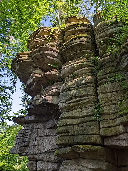 Čertův hrádek Mountain, Rohozná14 km SE
-
Mešnice Mountain, Nový Rychnov13 km E
Sources & licences
Data last updated: