Staré Vyklantice
Located in Vyklantice, Pelhřimov District Coordinates: 49°33′21″ N 15°02′15″ E

- Population
- 235
- 235
- Elevation
- 591 m
- above sea level
- Local time
- UTC+01:00
- Europe/Prague · UTC+01:00
- Airports
- PED Pardubice Airport72 km
- JCL České Budějovice South Bohemian Airport81 km
About Staré Vyklantice
Staré Vyklantice is a village. Location: Vyklantice, Pelhřimov District. Population: 235. Elevation: 591 m. The best months to visit are June–August. The nearest airport is Pardubice Airport (72 km). Nearby sights include Rejd and Řísnický vrch.
At a glance
- Area
- 3.5 km²
Source: Wikidata
Photos of Staré Vyklantice
-

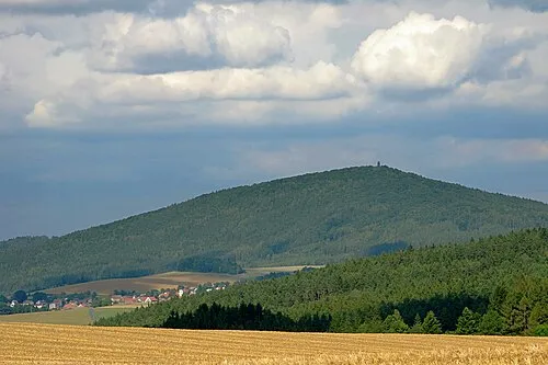
Freibo · CC BY-SA 3.0 -

Freibo · CC BY-SA 3.0


Population of Staré Vyklantice over time
| 1900 | 200 | |
|---|---|---|
| 1910 | 187 | |
| 1921 | 202 | |
| 1930 | 186 | |
| 1950 | 146 | |
| 1961 | 192 | |
| 1970 | 161 | |
| 1980 | 132 | |
| 1991 | 116 | |
| 2001 | 102 | |
| 2011 | 100 | |
| 2021 | 76 |
Censuses and official estimates; source: Wikidata.
Climate of Staré Vyklantice
Best months for sightseeingBest months for sightseeing: June–August.
This month · November
A cold month
Day 5° · Night 0° · Rain 36 mm
- Hottest month
- August (day 23°)
- Coldest month
- January (night -5°)
- Wettest month
- July (81 mm)
- Driest month
- February (25 mm)
Bars: average monthly low and high temperature. Below: precipitation. Monthly averages for 1970–2000 at about 18 km resolution, adjusted for elevation. Highlighted months are mild and relatively dry. Source: WorldClim 2.1 (CC BY 4.0).
Show values as a table
| Month | Jan | Feb | Mar | Apr | May | Jun | Jul | Aug | Sep | Oct | Nov | Dec |
|---|---|---|---|---|---|---|---|---|---|---|---|---|
| Average high (°C) | 1° | 3° | 6° | 12° | 18° | 20° | 23° | 23° | 17° | 11° | 5° | 1° |
| Average low (°C) | -5° | -4° | -1° | 2° | 7° | 10° | 12° | 11° | 8° | 4° | 0° | -4° |
| Precipitation (mm) | 27 | 25 | 32 | 40 | 66 | 78 | 81 | 67 | 45 | 33 | 36 | 33 |
How to get to Staré Vyklantice
The nearest airport is Pardubice Airport (PED), 72 km to the northeast as the crow flies. The nearest large city is Prague, 74 km to the northwest.
Airports
- Pardubice Airport (PED) Pardubice 72 kmnortheast
- České Budějovice South Bohemian Airport (JCL) České Budějovice 81 kmsouthwest
- Václav Havel Airport Prague (PRG) Prague 83 kmnorthwest
Nearby large cities
- Prague Population: 1.2M 74 kmnorthwest
- Brno Population: 404.3K 121 kmeast
- Linz Population: 204.8K 149 kmsouth
- Dresden Population: 564.9K 190 kmnorthwest
- Chemnitz Population: 247.2K 207 kmnorthwest
Straight-line distances; road distances are longer. Airport data: OurAirports.
Day trips from Staré Vyklantice
Within 100 km: 33 historic and cultural sites, 736 natural sites, 97 lakes, rivers and coasts.
0–25 km10 places
- Tlučin Mountain 24 kmS
- Vršík [Pošná] outlook p. Mountain 11 kmS
- Vrchy Mountain 19 kmS
- Blaník Mountain 15 kmNW
25–60 km214 places
- Královský vršek Mountain 43 kmE
- Langholz Natural site 60 kmS
- Hořánck Mountain 59 kmN
- Žebrák Mountain 30 kmNW
60–100 km642 places
- Kranbühel Mountain 79 kmS
- Hutbühel Mountain 78 kmS
- Geißbühel Mountain 81 kmS
- Steinberg Mountain 94 kmSE
Straight-line distances.
Nearby attractions & nature
Everything nearby-
Rejd Mountain, Pacov8.6 km S
-
Řísnický vrch Mountain, Načeradec9.4 km W
-
Vršík [Pošná] outlook p. Mountain, Pošná11 km S
-
Pravětický vrch Mountain, Načeradec11 km W
-
 Blaník Mountain, Louňovice pod Blaníkem15 km NW
-
Orlov Mountain, Nová Cerekev20 km S
Sources & licences
Data last updated: · 2 independent sources