Věcov
Located in Žďár nad Sázavou District, Vysocina Coordinates: 49°36′45″ N 16°10′15″ E
- Elevation
- 630 m
- above sea level
- Local time
- UTC+01:00
- Europe/Prague · UTC+01:00
- Places inside
- 4
- listed under Věcov
- Airports
- PED Pardubice Airport54 km
- BRQ Brno-Tuřany Airport64 km
About Věcov
Věcov is a municipality. Location: Žďár nad Sázavou District, Vysocina. Elevation: 630 m. The best months to visit are June–August. The nearest airport is Pardubice Airport (54 km). Nearby sights include Pohledecká Skála and Na jedli.
Climate of Věcov
Best months for sightseeingBest months for sightseeing: June–August.
This month · November
A cold month
Day 4° · Night -1° · Rain 40 mm
- Hottest month
- August (day 21°)
- Coldest month
- January (night -6°)
- Wettest month
- June (88 mm)
- Driest month
- February (27 mm)
Bars: average monthly low and high temperature. Below: precipitation. Monthly averages for 1970–2000 at about 18 km resolution, adjusted for elevation. Highlighted months are mild and relatively dry. Source: WorldClim 2.1 (CC BY 4.0).
Show values as a table
| Month | Jan | Feb | Mar | Apr | May | Jun | Jul | Aug | Sep | Oct | Nov | Dec |
|---|---|---|---|---|---|---|---|---|---|---|---|---|
| Average high (°C) | 0° | 1° | 5° | 11° | 17° | 19° | 21° | 21° | 17° | 11° | 4° | 0° |
| Average low (°C) | -6° | -5° | -2° | 1° | 6° | 9° | 10° | 10° | 7° | 3° | -1° | -4° |
| Precipitation (mm) | 28 | 27 | 32 | 39 | 64 | 88 | 82 | 69 | 49 | 36 | 40 | 35 |
How to get to Věcov
The nearest airport is Pardubice Airport (PED), 54 km to the northwest as the crow flies. The nearest large city is Brno, 56 km to the southeast.
Airports
- Pardubice Airport (PED) Pardubice 54 kmnorthwest
- Brno-Tuřany Airport (BRQ) Brno 64 kmsoutheast
- Leoš Janáček Airport Ostrava (OSR) Mošnov 140 kmeast
Nearby large cities
- Brno Population: 404.3K 56 kmsoutheast
- Prague Population: 1.2M 137 kmnorthwest
- Linz Population: 204.8K 200 kmsouthwest
- Dresden Population: 564.9K 236 kmnorthwest
- Győr Population: 129.3K 240 kmsoutheast
Straight-line distances; road distances are longer. Airport data: OurAirports.
Day trips from Věcov
Within 100 km: 25 historic and cultural sites, 912 natural sites, 71 lakes, rivers and coasts.
0–25 km23 places
- Šibenice Mountain 22 kmSW
- Pohledecká Skála Mountain 4 kmSW
- Na jedli Mountain 8 kmE
- Librův Kopec Mountain 10 kmE
25–60 km276 places
- Královský vršek Mountain 48 kmSW
- Úsobrnka Natural site 45 kmE
- Zlobica Mountain 41 kmSE
- Zahořanský Kopec Mountain 33 kmN
60–100 km709 places
- Sucha Kopa Mountain 90 kmNE
- Schoberberg Mountain 89 kmS
- Birkenschlag Mountain 89 kmS
- Habermaiß Mountain 91 kmS
Straight-line distances.
Places in Věcov
4 placesBar: population relative to the most populous place in this list.
Nearby attractions & nature
Everything nearby-
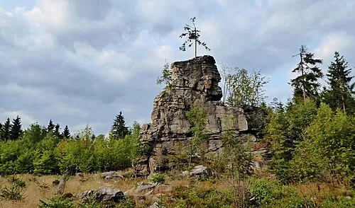 Pohledecká Skála Mountain, Nové Město na Moravě4.3 km SW
-
Na jedli Mountain, Pardubice Region8.3 km E
-
Kříby Mountain, Nové Město na Moravě7.5 km W
-
Librův Kopec Mountain, Nedvězí9.6 km E
-
Kočíko Mountain, Pardubice Region9.7 km E
-
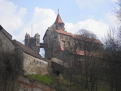 Pernštejn Castle Historic site, Nedvědice21 km SE
-
Rodkovský les Mountain, Blažkov13 km S
-
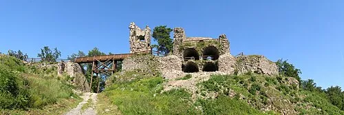 Zubštejn Mountain, Bystřice nad Pernštejnem15 km SE
Sources & licences
Data last updated: