Pořežínský kopec
Located in Velká Losenice, Žďár nad Sázavou District Coordinates: 49°35′00″ N 15°48′27″ E
- Elevation
- 597 m
- above sea level
- Local time
- UTC+01:00
- Europe/Prague · UTC+01:00
- Airports
- PED Pardubice Airport48 km
- BRQ Brno-Tuřany Airport80 km
About Pořežínský kopec
Pořežínský kopec is a mountain. Location: Velká Losenice, Žďár nad Sázavou District. Elevation: 597 m. The best months to visit are June–August. The nearest airport is Pardubice Airport (48 km). Nearby sights include Královský vršek and Řehořovský vrch.
Climate of Pořežínský kopec
Best months for sightseeingBest months for sightseeing: June–August.
This month · November
A cold month
Day 4° · Night -1° · Rain 38 mm
- Hottest month
- August (day 22°)
- Coldest month
- January (night -6°)
- Wettest month
- June (82 mm)
- Driest month
- February (25 mm)
Bars: average monthly low and high temperature. Below: precipitation. Monthly averages for 1970–2000 at about 18 km resolution, adjusted for elevation. Highlighted months are mild and relatively dry. Source: WorldClim 2.1 (CC BY 4.0).
Show values as a table
| Month | Jan | Feb | Mar | Apr | May | Jun | Jul | Aug | Sep | Oct | Nov | Dec |
|---|---|---|---|---|---|---|---|---|---|---|---|---|
| Average high (°C) | 0° | 1° | 6° | 11° | 17° | 20° | 22° | 22° | 17° | 11° | 4° | 1° |
| Average low (°C) | -6° | -5° | -2° | 1° | 6° | 9° | 10° | 10° | 7° | 3° | -1° | -4° |
| Precipitation (mm) | 26 | 25 | 32 | 39 | 63 | 82 | 80 | 66 | 45 | 34 | 38 | 32 |
How to get to Pořežínský kopec
The nearest airport is Pardubice Airport (PED), 48 km to the north as the crow flies. The nearest large city is Brno, 72 km to the southeast.
Airports
- Pardubice Airport (PED) Pardubice 48 kmnorth
- Brno-Tuřany Airport (BRQ) Brno 80 kmsoutheast
- České Budějovice South Bohemian Airport (JCL) České Budějovice 123 kmsouthwest
Nearby large cities
- Brno Population: 404.3K 72 kmsoutheast
- Prague Population: 1.2M 114 kmnorthwest
- Linz Population: 204.8K 181 kmsouthwest
- Bratislava Population: 423.7K 186 kmsoutheast
- Dresden Population: 564.9K 220 kmnorthwest
Straight-line distances; road distances are longer. Airport data: OurAirports.
Day trips from Pořežínský kopec
Within 100 km: 35 historic and cultural sites, 903 natural sites, 100 lakes, rivers and coasts.
0–25 km22 places
- Královský vršek Mountain 25 kmSW
- Šibenice Mountain 17 kmSE
- Pohledecká Skála Mountain 23 kmE
- Kříby Mountain 19 kmE
25–60 km292 places
- Seč Mountain 49 kmS
- Zlobica Mountain 59 kmSE
- Zahořanský Kopec Mountain 47 kmNE
- Vršík [Pošná] outlook p. Mountain 57 kmW
60–100 km724 places
- Kranbühel Mountain 87 kmSW
- Hutbühel Mountain 91 kmSW
- Geißbühel Mountain 91 kmSW
- Steinberg Mountain 89 kmS
Straight-line distances.
Nearest towns and villages
-
 Pořežín Village, Velká Losenice0.7 km S
-
Velká Losenice Village, Velká Losenice2.1 km E
-
Malá Losenice Village, Malá Losenice2 km NW
-
Nové Dvory Village, Nové Dvory2.1 km S
-
Vepřová Village, Vepřová3.5 km NE
-
 Buková Village, Nížkov4.5 km S
Nearby attractions & nature
Everything nearby-
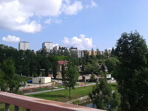 Královský vršek Mountain, Jihlava25 km SW
-
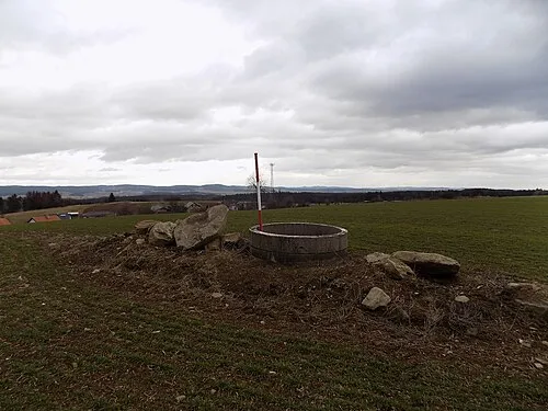 Řehořovský vrch Mountain, Kamenice21 km S
-
Vysoká Mountain, Vysoká13 km W
-
Dědkovská hora Mountain, Blízkov19 km S
-
Kopeček Mountain, Kamenice19 km S
-
U Serpentinky Mountain, Štoky21 km SW
-
Friedlerův kopec Mountain, Chotěboř14 km NW
-
Na Babylónu Mountain, Vysoké Studnice21 km S
Sources & licences
Data last updated: · 2 independent sources