Olsker
Located in Bornholm Kommune, Capital Region Coordinates: 55°14′23″ N 14°47′43″ E
- Elevation
- 97 m
- above sea level
- Local time
- UTC+01:00
- Europe/Copenhagen · UTC+01:00
About Olsker
Olsker is a village. Location: Bornholm Kommune, Capital Region. Elevation: 97 m.
Olsker is a small community in the north of Bornholm island, Denmark. It is situated in Olsker parish, some 3.5 km south of Allinge and 2.5 km from Tejn. As of 2009, it has 67 inhabitants. It is known for having the highest of the island's four round churches, Sankt Ols Kirke, from which it takes its name. Olsker also has Bornholm Cable substation. Views from Olsker include that of the Baltic Sea, Christianso island, and two other islands.
Read more on Wikipedia Text: Wikipedia contributors · CC BY-SA 4.0 · shortened
In comparison
- Nearest larger town: Tejn, 3 km E
- 6 sights and natural places within 10 km Egeshøj, Finnedalen
Airports nearest to Olsker
- Bornholm Airport (RNN) Rønne 20 km
- Malmö Sturup Airport (MMX) Malmö 96 km
- Ronneby Airport (RNB) Ronneby 118 km
Straight-line distance; airports with scheduled flights only. Source: OurAirports (public domain).
Nearby attractions & nature
Everything nearby-
Egeshøj Mountain, Bornholm Kommune2.4 km SW
-
Finnedalen Natural site, Bornholm Kommune3.3 km NW
-
Stjernehøj Mountain, Bornholm Kommune4 km SE
-
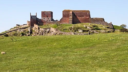 Hammershus Historic site, Bornholm Kommune4.3 km NW
-
Kløven Natural site, Bornholm Kommune6.1 km SE
-
Svartingedal Natural site, Bornholm Kommune6.4 km SW
Sources & licences
Data last updated: · 2 independent sources