Finnedalen
Located in Bornholm Kommune, Capital Region Coordinates: 55°15′12″ N 14°44′55″ E
- Elevation
- 71 m
- above sea level
- Local time
- UTC+01:00
- Europe/Copenhagen · UTC+01:00
- Airports
- RNN Bornholm Airport21 km
- MMX Malmö Sturup Airport92 km
About Finnedalen
Finnedalen is a natural site. Location: Bornholm Kommune, Capital Region. The best months to visit are June–August. The nearest airport is Bornholm Airport (21 km). Nearby sights include Hammershus and Egeshøj.
Climate of Finnedalen
Best months for sightseeingBest months for sightseeing: June–August.
This month · November
A cold month
Day 7° · Night 4° · Rain 63 mm
- Hottest month
- August (day 20°)
- Coldest month
- February (night -1°)
- Wettest month
- September (64 mm)
- Driest month
- February (35 mm)
Bars: average monthly low and high temperature. Below: precipitation. Monthly averages for 1970–2000 at about 18 km resolution, adjusted for elevation. Highlighted months are mild and relatively dry. Source: WorldClim 2.1 (CC BY 4.0).
Show values as a table
| Month | Jan | Feb | Mar | Apr | May | Jun | Jul | Aug | Sep | Oct | Nov | Dec |
|---|---|---|---|---|---|---|---|---|---|---|---|---|
| Average high (°C) | 2° | 2° | 4° | 8° | 13° | 17° | 20° | 20° | 16° | 12° | 7° | 4° |
| Average low (°C) | -1° | -1° | 0° | 2° | 7° | 11° | 14° | 14° | 11° | 7° | 4° | 1° |
| Precipitation (mm) | 50 | 35 | 40 | 35 | 37 | 45 | 53 | 47 | 64 | 59 | 63 | 57 |
How to get to Finnedalen
The nearest airport is Bornholm Airport (RNN), 21 km to the south as the crow flies. For international flights: Malmö Sturup Airport (MMX) (92 km). The nearest large city is Malmö, 117 km to the west.
Airports
- Bornholm Airport (RNN) Rønne 21 kmsouth
- Malmö Sturup Airport (MMX) Malmö 92 kmwest
- Ronneby Airport (RNB) Ronneby 117 kmnorth
Nearby large cities
- Malmö Population: 362.1K 117 kmwest
- Copenhagen Population: 1.2M 146 kmwest
- Helsingborg Population: 104.2K 157 kmnorthwest
- Rostock Population: 198.3K 212 kmsouthwest
- Odense Population: 180.9K 277 kmwest
Straight-line distances; road distances are longer. Airport data: OurAirports.
Day trips from Finnedalen
Within 100 km: 1 historic or cultural site, 12 natural sites, 21 lakes, rivers and coasts.
0–25 km6 places
- Antoinette Beach 15 kmS
- Stjernehøj Mountain 7 kmSE
- Egeshøj Mountain 4 kmSE
- Svartingedal Natural site 7 kmS
25–60 km5 places
- Hullehavn Beach 29 kmSE
- Bögön Island 56 kmNW
- Tat Island 28 kmE
- Frederiksø Island 29 kmE
60–100 km23 places
- Enön Island 100 kmN
- Harö Island 99 kmN
- Gislövs Strandmark Beach 96 kmW
- Rakö Island 83 kmN
Straight-line distances.
Nearest towns and villages
Nearby attractions & nature
Everything nearby-
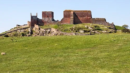 Hammershus Historic site, Bornholm Kommune2 km N
-
Egeshøj Mountain, Bornholm Kommune4.1 km SE
-
Stjernehøj Mountain, Bornholm Kommune7.1 km SE
-
Svartingedal Natural site, Bornholm Kommune7.2 km S
-
Kløven Natural site, Bornholm Kommune9.1 km SE
-
Antoinette Beach, Bornholm Kommune15 km S
Sources & licences
Data last updated: · 2 independent sources